Below are images from the “Map of the Territories & Pacific States” included with the book Across the Continentby Samuel Bowles published in 1866. For more background on the map and book visit 1865 California and U.S. map unfolded. There seems to be a problem with the image portion of WordPress. It’s probably me, but the images aren’t enlarging to their proper size when the thumbnail image was clicked. Until I get that resolved, here are the map images as large as your computer screen will make them.
Download the 1865 Map
I had the map scanned in preparation for mounting. The scanned JPG is approximately 10MB and has better resolution than my photographs.
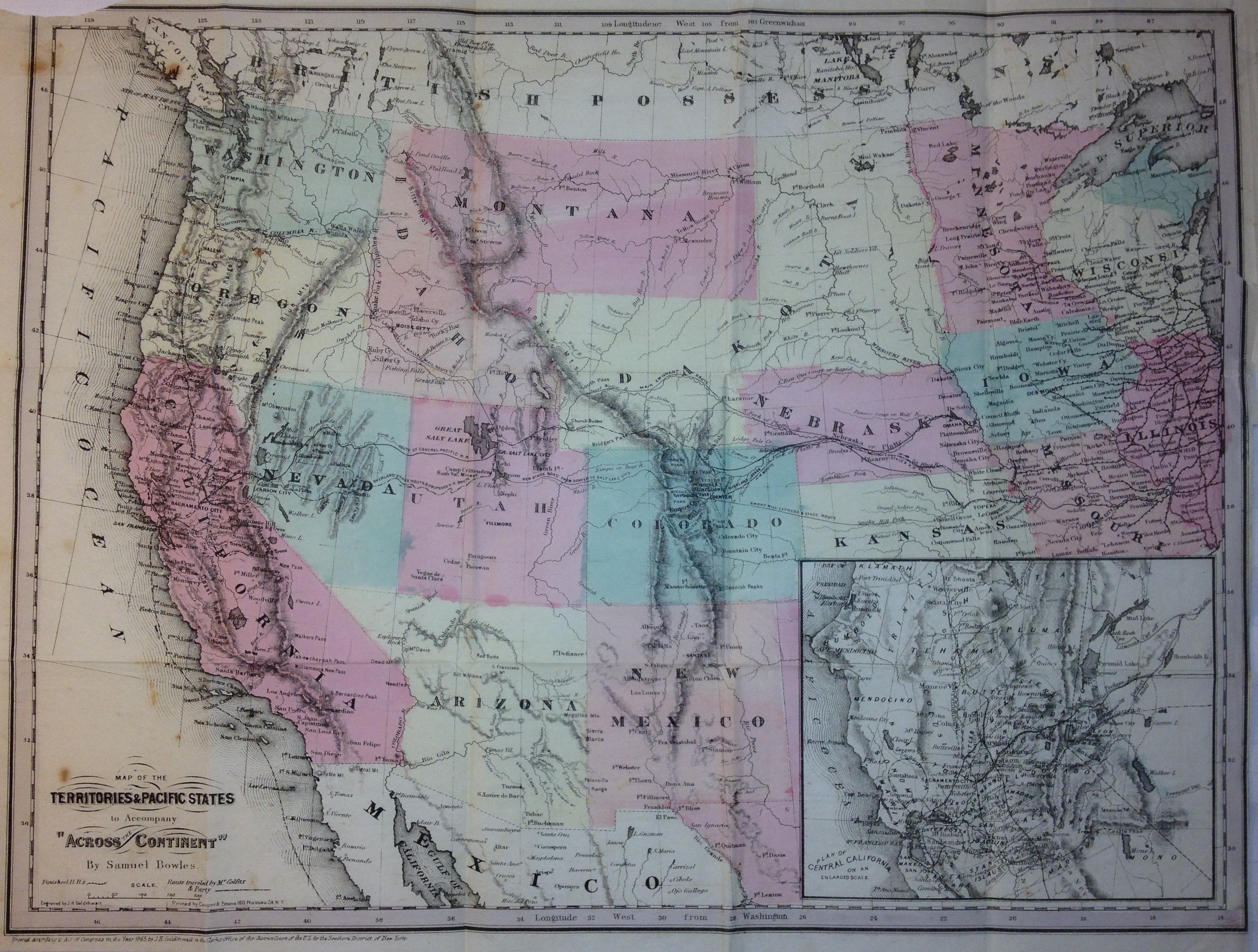
Western territories and U.S. map included with “Across the Continent” by Samuel Bowles, 1866.
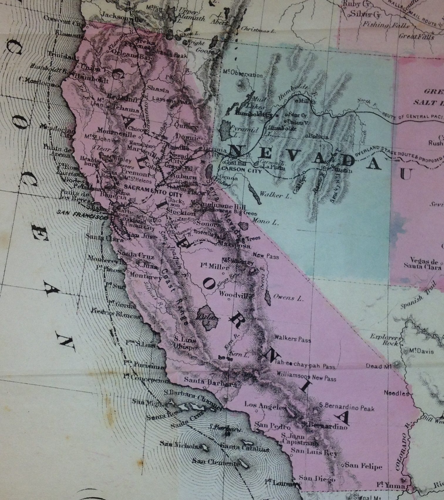
California state, 1865.
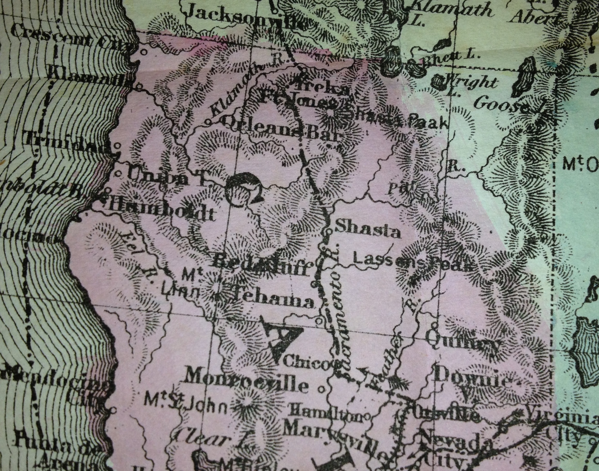
Northern California 1865 map, Crescent City down to Mendocino.
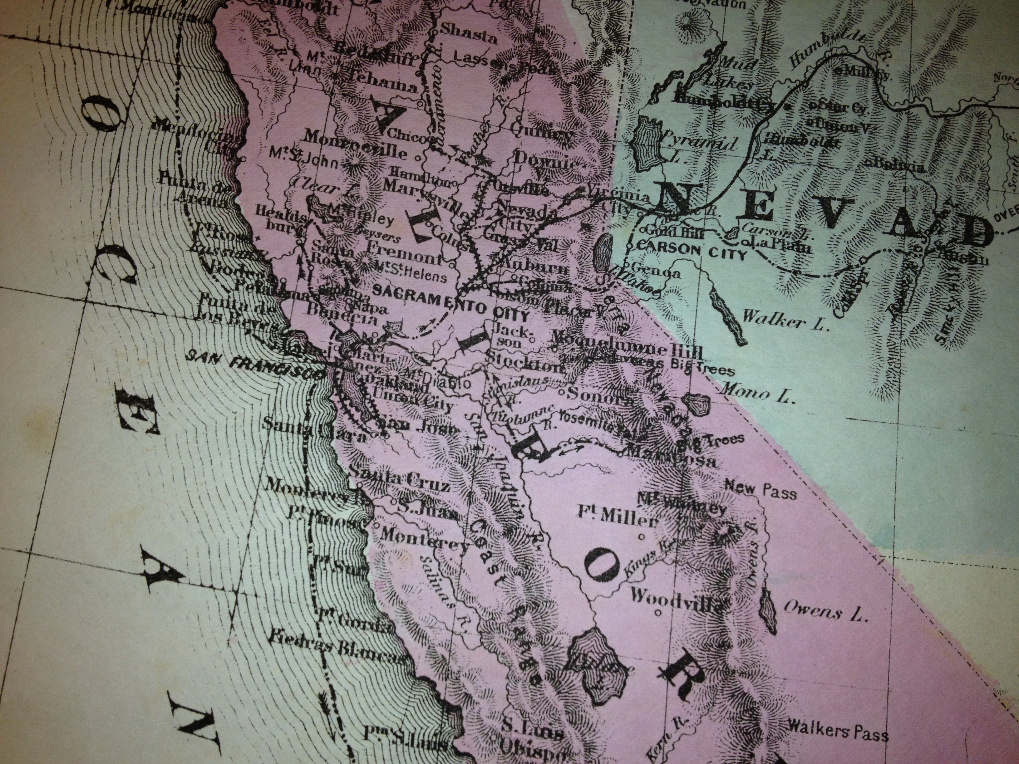
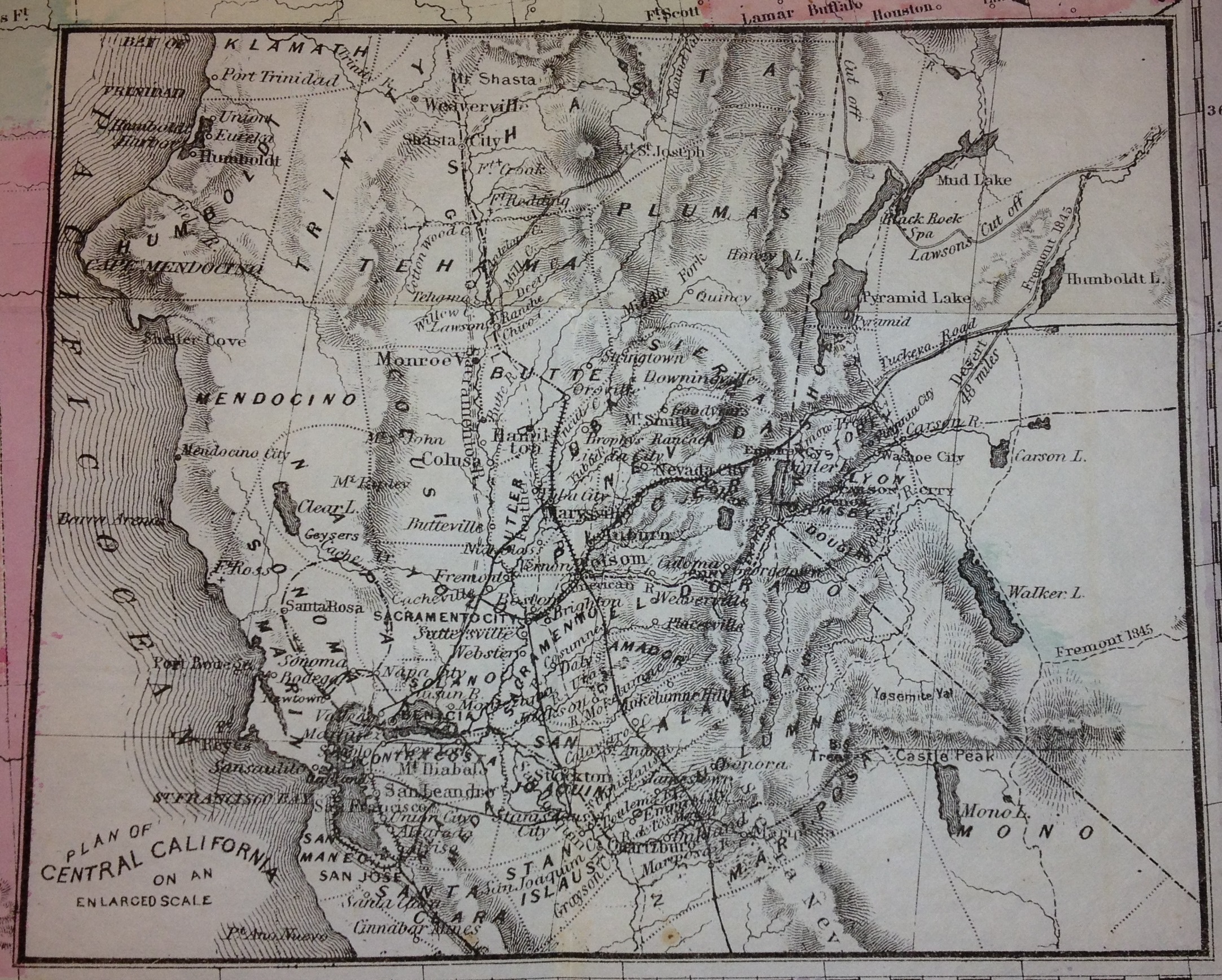
Central California state map, 1865. Mendocino, San Francisco, Monterey, Sacramento, Yosemite
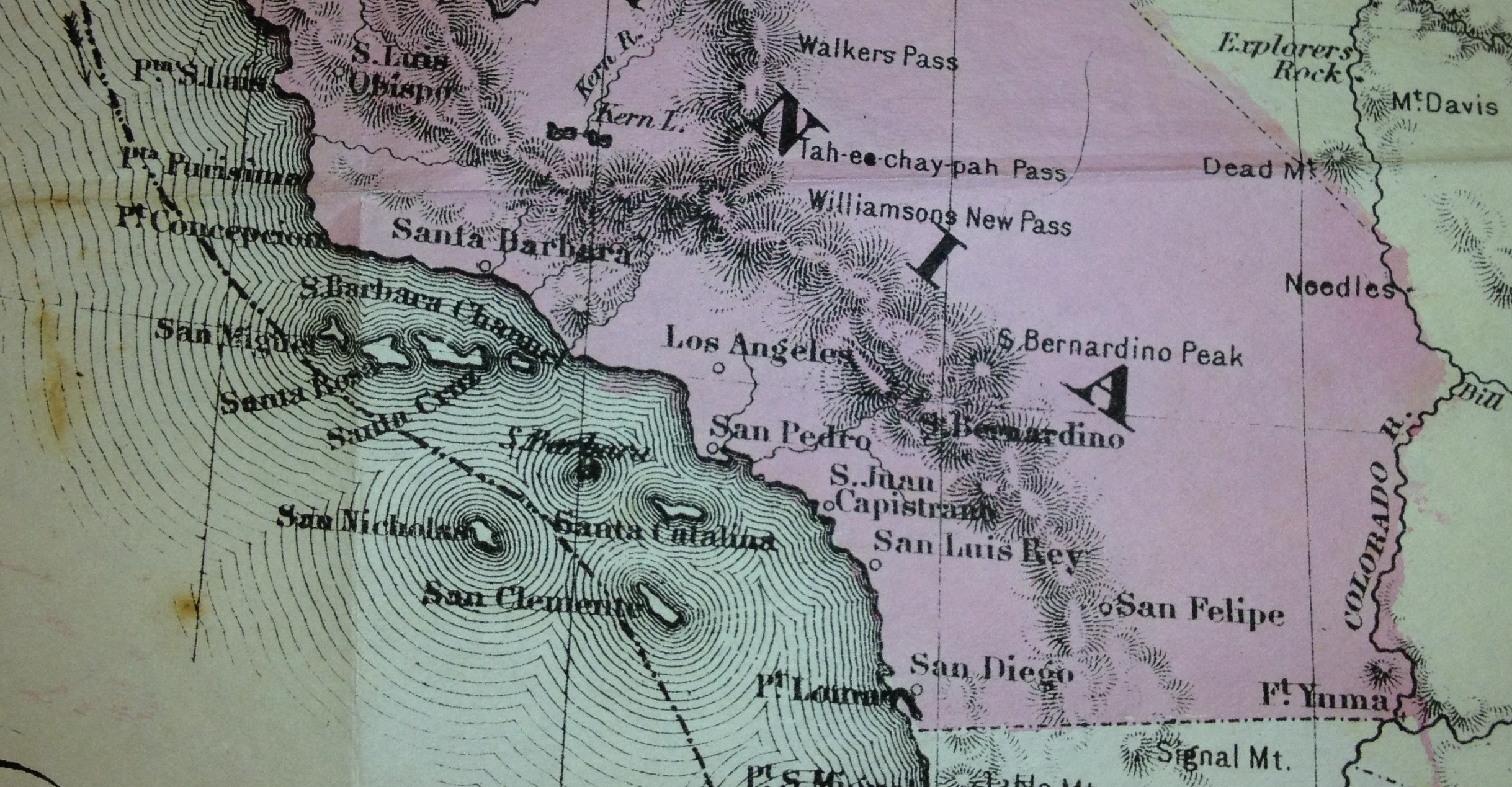
Southern California 1865 map, Santa Barbara to San Diego
Central California inset map, 1865, travel routes, roads, railroads from “Across the Continent” by Samuel Bowles.
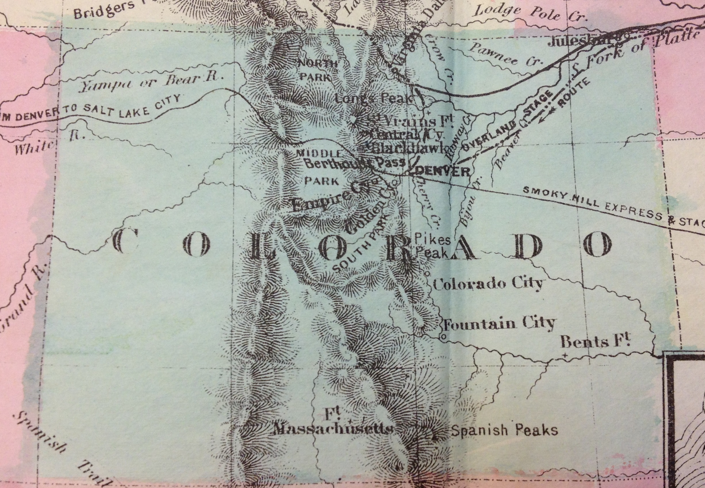
Colorado territory map 1865.
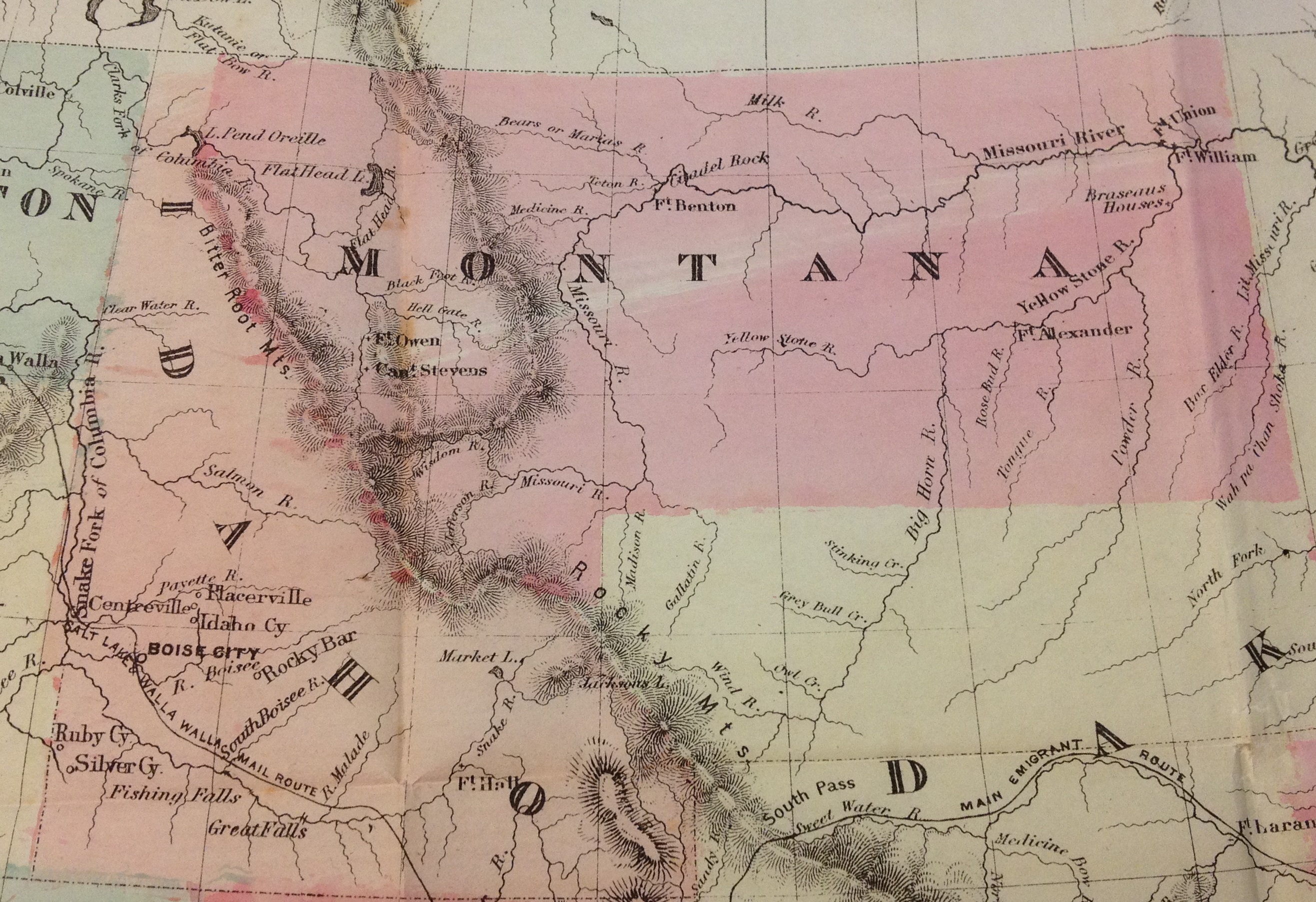
Idaho and Montana territory map, 1865.
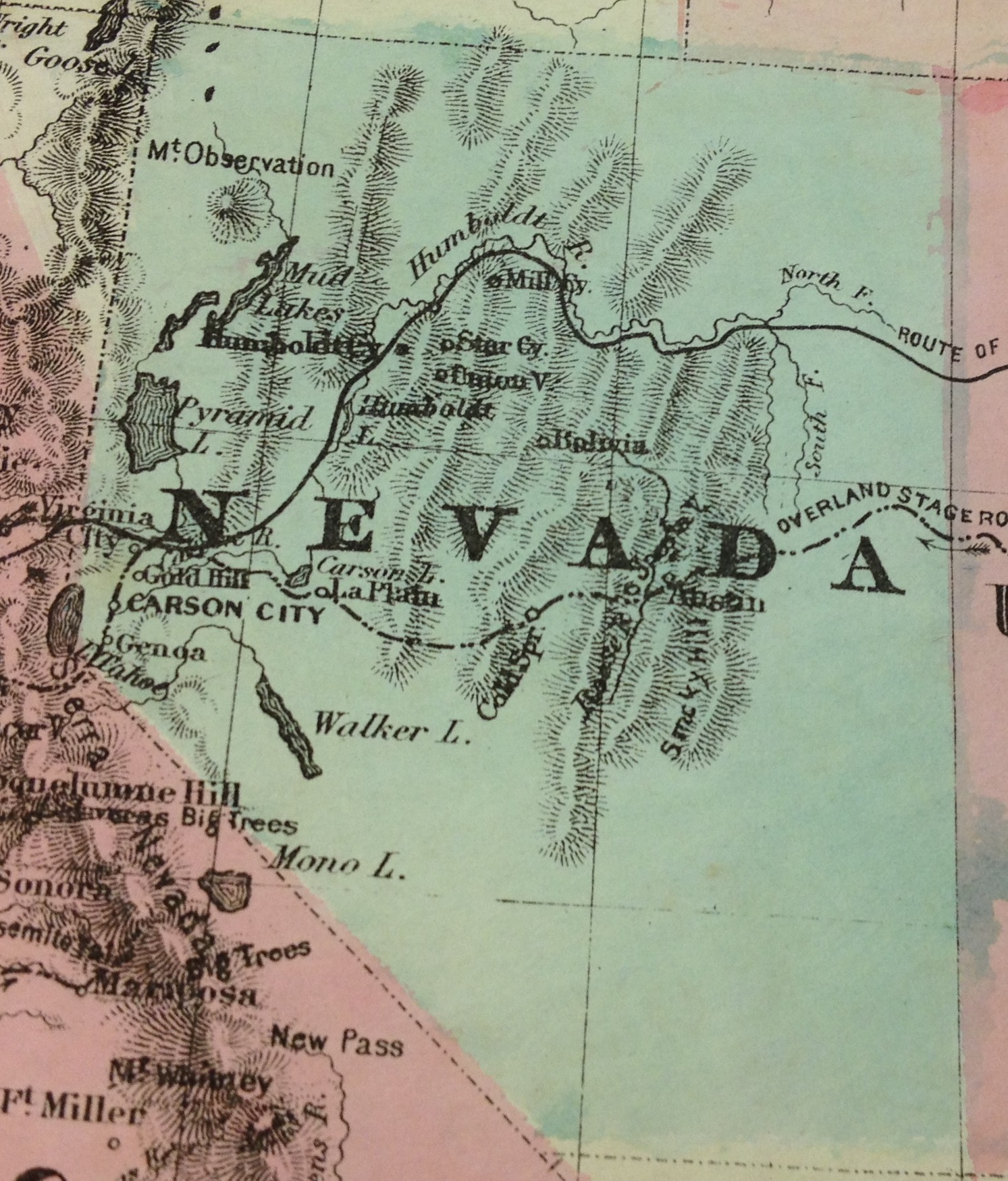
Nevada state map 1865.
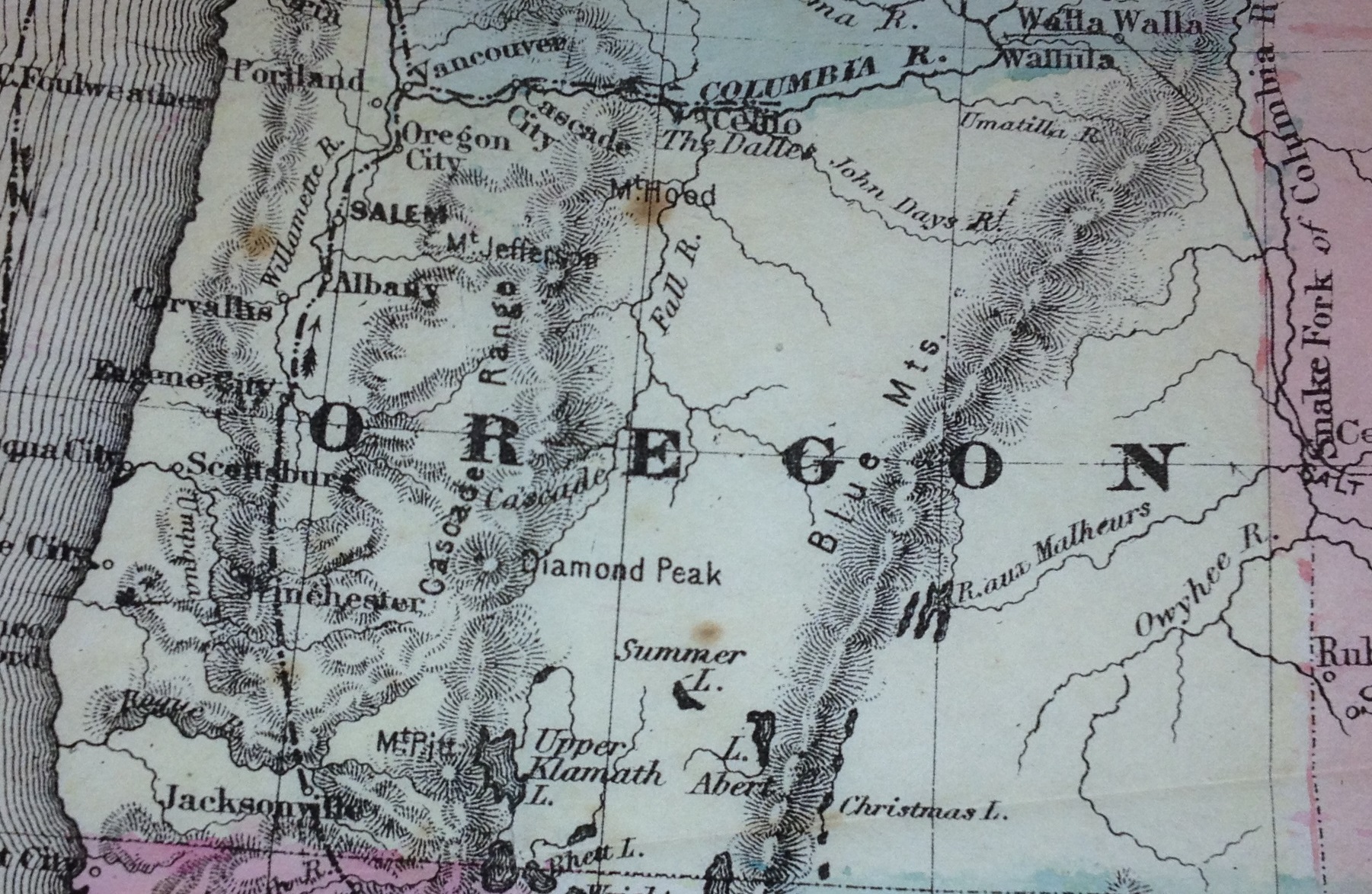
Oregon state 1865 map
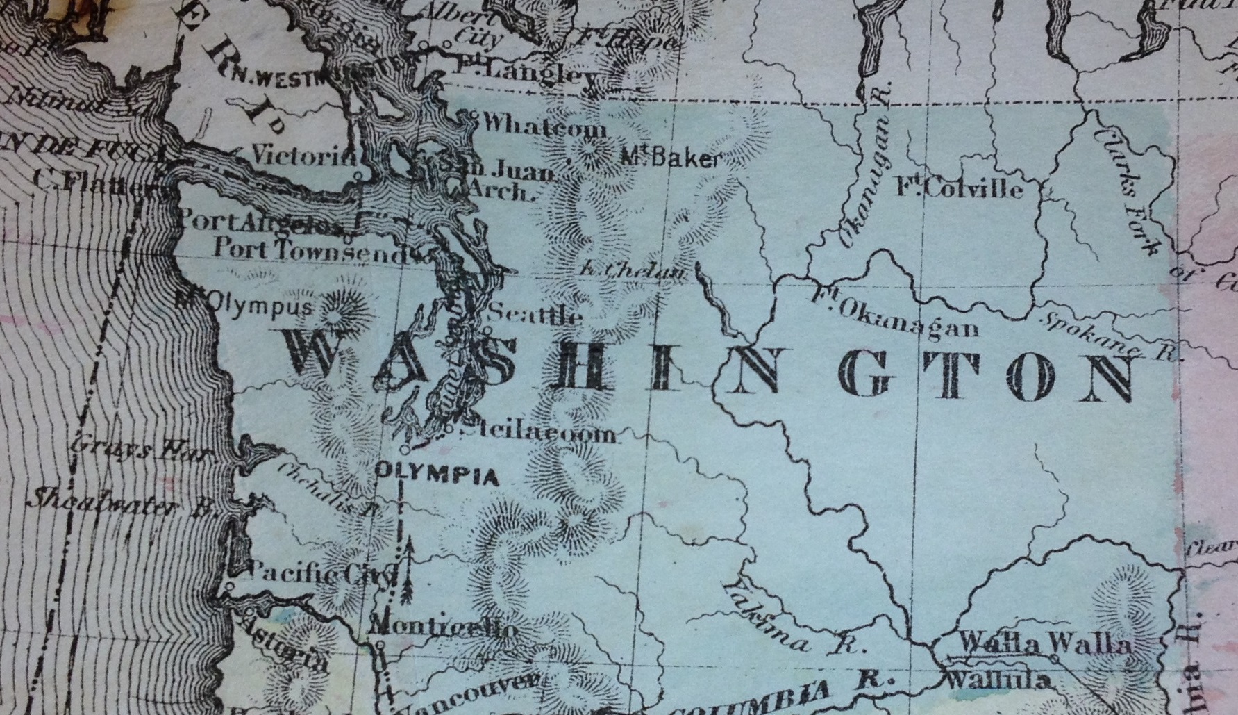
Washington state 1865
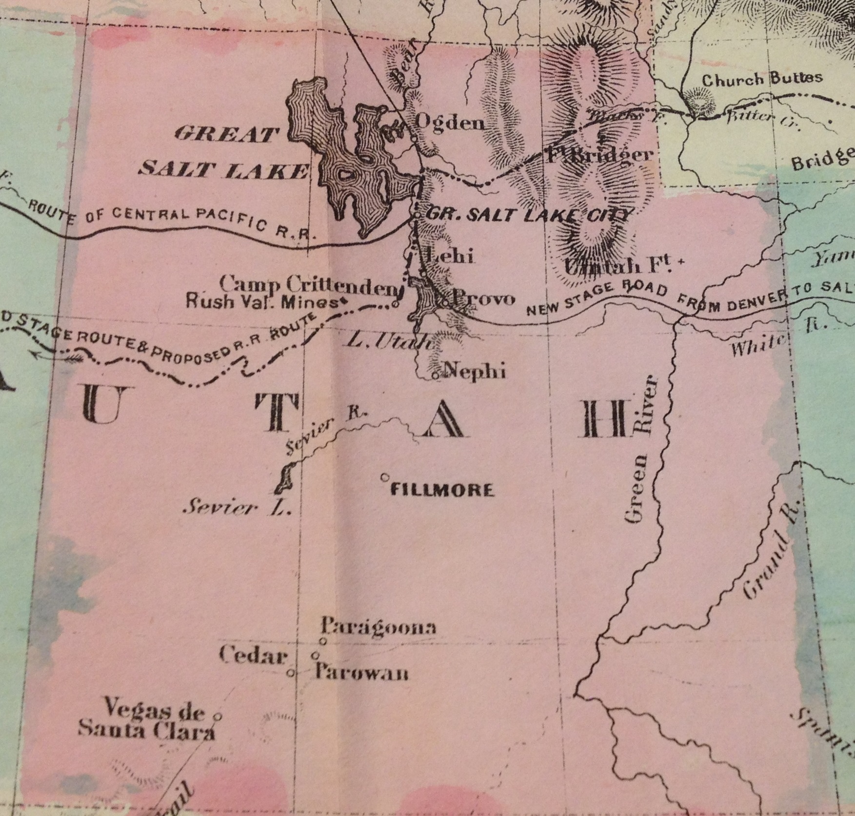
Utah Territory 1865 map
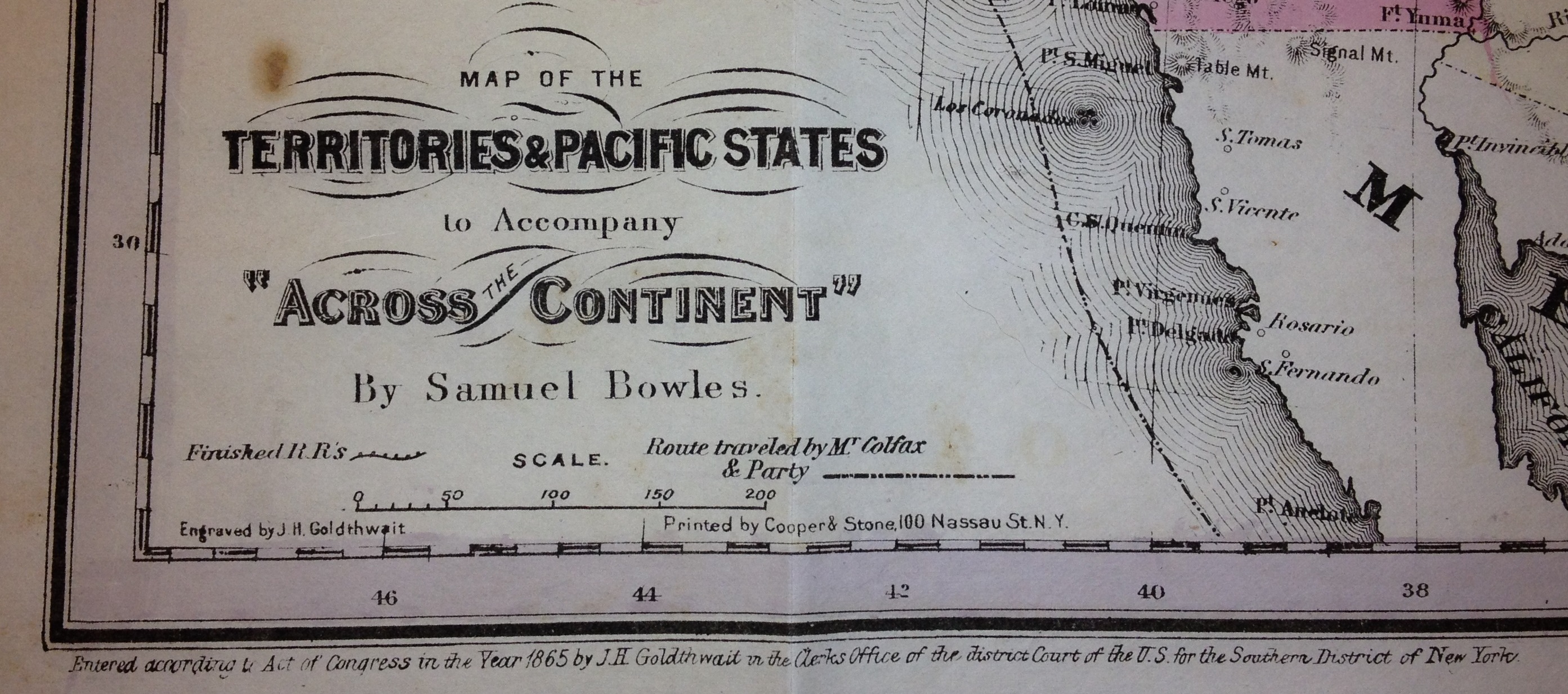
Territories & Pacific States engraved by J. H. Goldthwait, 1865, by Samuel Bowles.
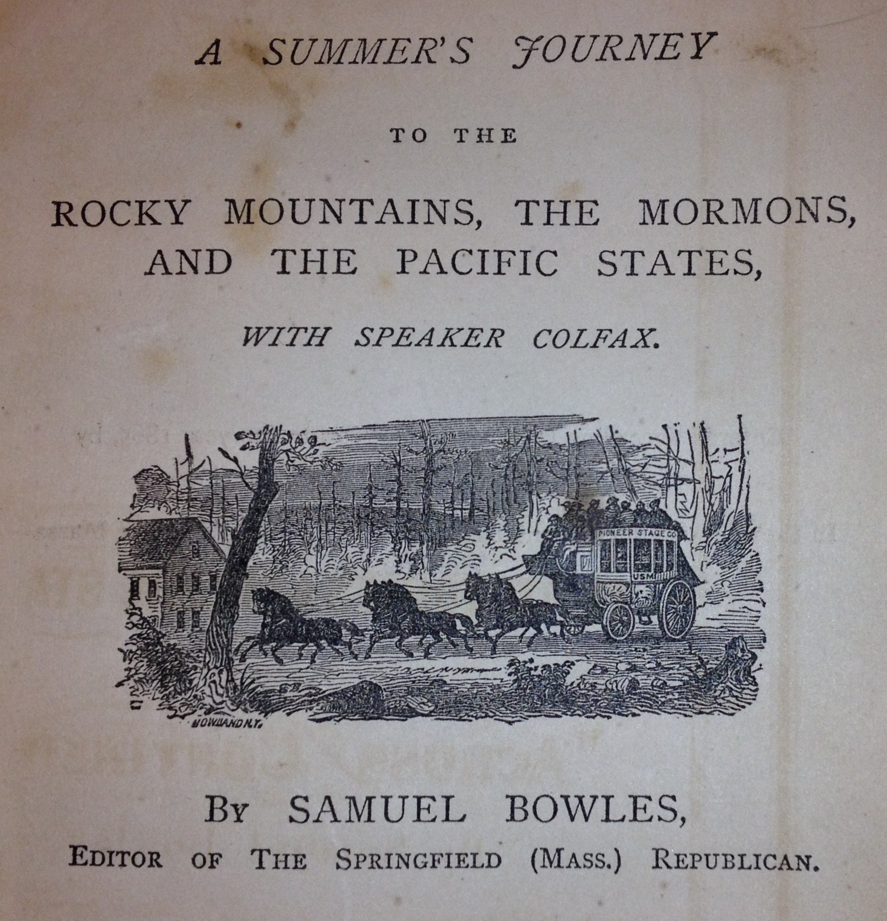
A Summer’s Journey to the Rocky Mountains, the Mormons, and the Pacific States with Speaker Colfax. By Samuel Bowles, Editor of the Springfield (Mass.) Republican. 1866