
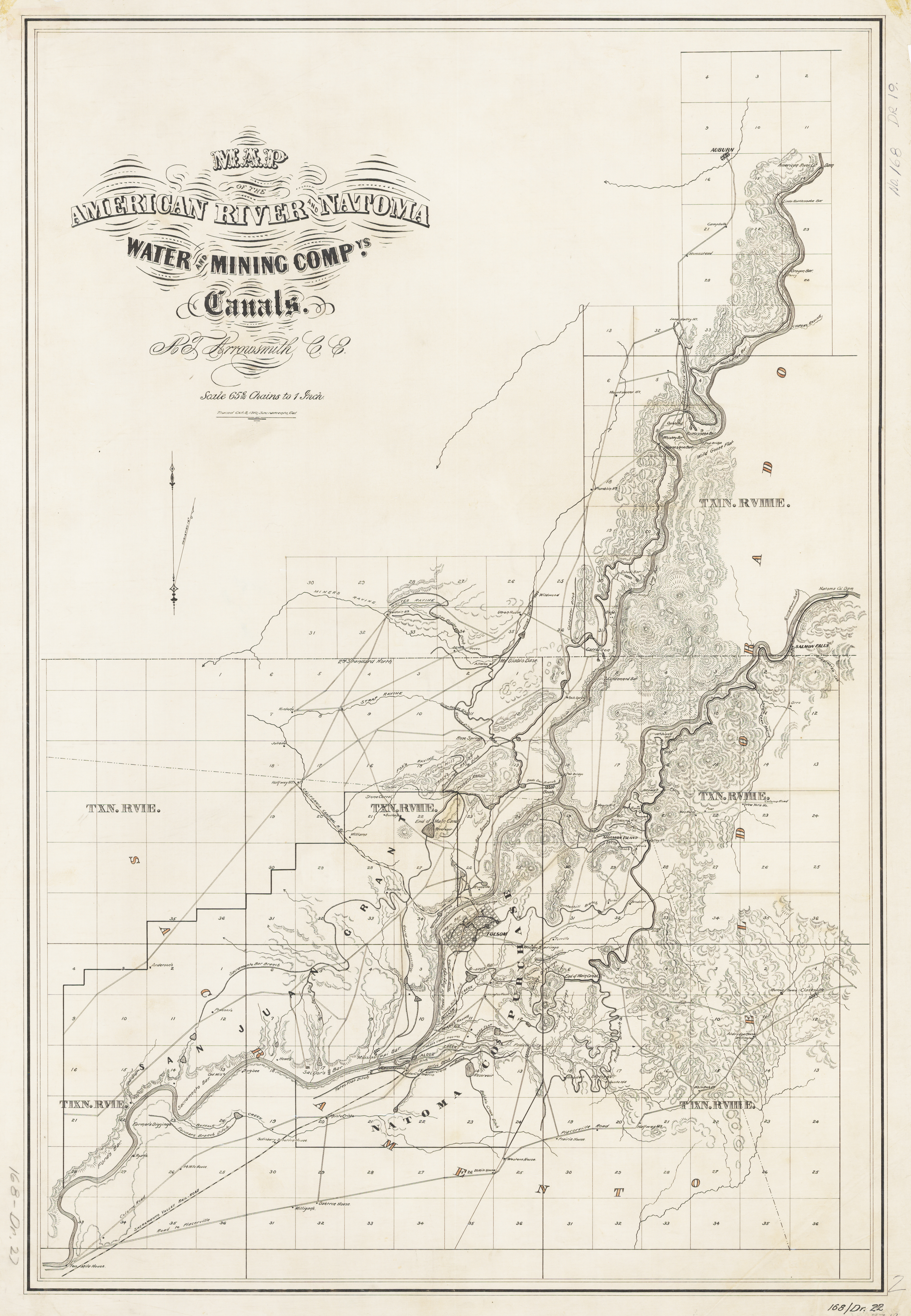
This map is a reduced and enhanced version of the original digitized American River & Natoma Water and Mining Canals map drawn in 1910. It doesn’t show the water canal on the north side of the South Fork of the American River. The map was drawn as a way to show the assets and extent of the water canals and not as scale topographical map of record. However, there are some place names and roads on this map that don’t show up on later USGS topographic quad maps. Center for Sacramento History 1981-037-0821.tif
Down load the map:
American_River_Water_Canals_1910
Map of the water canals along the North Fork and South Fork of the American River drawn in 1910.