

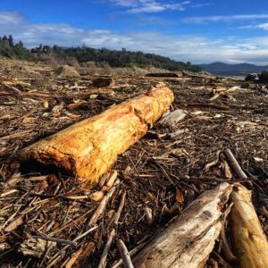
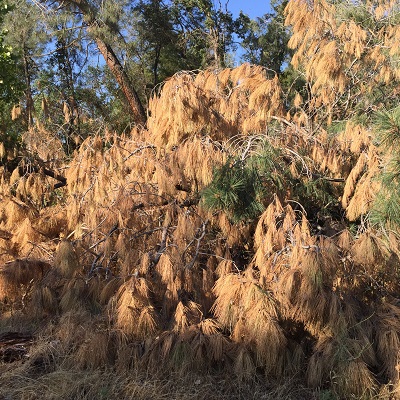
While Folsom State Recreation Area is focused on cleaning up the massive amounts of driftwood brought into the lake with the 2017 winter storms, no one is paying attention to the high fuel load developing on land. The powerful storms that raged across Northern California officially ending the drought also blew down many trees in the park and helped grow a bumper crop of tall grass and weeds. All of this fuel load adds to the fact that since Folsom Lake was created in the 1950s, there has been little attempt to reduce the risk of fire as houses sprouted up on the periphery of the park.
The last major attempt to reduce the fire hazard at Folsom State Recreation area occurred in the early 1950s. The U.S. Army Corp of Engineers, who were managing the construction of Folsom Dam and Reservoir, undertook large brush and tree clearing project within the boundaries of the park. Most of the brush and tree clearing efforts were directed at land that would be inundated seasonally by Folsom Lake. Some of the proposed clearing was to be at future recreational sites to reduce fire hazards from people. (See: Clearing Brush and Trees Before Folsom Lake Filled)
Removing Trees To Reduce Folsom Lake Fire Hazard
Since that initial clearing, little has been done to remove fallen trees or excessively tall grasses and woody shrubs from the park landscape, excluding when new recreational sites are developed and the occasional small fire. Park management, along with lots of luck, have been very good at preventing fires and suppressing them before they get out of control in the 60 years since the park was opened.

50 Years of Tree Growth
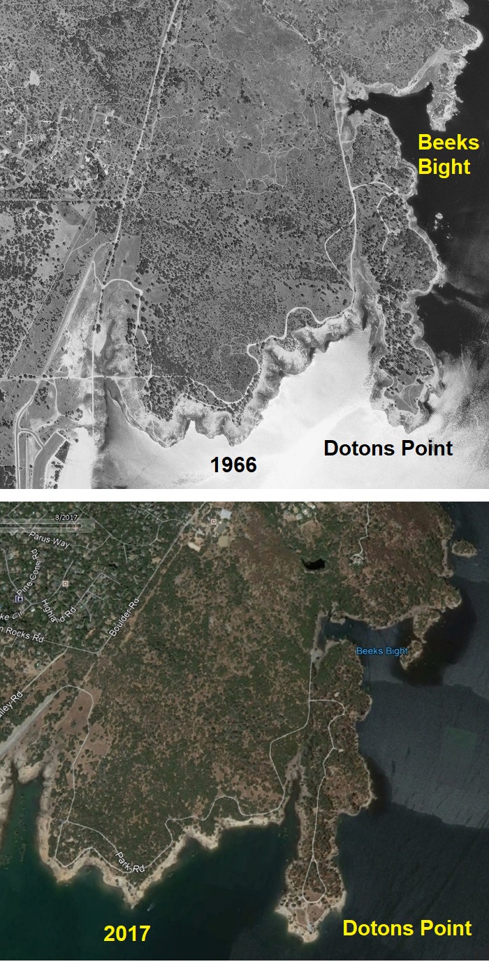
An aerial comparison of one section of the Folsom State Recreation Area shows how, in the absence of local landowners clearly the land or using it for cattle grazing, there has been a proliferation of oak trees. I located an aerial image from 1966 from Dotons Point to Beeks Bight. I then captured an image from Google Earth of the same area from 2017. Even though the 1966 photo is black and white, it is easy to see how many more trees have grown over that 50 year period.
Long before the gold rush, Native Americans would selectively start fires for a variety of purposes usually associated with hunting and food gathering. When the mining immigrants swarmed the north and south forks of the American River, fires broke out with almost routine frequency and devastation. The community of Rattlesnake Bar was wiped out by a fire in 1864 and never recovered. Hillsides would regularly burn when a structure fire spread to dry grass and trees.
The miners also harvested many of the oaks and gray pines in the area for fire wood and to build homes, barns, and the flumes and sluices for gold mining. When placer mining faded in the 1860s, the remaining immigrants turned their focus on agricultural pursuits. Where the soil was deep enough, and the slope not too steep, farmers cleared acreage for orchards, and ranchers cleared land for pasture. The mining era water works projects of the North Fork Ditch and Natomas Ditch provided the landowners with water for irrigation. Mining continued into the early 20th century, but new machines, dredges, and equipment which were fueled with petroleum products. Trees no longer were a primary source of energy.
While the landscape began to sprout new trees, bushes and grasses, it was kept somewhat in check by the economic activity of the farms, ranches, and smaller mining operations. All that activity ceased in the 1950s as the Folsom Project got underway. The U.S. Army Corp of Engineers bought all the land under the high water level of the lake and approximately 300 feet above it. In many cases, the periphery above the high water line of Folsom Lake is comprised of very steep slopes. Today, on top of hills that create the steep slopes are homes.
Most of the homes that are most directly threatened by a fire at Folsom Lake are in Granite Bay and El Dorado Hills. There are only a few scattered homes above and around the Peninsula Campground. Ironically, it is the peninsula that has some of the best fire suppression features. There are more meadows with fewer trees. Fewer people visit the Peninsula Campground Park because it can be difficult to access, especially when towing a boat, from Highway 49. There are also wide dirt roads that act both as fire break and allow for fire trucks to reach areas burning.
In contrast, large swaths of Folsom Park land in Granite Bay and El Dorado Hills have only small dirt footpaths with limited access for large fire trucks. There is more human activity in these areas as they are close to recreational access points.
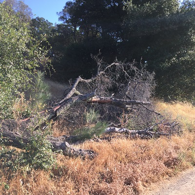
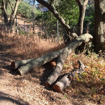
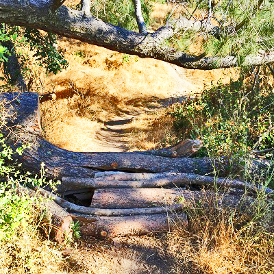
Anyone who uses the Folsom Park trails on a regular basis can attest to the fact that there were an unprecedented number of trees that blew over during the winter storms. After every storm, there seemed to be one or two new trees that had fallen across the trails. The Park Department was very good at cutting up the large oak or gray pine trees that toppled over to clear the path. But the wood was left in place and pushed to the side of the trail. If a tree goes down that does not disturb the trail, it is left in place.
It is important to let trees and bushes decay naturally in situ. There are all kinds of insects and critters that find decaying wood matter a source and habitat for food. But there is also a balance between the natural build-up of dead trees and natural fire to clear out the land. The Folsom Park area is missing the natural burn cycle and only experiencing the natural accumulation of dead woody material. This is a recipe for disaster.

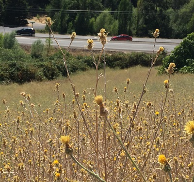
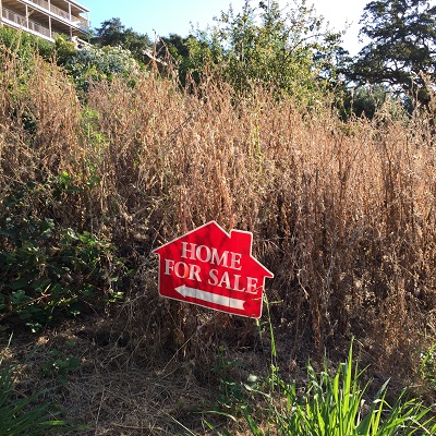
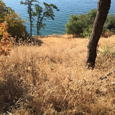
With the water levels higher in the lake because of the large snow pack of the winter storms, more people are spending more time at the intersection of the park property that is never inundated with lake water and loaded with fire fuel. It is one thing to have a beach fire when you are surrounded by a dry lake bed of decomposed granite for a ¼ mile in any direction. But it is downright irresponsible to spark up a bar-b-que on the beach surrounded by 3 foot tall weeds and enough down trees to heat hundreds of homes for the winter.

I have seen a couple of the homeowners with property right up to the park boundary make an attempt at defensible space by knocking down high weeds and clearing dead wood, ON PARK PROPERTY. Unfortunately, most homeowners don’t think the park is their responsibility and they are partly correct. But I would not hold your breath hoping the State Parks Department will start clearing out the accumulated fire hazard anytime soon. They haven’t done it for the past 60 years so I doubt they will start this year.
I really don’t want to see any fires out at Folsom Lake. My house is just under ½ mile north of Folsom Lake. I would not say I am in any imminent danger unlike the homes the front Folsom Lake. But I never thought I would have a flooding issue until Linda Creek jumped out of its creek bed and surrounded my home a couple years after we bought the house. When I saw that the 2016 FEMA Flood Maps were wrong, I worked with Placer County to file a letter requesting a change to the map. It looks like FEMA has acknowledges an error with their maps with respect to Linda Creek. I’m still in a flood plain, but perhaps not as bad as before.
Home owners that are up the hill from Folsom Lake, and for whom there is substantial load of fuel from dead trees, brush and grasses, should at least reach out to the Folsom State Recreation Area to see if there are any steps they can cooperatively initiate to reduce the potential for a catastrophic fire. I understand we all like to point fingers at the other guy, but sometimes the loss from a natural disaster is so great you need to work with the parties that have the responsibility to correct the situation. A little bit of community effort can considerably reduce the risk of fire.