

Go to -> 1865 map page
Maps of the U.S. in 1865
With the exception of the rail routes and potentially new towns, it isn’t apparent that the expedition added any new details to the overall map of the United States. The map is a snap shot in time of the development that had occurred up to 1865. Published in 1866, the map of the United States with the travel routes of the party was a companion piece to Bowles’ book Across the Continent: A summer’s Journey to the Rocky Mountains, the Mormons, and the Pacific States, with Speaker Colfax.
Route of the overland stage coach journey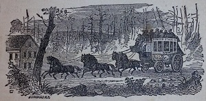

The book is comprised of a series of letters back to Bowles’ newspaper. I found the map incorporated as a pull out on onion skin paper. It was meant to help the reader follow the overland journey outlined in the book. It was like Christmas morning as I unfolded the map inside the front cover and saw all the colors. With respect to the map, Bowles writes,
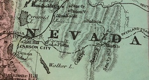
“A Map, too, is improvised, by which the reader can follow our travels, and see the general “lay of the land” beyond the Mississippi. The Map is corrected according to the latest surveys, and defines the present limits of the Territories, and the locations of the principle Mining Centers.”
Early transcontinental railroad line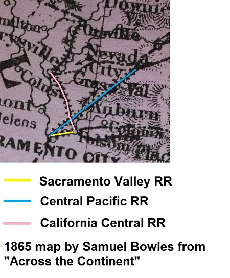

The Sacramento portion of the map seems to accurately reflect the three major railroads at the time:
- Sacramento Valley Railroad from Sacramento to Folsom
- California Central Railroad (CCRR) from Folsom to Lincoln
- Central Pacific Railroad (CPRR) from Sacramento up to Auburn
The Bowles account of the train trip up the Sacramento Valley indicates a rail line from Marysville to Oroville.
“Our point of departure was Sacramento, and the distance to Portland from there is six hundred and fifty miles, due north. Two short bits of railroad put us forward in the Sacramento valley about fifty miles; at Oroville we began the stage ride proper,…”
Is Oroville railroad a new line?
Marysville is very close to being fifty miles from Sacramento via the CPRR and CCRR. Bowles’ recollection of “Two short bits”, would seem to indicate the party left on the CPRR in Sacramento, traveled to Junction (present day Roseville) and connected with the CCRR up to Marysville. However, I haven’t found any reports that the line from Roseville to Lincoln was extended up to Marysville until 1868, after the CPRR purchased the remnants of the CCRR.
No map is perfect
It’s entirely possible that Bowles was confused. Can you imagine traveling through the Sacramento Valley in July or August making connections between ships, stage coach lines and trains all in the summer heat? Add to that the packing and unpacking of luggage and a politician that is stopping to make speeches every chance he gets. There is always the possibility that there was a short line between Marysville and Oroville in 1865. If so, this map is the evidence.
1865 map page
In order for this post to load faster, the larger images of the map are on a separate page. I included several individual images of the states or territories on the map. They are not the greatest pictures as they were taken with my camera phone. Let me know if you would like a close up of any parts of the map and I will do my best to capture it and send them to you. I’ll be putting together a more comprehensive review of the book in the future. But I just couldn’t sit on this map any longer. For being close to 150 years old, it’s in pretty good shape, along with the book.
Go To 1865 Map Page