
In 1871 California had fifty different counties. These counties were outlined in water color on an 1871 County Map of the State of California. Counties yet to be created were Glenn, Imperial, Kings, Madera, Modoc, Orange, Riverside, San Benito, and Ventura. The 1871 map also has an inset of San Francisco that also has water-colored outlines of different districts. I recently purchased this map and wanted to share it with people interested in the history of California. A higher resolution map image is available at the end of the post.
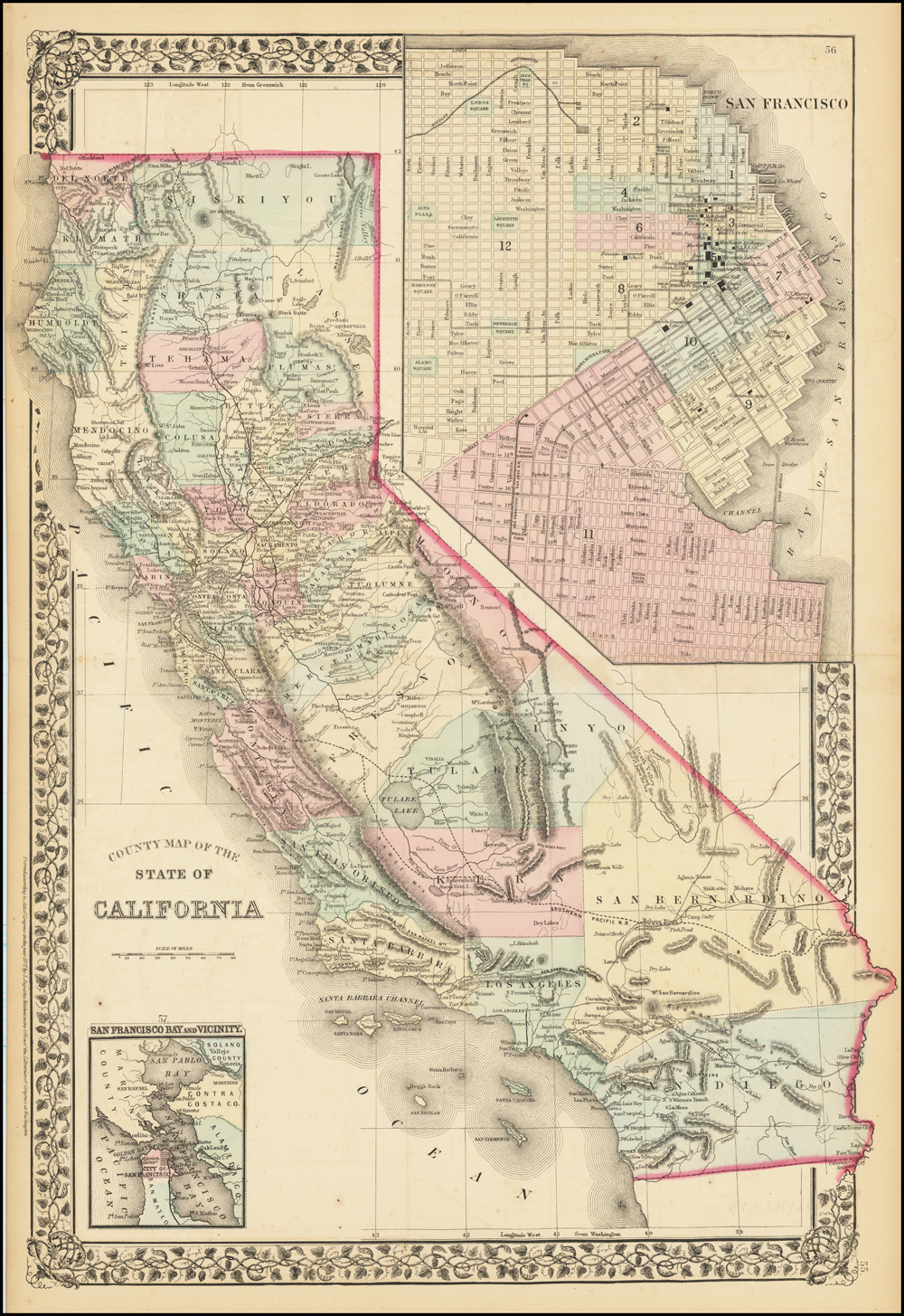
The map is topographically weak understating the mountain ranges and other topographical features of California. Of course, the purpose was not to emphasize the landscape, but to define the boundaries of the numerous counties that had been authorized by the State Legislature. Major railroad lines, with their proposed extensions, are noted on the map.
Tulare Lake and Owens Lake are represented on the map along with the major rivers of the state. The map border is a nice repeating motif of grape vines, leaves, tendrils, and berry clusters, which emphasized California’s growing grape and wine industry.
There is nothing especially revealing about the map. It is a snap shot of California in 1870. It’s greatest use is to historians to compare to current state maps and potentially find towns and lakes that no longer exist. I hope you enjoy studying the map and finding something lost or found.
1871 California Counties Map med knauss
Map of the State of California outlining the various counties with an inset of San Francisco City and the Bay, 1871