

This post is a work in progress. I will add to it as I document and acquire new information about the history of the Granite Bay region. If you would like to share your recollections and information, please contact me and I will be happy to include your family history into the post.
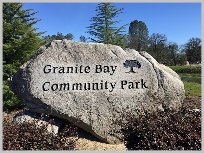
Early History of Granite Bay, California
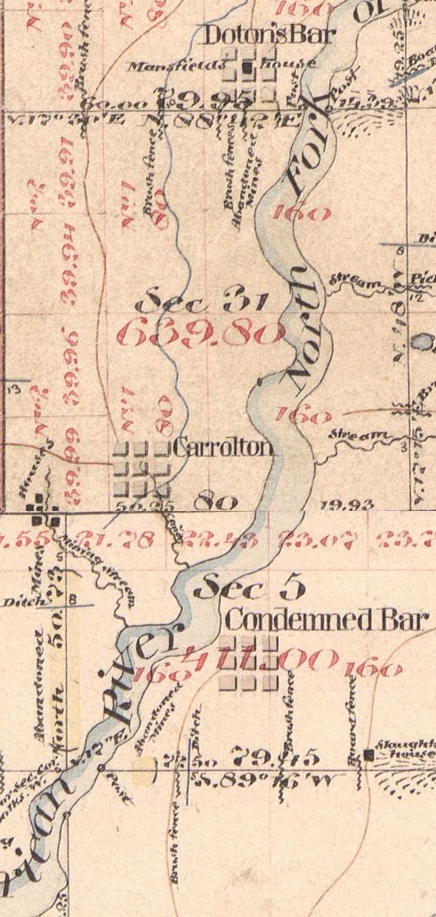
There are varying opinions as to how Granite Bay was named. Before Granite Bay was officially recognized as a community with its own zip code in 1987, homes and business at the eastern end of Douglas Blvd. was just part of greater Roseville. It was just a semi-rural area you drove through on your way to Granite Bay Beach at the Folsom Lake State Recreation Area. There is a reference to Granite Bar near Doton’s Bar in a cultural resources document created by the California Parks Department. I have never found Granite Bar listed on any historic maps. The nearest gold rush town was Carrolton which sat at the base of what is known today as Dotons Point at Folsom Lake. I guess Granite Bay sounded better than naming the park or area after Condemned Bar on the other side of the river.

Once Folsom Lake was filled, it created a nice crescent shaped bay with a relatively flat beach area just perfect for picnicking just north of where Douglas Boulevard terminates at the park entrance. Because the surrounding soil is primarily decomposed granite, the name Granite Bay Beach was applied to the area by the California State Parks.
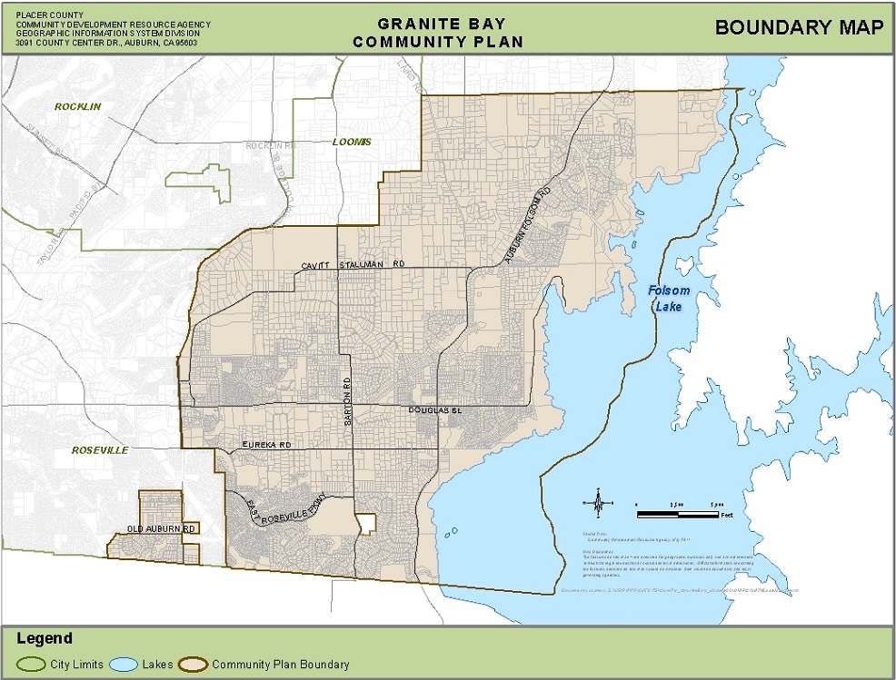
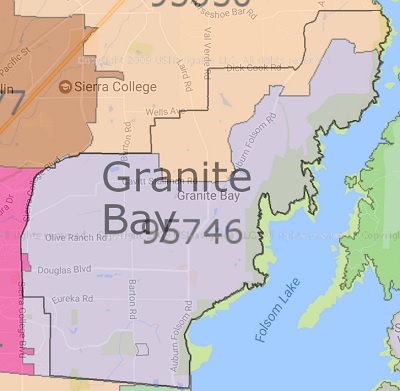
The boundaries for the Granite Bay area can be different between zip code maps and Placer County’s Community Plan Map. In general, Granite Bay’s eastern edge is Folsom Lake. The southern boundary is the Placer – Sacramento County line. On the western side it is Sierra College Blvd. up to where the road intersects with Rocklin and Loomis. Loomis Township marks part of the northern boundary. The northern edge of Granite Bay then heads north-east up to Horseshoe Bar Road and then east over to Folsom Lake.

Early Inhabitants of Granite Bay

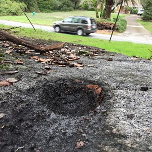
Before the area was flooded with immigrants prospecting for gold, the rolling landscape of Granite Bay was home to small villages of Maidu Native Americans. Vestiges of the Maidu life can be found in the numerous grinding holes they used to mash up acorns. The Maidu grinding holes are usually found on top of granite boulders that are relatively flat. A nice set can be viewed on the Miners Ravine Nature Trail off of Auburn-Folsom Road. When Folsom Lake water levels are low, you can also locate the grinding holes that would have been closer to the North Fork of the American River.
In 1977 when Folsom Lake was at exceeding low water levels because of the drought, the California State Parks did additional research into Native American villages in the region. They documented several sites and collected numerous artifacts such as arrow heads and atlatls. Some of the artifacts were dated to have been developed as early as 1200 AD.
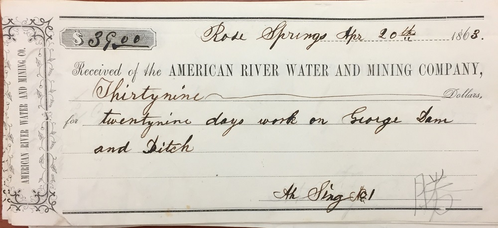
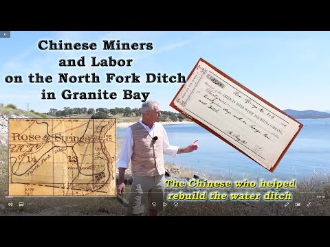
From the mid-1850s through the end of the 19th century, there were different communities of Chinese miners, laborers, and farmers. The North Fork Ditch employed Chinese labor in 1863 to repair the water canal. At the same, some of the same Chinese men were also buying water from the North Fork Ditch for mining and irrigation. Chinese Mining and Labor on the American River.

Water Development

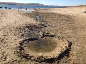
The Granite Bay area is typical oak savannah woodland where live oaks are plentiful. There are also several seasonal creeks that run through the area such as Linda Creek and Miners Ravine. These streams, without the advent of suburban water use, would essentially dry up in the summer. All but lost to history were two important springs or artesian wells that bubbled up water year round. Rose Springs is located on the north side of ridge that is close to the intersection of Auburn-Folsom Road and Eureka Road. A small community developed around this important resource known as Rose Springs. Water flowed west across todays Auburn-Folsom Road toward Linda Creek in the direction of Barton Road. With the construction of Dyke 5 of Folsom Dam, the westward flow of Rose Springs was re-directed eastward and into Folsom Lake.
Another water source for travelers along the Pioneer Express Trail that paralleled the North Fork of the American River was Rock Springs. When Folsom Lake is low during the summer you can still see Rock Springs bubbling out water on the eastern point of Mooney Ridge. There was also a small community that developed around this spring and the remnants of the Rock Spring house can still be seen when the lake gets very low. Both Rose Springs and Rock Springs within Folsom Lake were marked on old maps of Placer County as early as 1861.
North Fork Ditch
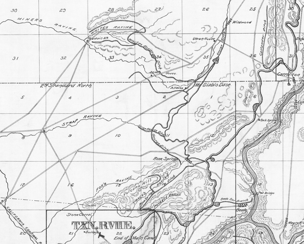
With the onset of the Gold Rush, several water ditches were constructed along the north and south forks of the American River to serve miners with water. The North Fork Ditch started up near Auburn and traveled 25 miles down to Beals Bar on the west side of the North Fork of the American River. Just south of today’s Beals Point was the North Fork Reservoir. By the 1890s, the North Fork Ditch was beginning to deliver water to Orangevale and Fair Oaks.
A branch of the North Fork Ditch ran from Baldwin Reservoir north along Barton Road and was known as the Rose Springs Ditch. Before the North Fork Ditch reached the reservoir above Beals Bar, there was a branch called the Allens Ditch and also called George Ditch on some maps. This branch ditch went up to Miners Ravine Creek to serve properties along today’s Auburn – Folsom Road. Spurs of the Allens Ditch would serve properties north and south of Cavitt – Stallman Road north of Miners Ravine creek.
The design of the west wing dam and dykes for Folsom Lake necessitated terminating North Fork Ditch water canals that serve farms and homes to the west of the dam. The North Fork Ditch Reservoir was filled and covered by the west wing dam. Hinkle Reservoir, at the foot of the west wing dam, now holds the treated water from the San Juan Water District. Baldwin Dam and Reservoir were decommissioned. In order to continue serving ditch water to consumers north of Baldwin Reservoir, Rose Spring Ditch was extended north. There was a siphon under Auburn – Folsom Road and another in front of Dyke 5. The extended ditch and remnants of the siphon supports can still be seen today. The successor of the North Fork Ditch Company is the San Juan Water District. As the water district extended treated water to more homes and businesses in Granite Bay area, deliveries of raw ditch water were terminated for lack of demand and the siphon pipes removed.
San Juan Water District has 33,000 acre-feet of pre-1914 water rights. The water rights comes from the original dam placed on the North Fork of the American River in 1855 to divert water by the American River and Mining Company. The water appropriation was adjudicated in 1898 with a maximum appropriation of 3,000 inches from the river.
Sacramento, Placer, and Nevada Railroad
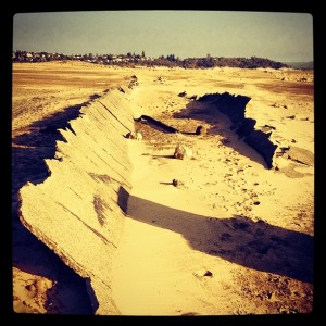
In 1861 construction was started on the Sacramento, Placer, and Nevada Railroad (SPNRR). The rail line was originally designed to run from the City of Folsom up to Grass Valley. Only the lower division built was built, primarily through what would become Granite Bay. The SPNRR started at Ashland Station (corner of Greenback Lane and Auburn – Folsom Road) and terminated north of King Road in Loomis. The final construction to the railroad through today’s Folsom Lake closely aligned with the North Fork Ditch. It travelled under Dyke 5 and then north to Miners Ravine where it followed the course of the creek through the Granite Bay area.
With the construction of the Central Pacific Railroad from Sacramento to Auburn in 1865 there was little use for the SPNRR and it was eventually abandon. Parts of the old railroad grade can still be seen along Miners Ravine Nature Trail, through Hidden Lake, and on private property in the area. View the original 1861 SPNRR map compared to current roads in Granite Bay.
Folsom Dam
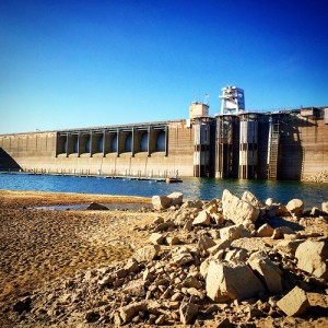
The need for flood control along the American River had been well documented as the City of Sacramento flooded repeatedly since its inception beginning with Sutter’s Fort. Folsom Dam was originally designed only for flood protection. It was later redesigned as both a flood control dam and storage reservoir with hydro-electrical generation. Work on Folsom Dam was started in 1948 and was finished in 1956. Why is Folsom Dam Releasing Water During The Winter?
Folsom Lake completely changed how potential residents viewed the area. The land at the end of what was called Mooney Road, later to become Douglas Blvd., was now a recreational destination. The allure of Folsom Lake drew developers to sub-divide land around the lake and start building suburban homes. Auburn – Folsom Road, which had traveled along the North Fork of the American River, was re-routed around Folsom Lake on its west side to intersect with today’s Douglas Blvd.
How Granite Bay got its name
John Hogg on the naming of Granite Bay. John had moved close to Folsom Lake and opened a dental practice in the area in 1980. It was at this time that the area started to experience noticeable growth.
The addition of so many businesses into the community and the lack of interest by Roseville Chamber of Commerce to help deal with issues that would need to be presented to Placer County rather than the City of Roseville forced us to start a local chamber of Commerce named Folsom Lake Chamber of Commerce. I was one of the founders and second President. While I was President, the U.S. Postal service decided to open up a branch in Granite Bay Village with a Zip Code of 95746. There was no proper name for the area. The postal service reached out to Placer County for guidance and we’re referred to the local entities. These were the South Placer Fire District (fire chief Warren Desmond), Eureka Union School District (superintendent Ron Feist), and the Folsom Lake Chamber of Commerce (myself President).
I don’t remember that San Juan Water District was involved, but they might have been. Ideas were Granite Bay, after the entrance to Folsom Lake, Folsom Lake, after the chamber, South Placer, after the fire district, and East Roseville. Both the fire district and school district chose Granite Bay. The chamber took a vote and more than 60% chose Granite Bay. This was interesting since Granite Bay lost out to Folsom Lake in the naming of the chamber. The most likely reason for this was the City of Folsom Chamber complaining that our chamber could easily be confused with theirs. With all business and public organizations choosing the same name the postal service announced it as the name of the branch.
After the announcement there was no negative feedback so that is how Granite Bay became Granite Bay. I guess you could say the post office forced our hand. As an interesting aside, the original boundary was Placer County line, Folsom Lake, City of Roseville, and including Hidden Valley to the east. The developers of Los Logos decided that the new Granite Bay community would be a more exclusive community than Loomis, which was much more rural, and petitioned with the postal service to be included in the zip code. All of the land on either side of Auburn-Folsom Road up to and including Los Logos was then placed in Granite Bay. Over the years, at various times, it has been proposed that Granite Bay become a city. This was usually to get the attention of the county to support various projects in Granite Bay. Technically Granite Bay is just an unincorporated area in South Placer.
This distinction is important. Prior to 1988 the area was represented by a county supervisor from Loomis (Mike Lee). During that time most property taxes were utilized in Loomis. There was a library in Loomis, none in Granite Bay. There was a regional park for little league in Loomis, no parks in Granite Bay. As more homes were built in Granite Bay in the 1980’s there were more voters. Upon Mike Lee’s retirement in 1988 a supervisor from Granite Bay was elected (my wife Susan Hogg). In 1989 the Granite Bay General Plan was enacted by the Board of Supervisors which has remained virtually unchanged since. This change of supervisors brought the widening of Douglas Blvd with landscaped median strip for safety, numerous parks, and a library. Kirk Uhler who followed my wife as supervisor continued the vision for Granite Bay.
John Hogg, June 7, 2022
More historical tidbits can be found at http://www.granitebay.com/History.html
How San Juan Water District Gained 33,000 Acre Feet of Folsom Lake Water

Chinese Miners In Granite Bay Region
Have information to add or share on the history and development of Granite Bay? Feel free to contact me.
Read my other posts on the American River and Folsom Lake Region.