
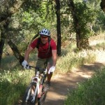
Five years ago I walked my bike more than I rode it on the trails around Folsom Lake in Granite Bay. With a lot of practice, I can now ride up some of those steep slopes with out stopping. But don’t let me scare you, the trails around Folsom Lake that you can ride your mountain bike on are not that challenging and it is perfectly acceptable to walk your bike.
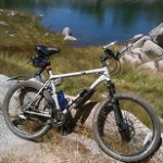
This blog post discusses the trail from behind Cavitt Junior High School up to the parking lot at Beek’s Bight. Unless noted otherwise, all of the photos were taken May 27, 2012. While some people may not like me saying this but, the trails around Folsom Lake are underutilized for the beauty and recreation they offer. Even though this post focuses on mountain biking, I also run the same trails, although, not as far.
If you are coming to ride, hike or run the trails on the weekend, a good spot to park is at Cavitt Junior High School on Fuller Rd. It is a short walk, or ride, through the school up to the top of the dyke which is part of Folsom Dam. The numbers correspond to pictures on the trail and are marked on the map.

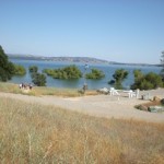
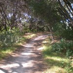
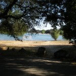
1. At the top the trail from Cavitt: To the right takes you to Beals Point along the top of the dykes. This a nearly flat ride where you can look down at the lake. To the left will take you to Granite Beach and more extensive trails.
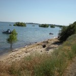
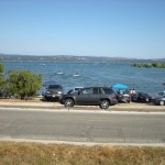
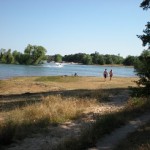
2. With the lake full the beach area can be small. The park will typically close the back part of the lake past Granite Beach because the high water restricts parking. Unless you take to the trails in Granite Bay during the winter when they are having a mountain bike race, you are not likely to encounter many bikers.
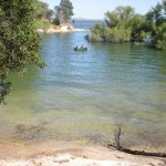
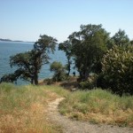
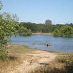
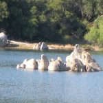
3. Some of the shallow coves and inlets make for great swimming when the lake is high.
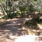
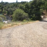
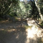
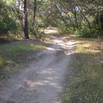
4. This part of the trail is more of an access road than trail. The worst part is the gravel (5) that makes it easy to slip out on your bike traveling down the slopes and around curves.
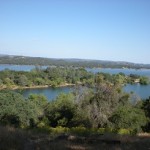
6. This point is a nice scenic overlook of the dam to the south and when the water is lower you can see the peninsula that divides the north fork from the south fork of the American river.
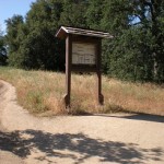
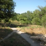
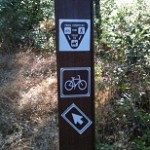
7. This trail kiosk marks the start of the multi-use trail system just inside the Granite Beach Park entrance. The trail to the left takes you to the park entry, to the right, the trail parallels the park road up to Granite Beach.
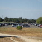
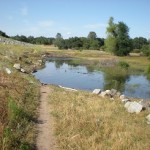
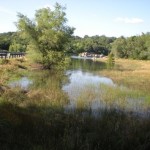
8. In a couple of weeks when the water drops, this expanse of water will reveal a giant black top parking lot. In the winter this parking lot is used by model airplane enthusiasts flying their planes. The water will have receded enough by July, that many of the trails shown here as flooded will be completely clear. Most of the trails are only covered in water for 4 to 8 weeks out of the year.
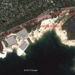
10. Use caution crossing the parking lot at Granite Beach. Most people just are not thinking. My son was bumped by a car here when he was younger. There are some trails that hug the lake up to the Granite Beach which can be fun to ride if there are not too many people walking around.
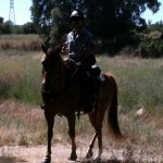
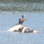
11. On the north side of the parking lot the trail will start again. The highest water I have ever seen occurred June 10th of 2011. Parts of the trail were covered in water that you would never expect. Remember, these are multi-use trail and you never know when you will come around the corner and be face to face with Mr. Horse.
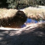
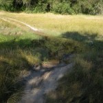
12. It is always surprising how far the water creeps towards the back of the lake as it fills. In the middle of this inlet of water is perhaps 6′ deep.
13. Miles away from the main dam, they still had to construct dykes to contain the water at full capacity. Real mountain bike riders, when you are familiar with the trails, will ride through the water (14).
15. The dead end of the County Rd. reminds us that beneath Folsom Lake there use to be a community.
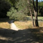
16. On the north side of the Park Rd. starts the back trail system. Fork left is a steady incline up to the Bench. Fork right is a longer ride up to the Bench with more hills and turns. Elevation at the base of the Cavitt trail is 430′. The highest elevation on the trail is at the Bench at 567′.
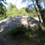
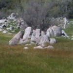
17. There are a couple places, usually on the top of ridges, where small rock outcroppings can be a real annoyance. If you don’t know how to hop the rocks, walk the bike around these patches. I have had my share of spills.
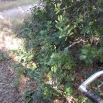
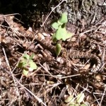
18. And you never know when that spill is going to take you into a batch of poison oak. In the spring, the large stands of poison oak give off an intense smell similar to clove oil.
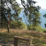
19. At the Bench you have a good view of Doton’s Point that you can bike to. On the east side Doton’s is the north fork of the American River.
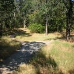
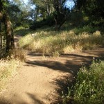
21. After you leave the Bench, the trail is still pretty friendly for moderate bike riding.
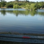
23 Beek’s Bight, like other coves, will fill when the lake is full. The Bight is 15′ to 20′ deep. This is also the end of the Park road that terminates in a parking lot with bathrooms. The trail around the west side going north around Beek’s Bight is for runners, hikers and horses only. You can take this trail to Rattlesnake bar and up to Auburn. To the right (25b) allows you to bike down to the tip of Doton’s Point. It makes for a nice afternoon ride when you can ride all the way to Doton’s. The round trip (Cavitt to Donton’s and back) will take between 2 and 3 hours depending on your level of experience.
26. Even though I don’t see too many other bikers, you still have to be listening as you come up to blind corners.
27. The Bench fork: to the left takes you around the hill and gently rolling trail. To the right is a steep hill, with switch backs to the top.
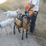
28. This was a first. I have never seen goats on the trail. But I had a nice conversation with this gentleman who uses the brown goat to pack the camping supplies.
29. With the lake water high, you are more apt to see rattle snakes. I will usually see them quickly slide across the trail. If you stay on the trail, you won’t have any problems.

Trail lines are approximate. Other trails, not marked, may also be used for running, hiking or biking.
There are other little side trails and inter-connected trails. It is hard to get lost because you are usually either close to the lake or road. These trails are year round. You will actually encounter more water in late spring and early summer than during the winter. I will usually pack to water bottles during the summer for the round trip bike ride.
Have fun on the trails and I’ll wave when we pass each other.