
Harper’s Weekly periodical published illustrations and map in its December 7, 1867, edition of work on the Central Pacific Railroad. The illustrations are from work in the Sierra Nevada mountains between Emigrant Gap and Donner Lake. The accompanying text has some inaccuracies but gives a general flavor of the work and the importance of the project. Specifically, the role of Chinese men excavating the road through the granite mountains. The reference to Giant’s Gap is probably Emigrant Gap. The deep valley of the American River is most likely known today as Royal Gorge.
The Central Pacific Railroad.
In speaking lately of the railroad which is shortly to span the continent, and unite the Mississippi and the Pacific, and which out to be call the “Continental Railroad,” we purposely ignored the separate existence of the two roads known as the Central Pacific and Union Pacific, and spoke of the entire route from Omaha to San Francisco as one line, as, when they are finished, they will be practically.
Some of our friends have supposed this to be an inadvertence, and several letters have suggested to us that perhaps, after all, the public does not generally understand that two corporations are engaged in this gigantic work; and that though the Union Pacific from Omaha west, and the Central Pacific from Sacramento east, are to unit at Salt Lake City, and become the great Pacific Railroad, they are for the present not only distinct and separate, but, in a certain sense, rival corporations.
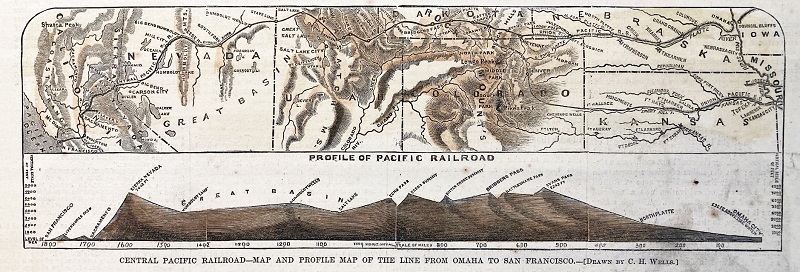
The rivalry exists in this – that the first company which shall complete its road to Salt Lake City shall be entitled to the national charter and the national land and money grants for the whole line from Omaha to Sacramento. We give in this Number of the Weekly a diagram which will perhaps better explain this, and which at the same time shows the work completed on each route, the work to be don, the distances, and with the aid of the Profile Map which we give, in a measure the nature of the difficult labor.
By this Map it will be seen that the Central Pacific Company has built something over 160 miles of t its road, and reached the summit of the Sierra Nevada, next to the higher level on the road, and has 385 miles to finish to Salt Lake City; that the Union Pacific Company has built 516 miles of its road, and has 439 miles to finish to Salt Lake City.
The immense work is prosecuted with the utmost vigor by both parties, and it is confidently believed that it will be finished before 1870. The latest report of the United States General Land – Office Commissioner shows that this country is now 3000 miles in advance of England on our routes to China, Japan, and the East Indies.
When this line of railroad is completed, and passengers can be carried across the continent in a week, instead of taking three times as long via Panama, and six times as long around the Horn – when goods can be sent from Hong-Kong to London in forty days, and to New York in thirty, it is easy for the most unimaginative person to the effect which will be produced on American commerce.
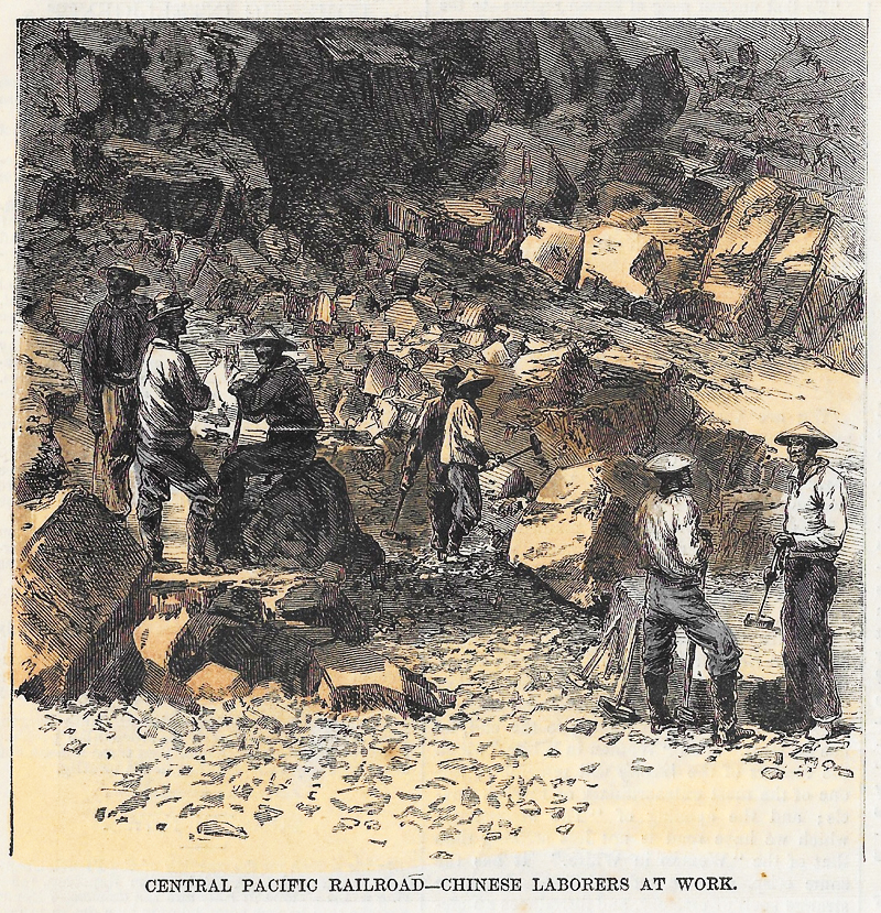
Accompanying this very suggestive Map are several views on the Central Pacific Railroad, which still further illustrate the difficulties encountered in its construction. The first of these represent the Chinese laborers at work on the road up the Sierra Nevada. The Central Company has over 10,000 of this race in its employ. The picture gives some idea of the Herculean nature of the work of tunneling and excavating through the solid granite of the mountains.
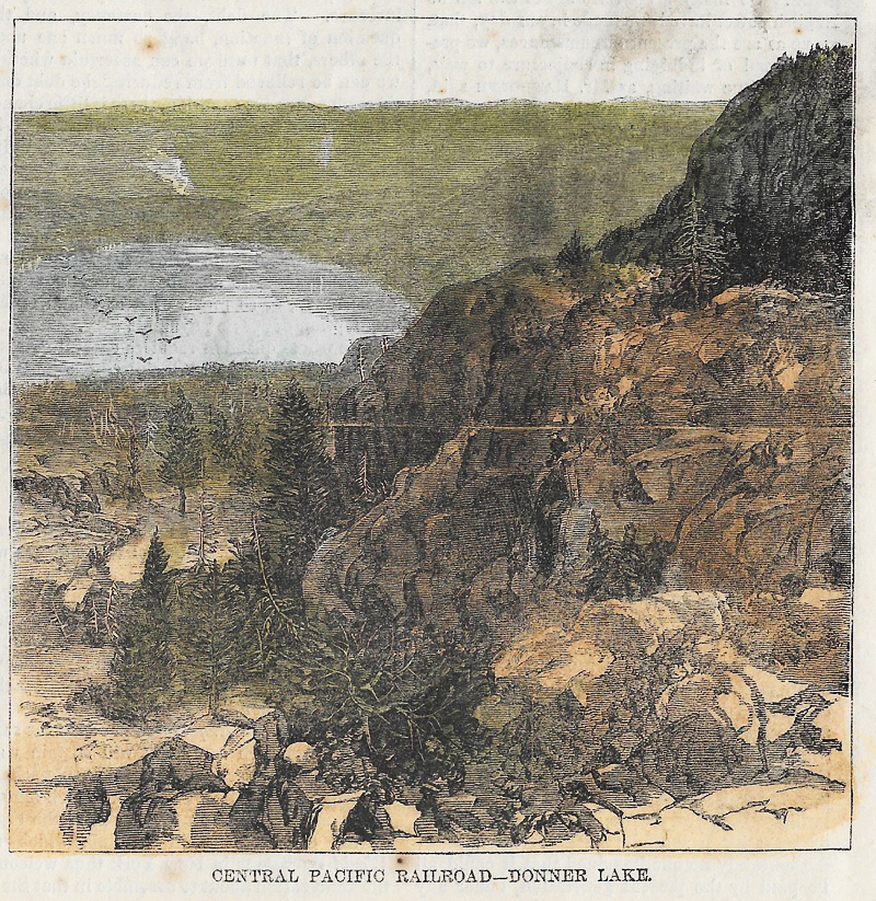
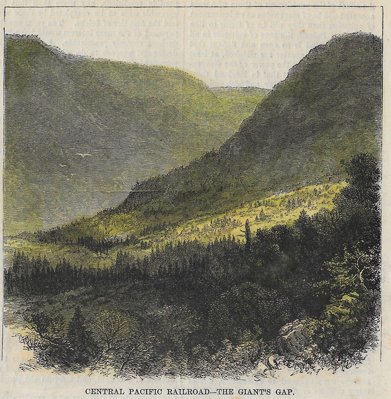
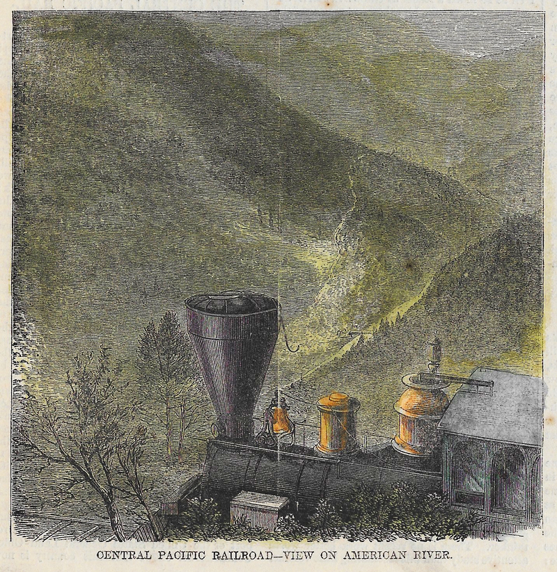
The “Giant’s Gap,” a gigantic opening in the mountains, shows the rugged nature of the country. The third engraving is a view of the American River, which flows through a narrow valley between peaks which tower 5000 feet above its waters. “Donner Lake” has an elevation of 5964 feet above the level of the ocean, and is surrounded by lofty peaks. The view obtainable from some of these peaks can not be surpassed in grandeur, beauty, and extent in part of Europe, save by that from Mont Blanc.