

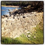

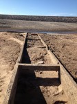
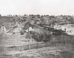
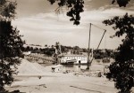
Before modern day Folsom Lake was filled, there was a community at the confluence of the North and South Forks of the American River. When the lake was extra-ordinarily dry in the summer of 2009, I took several photos of the the structures that existed before the the dam was built. The history associated with the old North Fork Ditch captured me such that I have been documenting more of the natural beauty and history of the area. See more pictures at Folsom Lake Pictures
Blog posts on Folsom Lake and Granite Bay, History, Hiking, Gold Mining
Granite Bay should be designated as cycling friendly community
Folsom Lake Peninsula Drought Hike
Hiking around Goose Flats and Zantgraf Mine
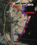
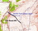
1910 Water Canal Map of American River
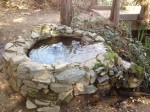
Rose and Rock Springs continued to bubble up even during drought
Salmon Falls Bridge to Bridge Hike
Folsom Lake Peninsula Drought Hike
Will drought create a residential water market?
Residents must conserve so Placer County can sell water to Bay Area
Granite Bay goes brown to conserve water during 2015 drought
American River images before Folsom Lake
Granite Bay water consumption drops without price hikes
Granite Bay Golf Club may be using historic Rose Springs water for irrigation
My cheap water Northern California water doesn’t foster conservation
Anderson Island bridge and Zantgraf Mine hike at Folsom Lake
Biking and Hiking the North Fork Ditch
Hiking down the Folsom Lake Peninsula
Hydroplane boat races visit Granite Bay, Folsom Lake
South Fork American River Trail, Salmon Falls Bridge to Hiway 49
Folsom to Roseville, California Central Railroad
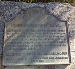
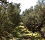
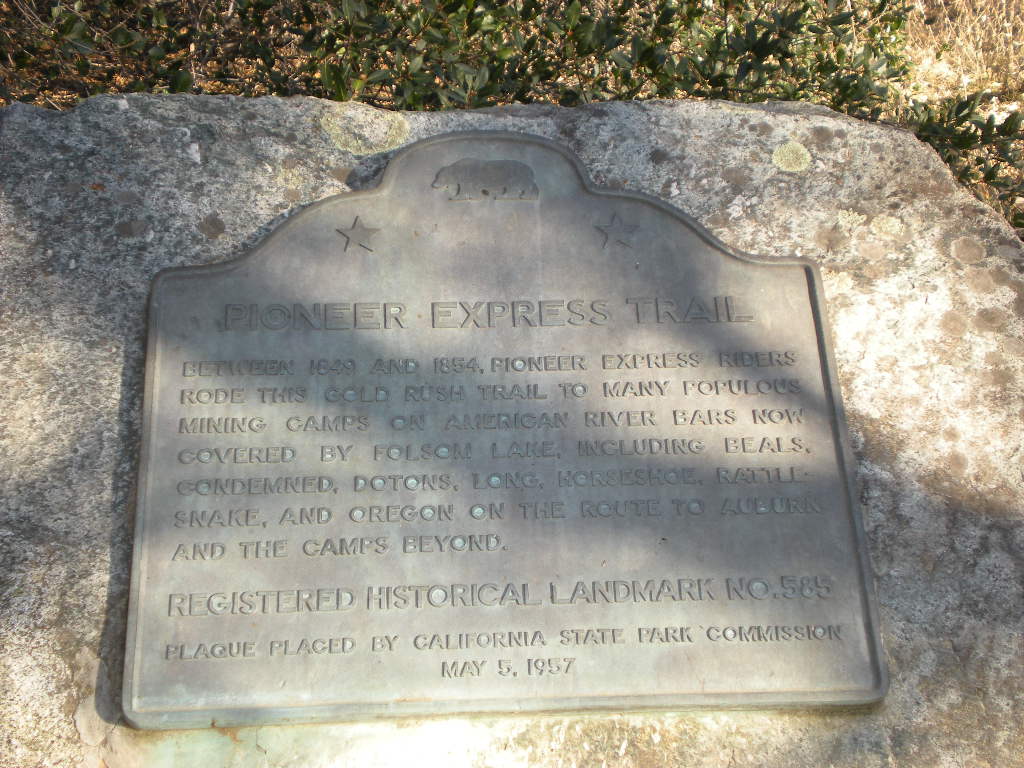
Olive orchards along the Pioneer Express Trail Folsom
North Fork and Rose Spring Ditch through the lake and Granite Bay
Historic Granite Bay Gold mine
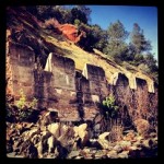
Mining Bars, Viaduct American River Folsom Lake
Folsom to Granite Bay: Sacramento, Placer and Nevada Railroad
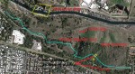
Pioneer Express Trail: Rattlesnake bar to Birdsall dam site, Avery’s Pond, North Fork Ditch
Granite Bay Folsom Lake Trails
Mountain Bikes are destroying trails around Folsom Lake
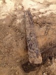
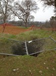
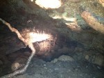
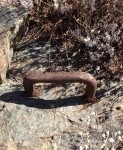
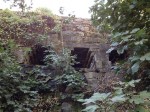
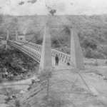
Anderson Island suspension bridge cables

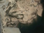
Cables and chiseled cut out mark the location of the 19th century suspension bridge that carried a water pipe over the North Fork of the American River, from the North Fork Ditch, to the mines on the east side of river which had very little water.
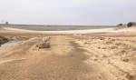
Mormon Island Folsom Lake 20% capacity
Rattlesnake Bar Bridge New Years Day 2014

Recording of the free flowing American River on January 1, 2014 at Rattlesnake Bar and Horseshoe Bar.
Click to enlarge thumbnails. Most of these photos are from various blog posts I have done.


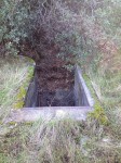


Hike to Avery’s Pond

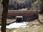
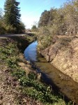
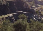
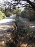
A nice easy hike will take you from the parking lot of Rattlesnake Bar boat launch all the way to Avery Pond (which was a mud settling pond for the North Fork Ditch) and you can continue to the PG&E Newcastle Power Plant. Look for the old remnants of the irrigation canal. Water was fed into the canal at the terminus of the PG&E water canals that feed the water through a series of hydro-electric turbines. The canals wound its way around modern day Folsom lake providing water to farms and eventually to the Baldwin Dam on the other side of Auburn Folsom Road.
This essay first appeared in the periodical California Northern Spring 2011
When we moved to Folsom Lake, from our home in Elk Grove to be closer to our parents, I never guessed that I would be spending every single weekend there. Oddly enough, I grew up in Citrus Heights, a suburb of Sacramento and relatively close to the lake. I spent two summers being a Junior Lifeguard at the lake back in the ‘70’s, but did not venture out to the lake much after junior high school. We are fortunate that in less than a mile from our home we can be at the lake. Folsom Lake is a State Recreation Area, and while very popular, I imagine there are few who are as attached to it as I am and visit it regardless of the season.
In roughly the center of Folsom lake is the intersection of northeast Sacramento County, southwest Placer County and northwest El Dorado County, approximately 25 miles from downtown Sacramento. A subtle, but striking, feature is the difference in parent material of the soil between the Placer County west side and the El Dorado eastern side. You first notice that the eastern side does not have the quantity or diversity of oak trees. Next you see that the soil has more of a reddish hue on the eastern side. Finally, the eastern side has virtually none of the granitic outcroppings that the west side has. How the earth can be so very different between one side of the American river and the other has always fascinated me.
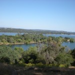
In the summer, I can feel the familiar crunch of the decomposed granite underneath my bike tires as I pull onto the trail. The air is heavy with the smell of grass and dust. The temperature in the Sacramento Valley often tops 100 degrees for days in a row. I can barely keep the sweat out of my eyes as I ride to the top of the levy to gaze out at the blue water of Folsom Lake. There are boaters, jet skis, and beach bathers everywhere I look taking advantage of the cool water on this warm day. The only animals around are the lizards that sometimes stir along the trail and the occasional rattlesnake. Most of them know better than this mountain biker to stay out of the heat.
Further down the trail I ride past the picnic grounds at Granite Bay Beach and the smell of summer barbeques fills the air. I ride past barbeques filled with hamburgers, hot dogs. Mothers chase their kids around with sunscreen. I hear people complain about all the congestion at the lake and all the people who take up the picnic areas, but I love to see these families enjoying the lake and having fun together outside. Listen closely to America at Folsom lake. You will here a collage of Spanish, English, Hmong, Cantonese and Hindi all coming from different families feasting at picnic tables next to one another. While there are many languages, the laughter and squealing of joy from little children playing is universal. Granite Bay State Park has brought an international flair to Placer County even if the surrounding neighborhoods don’t know it.
I continue to struggle up the hill toward the back part of the park where there are more hills, steeper slopes, and piles of horse manure to maneuver around. Horses and their riders follow the same trail, and the dust they kick up sticks to my face.
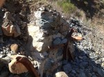
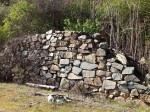
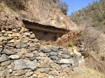
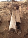
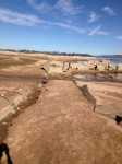
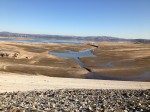
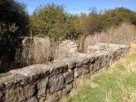
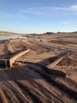
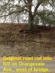
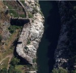
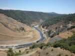
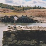
In autumn the lake water level is at its lowest exposing granite outcroppings that look like miniature versions of the monoliths in Yosemite. Folsom Lake is relatively new. The dam which created it was built-in 1956 at the confluence of the north and south forks of the American River. As with any good Bureau of Reclamation project, the recreational aspects of Folsom lake were hyped up along with the obvious benefits of flood protection, irrigation, and electricity. But the land had an entirely other life before the dam: Native Americans lived here, eventually pushed aside by gold prospectors, who became farmers and ranchers, until finally this man-made reservoir took over. When the water is very low, it’s possible to see and even walk around the outlines of old roads, irrigation canals, bridges and house foundations of the pre-dammed valley.
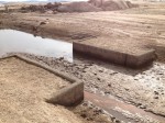
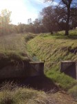
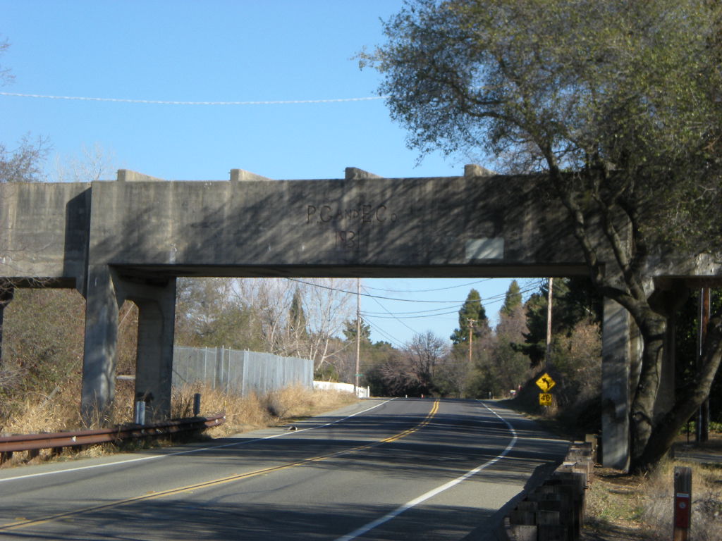
If you travel up the lake far enough, above the water level will be the remnants of the concrete line irrigation canal. This canal was the final leg of water that had traveled through many power plants and was used for local pasture and orchard irrigation before it terminated at Baldwin dam in north Folsom. The confluence of the south fork of the American river and the north fork must have been a beautiful site to behold from the surrounding foothills. Today we treasure the confluence of the north and middle forks of the American river in Auburn.
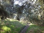
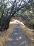
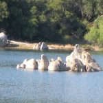
The autumn rains wash off the summer’s dustiness and bring a green carpet of grass to the hillsides and under the trees. Now that the temperature is significantly cooler, only trail runners, bikers, and horses are left taking advantage of the lake. The roar of jets skis and speedboats has been replaced with calm bass fisherman enjoying some solitude, and it is often quiet enough to hear the sirens at Folsom prison, just on the other side of the dam. The park is a classic oak savannah woodland, and since the live oaks only lose about half of their leaves in the fall, the trail has a hazy shade to it. If I’m lucky, I glimpse one of the few bald eagles that come here to fish during the fall.
With winter’s onset, trunks and branches of the oak trees are covered in moist lichen and moss. Clumps of fern stands along the trail side reawaken after going dormant in the summer heat. On especially cold mornings, steam rises from the warmer lake water, the thick valley fog will envelope the low foothills, and running the trails can make me feel like I am running in another world entirely. After a rainstorm, the little kid comes out in me as I ride my bike through the big puddles splashing water and mud all over the place.
The huge expanse of black top, filled in the summer with trucks and boat trailers during the summer, is deserted in winter. Parking lots become runways for model airplanes that soar high in the air with an engine whine that is oddly pleasant. Winter is also the time when many of the bike and trail running races take place because the park is virtually vacant. With the water this low and when the fog clears, I can see the finger of peninsula land that divided the north and south forks of the American.
By the time warmer temperatures bring on spring, stands of poison oak are sprouting new leaves, and the grasses are knee-high. Wildflowers cover the hillsides and my fellow bikers return to the trails, along with the horses. I lament that I have lost my solitary rides for the next few months. But I am excited to see the energy that my fellow trail lovers bring to the lake.