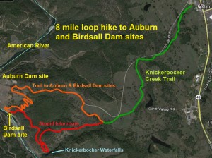
Hiking down to the Auburn and Birdsall Dam Sites.
Even in the midst of losing my water, grabbing onto poison oak bushes to maintain my balance, and enduring intermittent leg cramps, stumbling down to see the foundation of the historic Birdsall dam and Knickerbocker waterfalls still wasn’t the worst hike I’d taken. My mistake was thinking that I was smarter and stronger than the Auburn Area State Recreation Park. While the ultimate destination, the north side Knickerbocker water falls was a bust, I got some good pictures of the foundation of Birdsall dam.
Windy trail down to Auburn Dam site
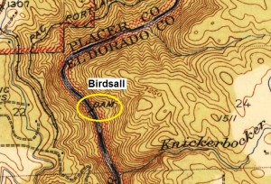
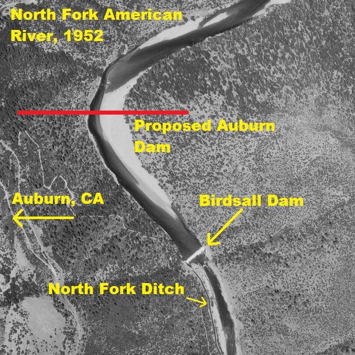
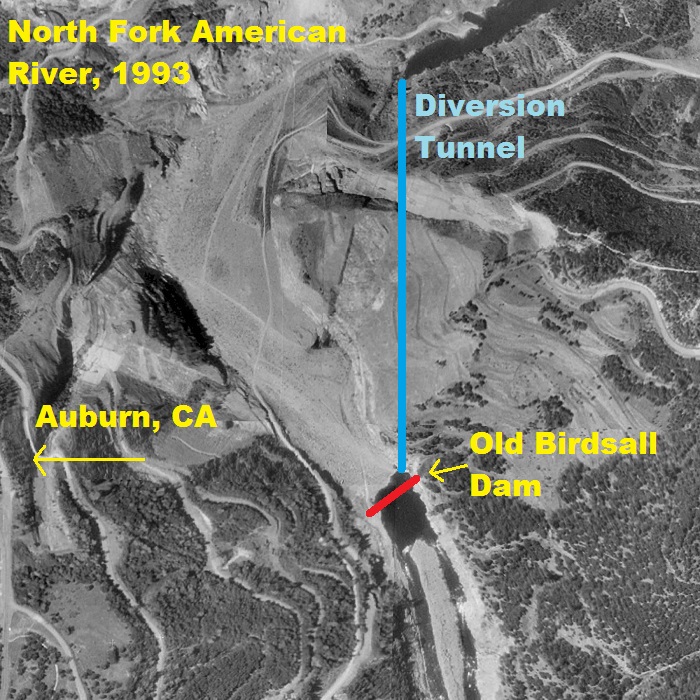
It’s always been a pleasant and easy hike along the Knickerbocker Creek Trail out of Cool in the Auburn Area State Recreation Park. At the point where the trail dips into Knickerbocker creek crossing, I trekked up the hillside toward the paved access road down to the site of the abandoned Auburn Dam. I knew the windy trail would eventually lead me to rocked over American River tunnel use to divert the river around the dam construction site. From an earlier hike on the west side of the American River I could tell the historic Birdsall Dam built in the 1870’s to divert water in to the north Fork Ditch should have terminated on the east side of the river directly south of the tunnel exit. Interesting that two structures, built one hundred years apart, were used to divert the North Fork of the American River either under a mountain or into a water ditch. (For more history on see Birdsall Dam History post.
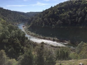
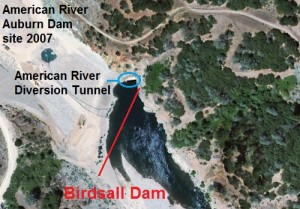
Diversion tunnel and Birdsall Dam side by side
American river diversion tunnel exit (rocked over) next to the foundation of the Birdsall Dam.
I don’t think it was necessarily total coincidence that the construction of the Birdsall Dam was directly below the site of the unconstructed Auburn Dam and the diversion tunnel exit. The natural site characteristics of exposed bed rock and a narrow point in the river lend itself to dam construction. After numerous dams had been washed out by the raging waters of the American River during winter storms, the Birdsall dam engineers were intent on building a dam that would withstand a torrent of water. Similar to today’s modern dam, the Birdsall was anchored to the bedrock of the north fork of the American River Canyon. See also the History of the North Fork Ditch
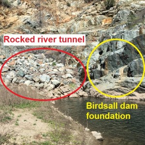
Birdsall Dam destroyed with completion of Folsom Dam
While the Birdsall Dam was blown up with the completion of Folsom Dam there are still faint outlines of the dam on either side of the river. It’s possible that an even a greater degree of destruction of the Birdsall dam occured because its eastern anchorage was next to exit of the diversion tunnel built to dewater the river at the dam site. Ironically, the Birdsall Dam built in 1870 lasted until 1955 while the larger Auburn Dam never did get built. All that remains are remnants of each on either side of the river they wanted to control. See also, One earthquake stopped the Auburn Dam
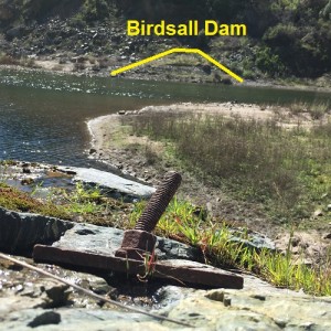
Bolts of the Birdsall
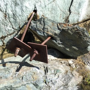
Bolts, rods, and plates of the Birdsall foundation have broken loose after a century in place.
Once I scrambled over the rocks that were dumped to close off the diversion tunnel and force the American back into its riverbed I was able to get a close up view of the anchor bolts and plates drilled in the bedrock for the Birdsall Dam. I couldn’t discern if the angled rock ledge was natural or if it had been cut out for the dam. The depth of the water because of the diversion tunnel on the wide rock ledge makes for a natural diving spot into the river.
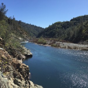
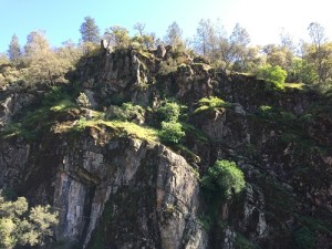
Knickerbocker Canyon right around the corner
Much to my disappointment the American River runs very close to the steep terrain of the east side of the canyon. My initial plan was just to walk the half mile south to where Knickerbocker creek empties in to the American River. When I saw the loose rock, steep slope and the deep water I was forced to either turn around or try to find an alternate route to Knickerbocker. I climbed up the hill and found what looked like an old road. What I would soon find out is that there are several old mining roads cutting across the east face of the American River canyon, but most of them become impassable at some point because of washouts, over growth or fallen trees.
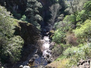
Driven by waterfall photos I never snapped

Looking at the towering south face of Knickerbocker Canyon.
Excited at the prospect of taking some great photos from the north side of Knickerbocker Canyon I trudge southward toward the waterfalls. It took me an hour to traverse a half a mile. When I finally slid down to a vantage point overlooking the creek, the waterfalls were obscured by trees and in the shadow of the south wall of the canyon. I was too high up to get any good pictures and the terrain was too steep to climb down. Three hours into my hike on a steep hillside with loose rock and dirt I felt my legs starting to cramp. For real pictures of the waterfalls, see: Hiking down Knickerbocker Canyon
Another fine mess I got myself into
It was stupid to attempt such a strenuous hike after a weekend of landscaping work around the house. But then again, I never thought I’d have to scramble up five hundred feet in elevation to find a clear path. My second mistake was taking a mining road that was higher up the hill than the one I originally hiked. As I fought through the manzanita, down trees and loose rock travelling to get back to the Auburn Dam trail road, my dirt path stopped. The road was so overgrown that my only options were to either back track or scramble up the hill to the top.

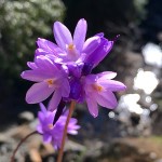
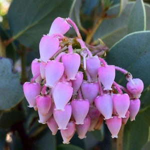
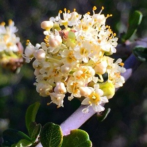
Purple wildflower above the Knickerbocker waterfalls.
Poison oak branch saves me from sliding down hill
I wasn’t lost. I knew that if I could just head east I’d eventually hit the Knickerbocker Creek Trail. But to head east I need to get to the top of hill where I knew from Google Earth images there was some open space and deer trails. It was about a hundred foot elevation gain over about 300 feet distance. That doesn’t sound like much, but there was no trail. I was just climbing over manzanita bushes, buckbrush, oak and grey pines, and trying desperately to avoid all the poison oak. When I grabbed onto small branch to keep from falling backwards, only to realize that it was stem of poison oak, I lost all pretense of trying to be cautious.
Leg cramps and will I need to call 911
Fortunately I was wearing a long sleeved shirt and wide brim hat, but I had changed into walking shorts for the hike. From a previous hike into Knickerbocker Canyon I knew that ticks and a poison oak rash awaited me. As I crested the top of the hill I realized that I lost my last water bottle. While I wasn’t desperate for water, my leg cramps were getting worse and I had a flash that I might need to call for assistance.
Crashing through brush like a drunken college student
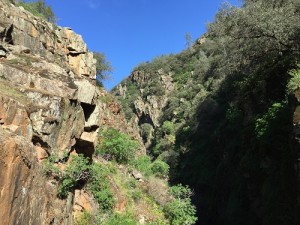
Looking east up Knickerbocker Canyon shows how steep the sides are.
To help with cotton mouth on long hot dry hikes I always carry breath mints that help keep the mouth moist. I started popping the mints as I trudged forward. Eventually, after crashing through another overgrown mining road, I did hit the Knickerbocker Creek Trail. It was a slow uneventful walk back to the car. Overall it was an eight mile round trip hike that started out at 1,522 feet elevation and went down to the North Fork of the American River at 512 feet elevation. Several hundred feet of the elevation gain was spent in a near prone position on the side of hills working my way to the top.
Only two ticks!
This wasn’t the most miserable hike I’ve attempted, but it was the most strenuous because I made dumb mistakes. Bad hikes are usually hot and dry with bland scenery and no decent destination worth mentioning. On the upside, I got some good pictures of the Birdsall Dam foundation. On the downside was the lousy view of the Knickerbocker waterfalls. Plus, as I write this, the poison oak rash that has yet to develop. I only found two ticks, one of which who went through the washing machine and survived. Ticks are tough little guys.
Auburn and Birdsall Dam intersection, good history and hikes
I would recommend hiking down to the Birdsall dam foundation. I would highly discourage any attempt to hike over to the Knickerbocker Canyon using my path. But I’m not giving up on walking into the Knickerbocker Canyon from where it exits to the American River. Later this summer I’ll attempt to walk across what I hope will be a drought trickle of an American River to Knickerbocker from the west side of the river.
Historic North Fork American River Photos
I found aerial photos of the North Fork of the American River from 1952 and 1993. The 1952 photo shows the Birdsall Dam intact before it was demolished. The 1993 photo shows the dewatered American River with the diversion tunnel exiting at approximately the spot of the historic Birdsall Dam.
Click on photos to enlarge


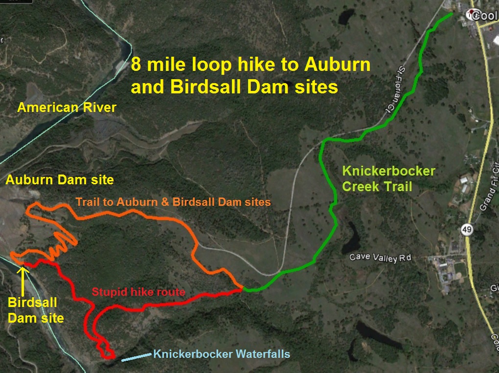
My poorly planned hike to Auburn and Birdsall Dam sites with detour to Knickerbocker Canyon.
Birdsall, American River and Knickerbocker trail hike pictures
Click the image to enlarge it