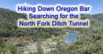
The Eureka Peak loop trail starts at the dam and goes up. There are great views of Eureka Lake at several places along the trail. Once at the peak, 7,447 feet, you can look into the valley below and see clear over to Grass Lake.

Kevin Knauss: Health, History, Travel, Insurance
Posts related to different hikes I have taken primarily in California and around Folsom Lake region. Pictures and maps
To get close to some of the larger waterfalls you will have to find a trail that will take you down the hill. Then you will have to push through some brush and willows to get stream-side. On my hike I encountered no mosquitoes and no rattlesnakes. It was really a nice, but short, hike. Within a span of 2 to 3 hours, you can see lots of waterfalls, spectacular mountain peaks, and a picturesque valley.
There is no record of when the last Native American camp ceased to exist in the Folsom Lake region. Many historians note that by 1853, most of the Native American population had dispersed, move south, died in conflicts with immigrant settlers, or died of disease. But there is no doubt that there was a thriving Native American population and culture along the north and south forks of the American River. Where Native Americans once ground acorns, skinned deer, or fashioned tools from local rocks, Folsom Lake visitors now fish, hike, ride horses, bikes, and have picnics.
What the house lacked in modern amenities, according to John, was more than made up for in the wild El Dorado County countryside that surrounded it. Fostered by the books John’s father read to him, his imagination blossomed and streams, fields, and hillsides were his land of adventure. There were whales to harpoon, witches to avoid, and Indian wars to recreate. By virtue of being an only child, John was forced out into the sunshine and fresh air to create his own daily entertainment.
After my son took a geology course in his freshman year at Williams College, he wanted to see the volcano on Hawaii. So we planned a short little trip over the 2016 Christmas holiday. This was only my third trip to the island chain and I came away even more unimpressed about Hawaii than on previous trips.
It can be a difficult task to locate the faint outlines of the Negro Hill Ditch which is usually under water at Folsom Lake. But when the lake is low enough it’s possible to find the old grade and structures associated with the historic water canal that ran from east of Salmon Falls down to Negro Hill and Massachusetts Flat. In the autumn of 2016 I was able to complete my goal of walking along most of the Negro Hill Ditch.
With Folsom Lake water levels low in the autumn of 2016, I decided to hike from Rattlesnake Bar up the North Fork of the American River to see if I could catch glimpses of gold rush era history. The terrain was far more difficult than I imagine. While I know the river canyon has change since the gold rush of 1849, I was surprised at just how arduous the hiking along this stretch of the river must have been for the gold miners.
As the lake level drops, the history is revealed. As Folsom Lake hit record low water levels in 2015, a whole lot of history was revealed. A drought shrunken Folsom Lake of 2015 was the highlight for a guy like me who had been hiking around the reservoir for years looking for historical sites. After numerous hikes around the North and South Forks of the American River at Folsom Lake, I finally organized my photographs and historical research into a book, Hidden History Beneath Folsom Lake – Hiking Across a Dry Lake in Time of Drought.
When the summer heat hits in the Sacramento Valley, my fail-safe hiking destination is the Marin Headlands in the Golden Gate Recreational Area. Even after all the spring wildflowers have faded away, there is still plenty of natural beauty to see on the hiking trails above the Pacific Ocean.
Kevin Knauss provides no cost health insurance rate quotes and enrollment.
Kevin Knauss, Education Before Enrollment, Health Insurance Bridge
Spam prevention powered by Akismet