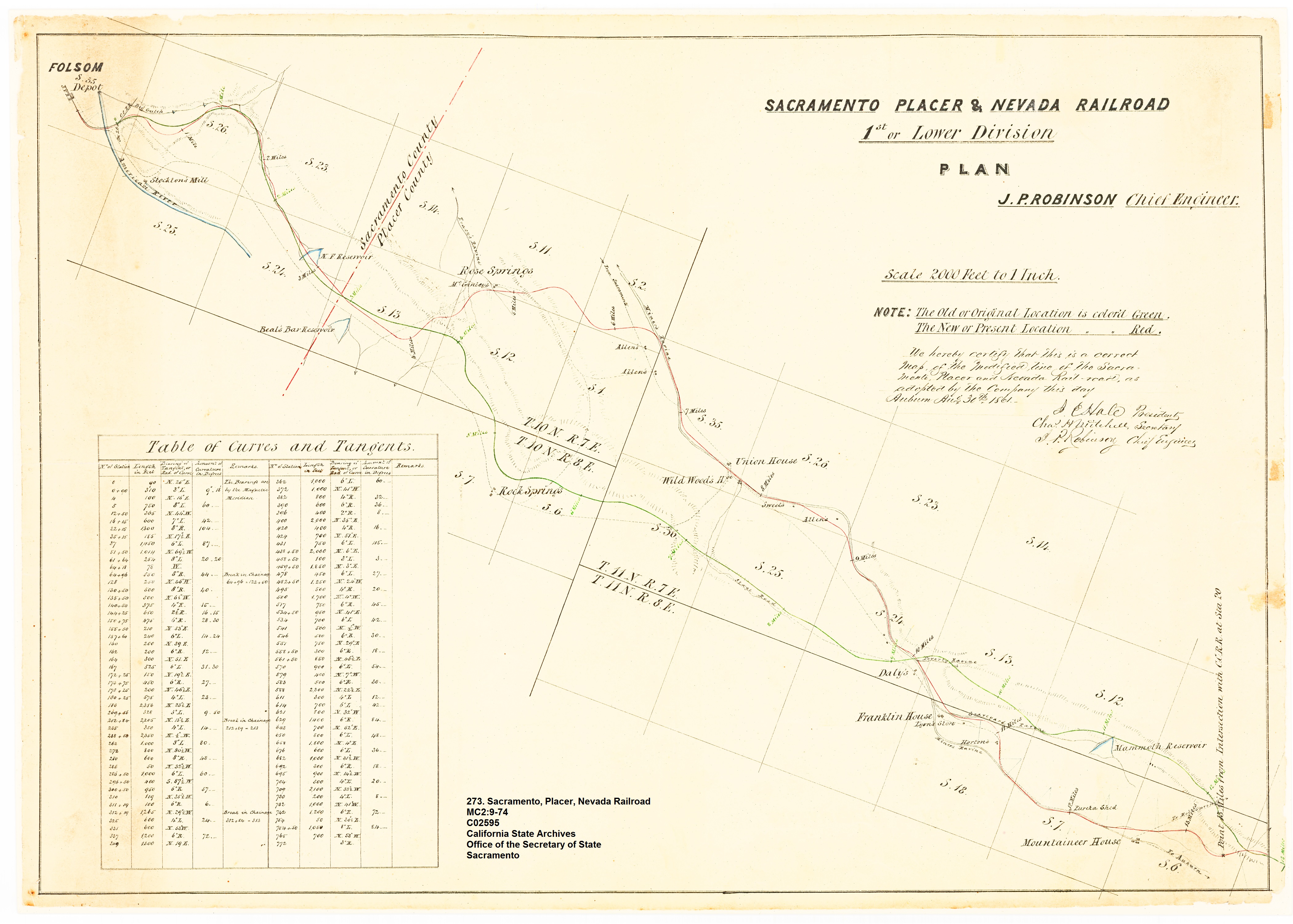
This map depicts the Sacramento, Placer and Nevada Railroad location as proposed in 1861. The map indicates an original alignment and the final grade which was in a different location.
The final rail road grade is the line that traveled northwest by Rose Springs and then followed Miner’s Ravine Creek. It’s interesting that the original location was to closely follow the North Fork Ditch taking the grade by Rock Springs. The part of the railroad grade between the N. F. Reservoir over to Rose Springs is covered by Folsom Lake when it is full. The SPNRR entered today’s Folsom Lake under the West Wing Dam, traveled around the base of Beal’s Point, and then exited underneath Dyke 5 which parallels Auburn-Folsom Road. The railroad shows up on a 1913 map of Placer County. When the rails were pulled up in 1863 the grade became a county road.
Text from the Sacramento, Placer & Nevada Railroad Map
Sacramento, Placer & Nevada Railroad
1st or Lower Division Plan
J. P. Robinson Chief Engineer
Note: The Old or Original Location is colored Green.
The New or Present Location is colored Red.
We hereby certify that this is a correct Map of the Modified line of the Sacramento, Placer and Nevada Rail road as adopted by the Company this day Auburn August 3rd, 1861.
Download the full map-
Click to enlarge map