

1951 U.S. Army Corp of Engineers report on clearing brush and trees from the future Folsom Lake bed.
By 1950, much of the brush and trees that had been cut down for fuel and building materials during the gold rush of 1850 had regrown along the north and south forks of the American River. From the perspective of the U.S. Army Corp of Engineers and the Bureau of Reclamation, all that woody material had to be cleared out before Folsom Dam was built and the reservoir allowed to fill. In 1951 a detailed plan to clear out the land was approved.
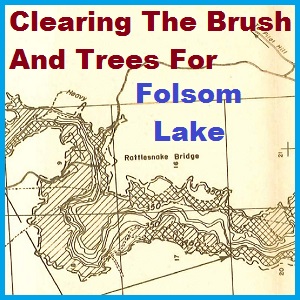
The Plan To Clear Brush and Trees At Folsom Lake
The Definite Project Report Folsom Project American River, California Part IX – Reservoir Clearing published in 1951 was the blueprint for clearing out the area to be inundated by Folsom Lake. It is a short report, only 9 pages long with two maps. The main focus was on the plant material that needed to be cleared away in order to prevent recreational hazards and reduce floating debris. It was estimated that the costs to clear 6,000 acres of soon to be Folsom Lake bed would be $1,130,000.
The main benefits, as outlined in the report were,
The clearing pattern proposed herein will reduce annual costs for removal and disposal of floating debris from the trashracks and reservoir. It will also remove some hazard to swimming and boating and from an aesthetic point, make the reservoir shore line more attractive to recreationalist.
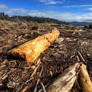
A small portion of the massive wooden debris that flowed into Folsom Lake in 2017 as the result huge storms during the winter of that year.
I reviewed this U.S. Army Corp of Engineers report as Folsom Lake was dealing with major amounts of floating debris brought in to the lake from the huge storms of 2017.
Deciding Where To Clear The Brush And Trees
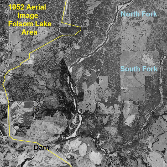
The entire area below the high water mark of Folsom Lake, 466 feet elevation, did not need to be cleared. There were large portions of the land to be inundated which had already been cleared for pasture as seen in this 1952 aerial photograph.
There was no need to clear the area that would be permanently underwater, which was estimated to be 15% of the total 1,000,000 acre feet of storage. Based on the expected fluctuations of Folsom Lake from being full at the end of Spring and the lowest draw down in the Fall, the clearing was set to take place between 360 feet and 450 feet in elevation.
The plan identified three types of clearing and the associated acreage with each.
- Heavy clearing 1,950 acres
- Light clearing 3,500 acres
- Selective clearing 580 acres

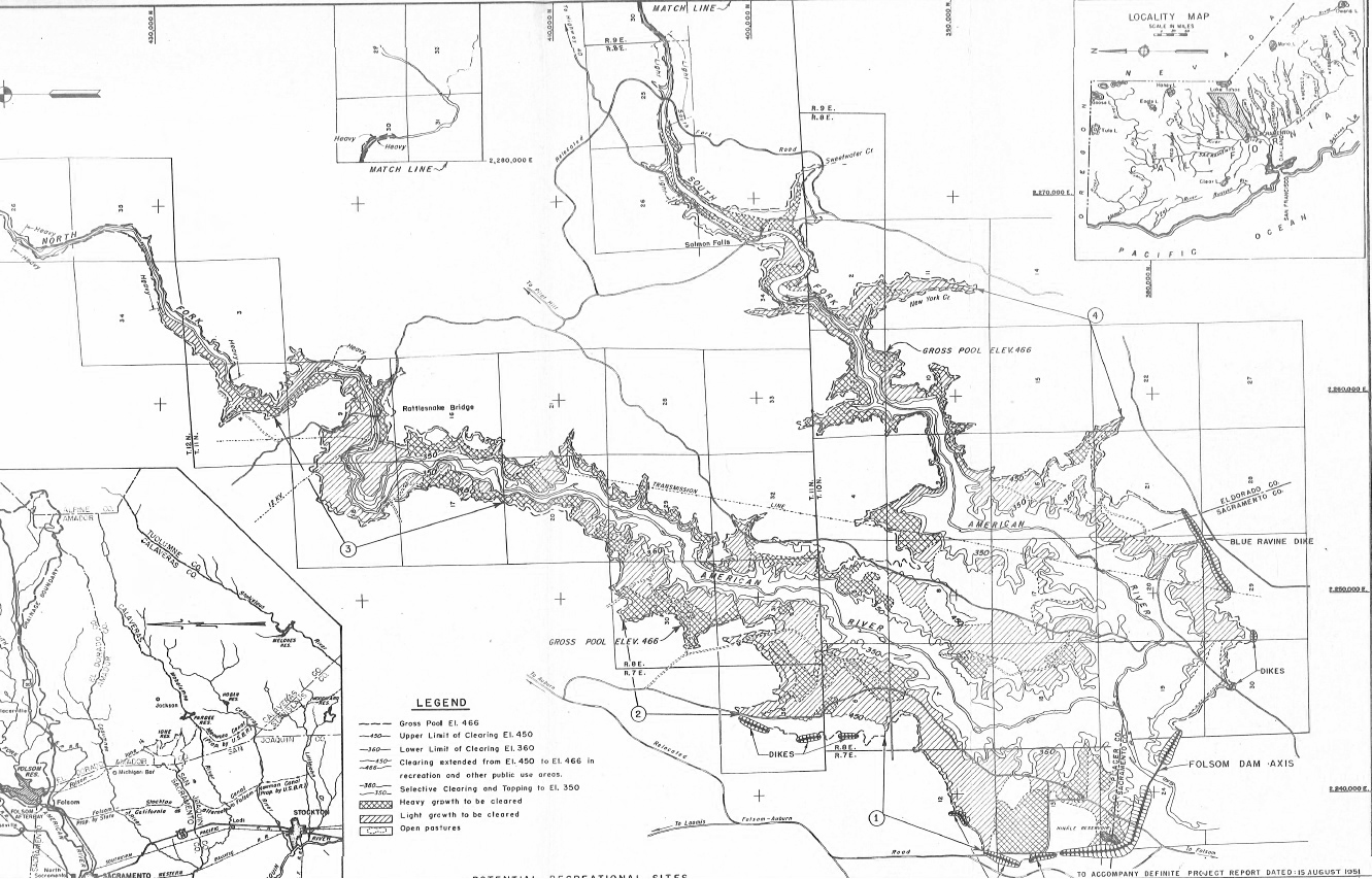
1952 aerial image of the lower portion of Folsom Lake area. Brush and Trees between 360 feet and 450 feet of elevation were to be cleared out. Trees below the minimum 15% elevation pool were to be topped 10 feet below, 350 feet, the expected low water line.
Within the 90 foot elevation change of the lake, it was proposed that all standing and down timber, brush over 6 feet high or with trunks greater than 2 inches in diameter would be cleared out. Trees whose height reached to 360 feet in elevation would be topped to 10 feet below the expected low water elevation.

The report focused on the clearing of brush and trees from immediate lake bed, it did note that there were three bridges within the reservoir.
Bridges
There are three bridges that will be affected by the reservoir. One is an ancient suspension bridge which was built nearly a century ago across the main river about 10 miles above the dam. (Rattlesnake Bar Bridge) It is jointly owned by Placer and El Dorado Counties and has no salvage value. (It collapsed in 1956 before the reservoir was completely filled) A steel bridge, jointly owned by Sacramento and El Dorado Counties is located on the south fork near its confluence with the main river. (Mormon Island Bridge) El Dorado County plans on salvaging the three steel trusses for uses on other county roads. Further up the south fork at Salmon Falls is a concrete bridge belonging to El Dorado County which can be left in place without detriment to reservoir operation. The suspension bridge should be razed for aesthetic reasons and because of its hazard to small craft using the reservoir.

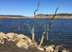
In November 2015, with Folsom Lake at 15% of capacity, the tops of trees, not cleared out in the 1950s, poke through the low water level.
No mention was made in this report about the removal of the Birdsall Dam on the North Fork of the American River or the Natomas Dam on the south fork. The Birdsall Dam was the diversion point of river water into the North Fork Ditch. The Natomas Dam diverted water into Negro Hill Ditch and the Natomas Ditch. Plans for the destruction of these dams are properly in another report that I have not located yet. There is also no mention of the homes, barns and other outbuildings that had to be razed that were within the zone of clearing.
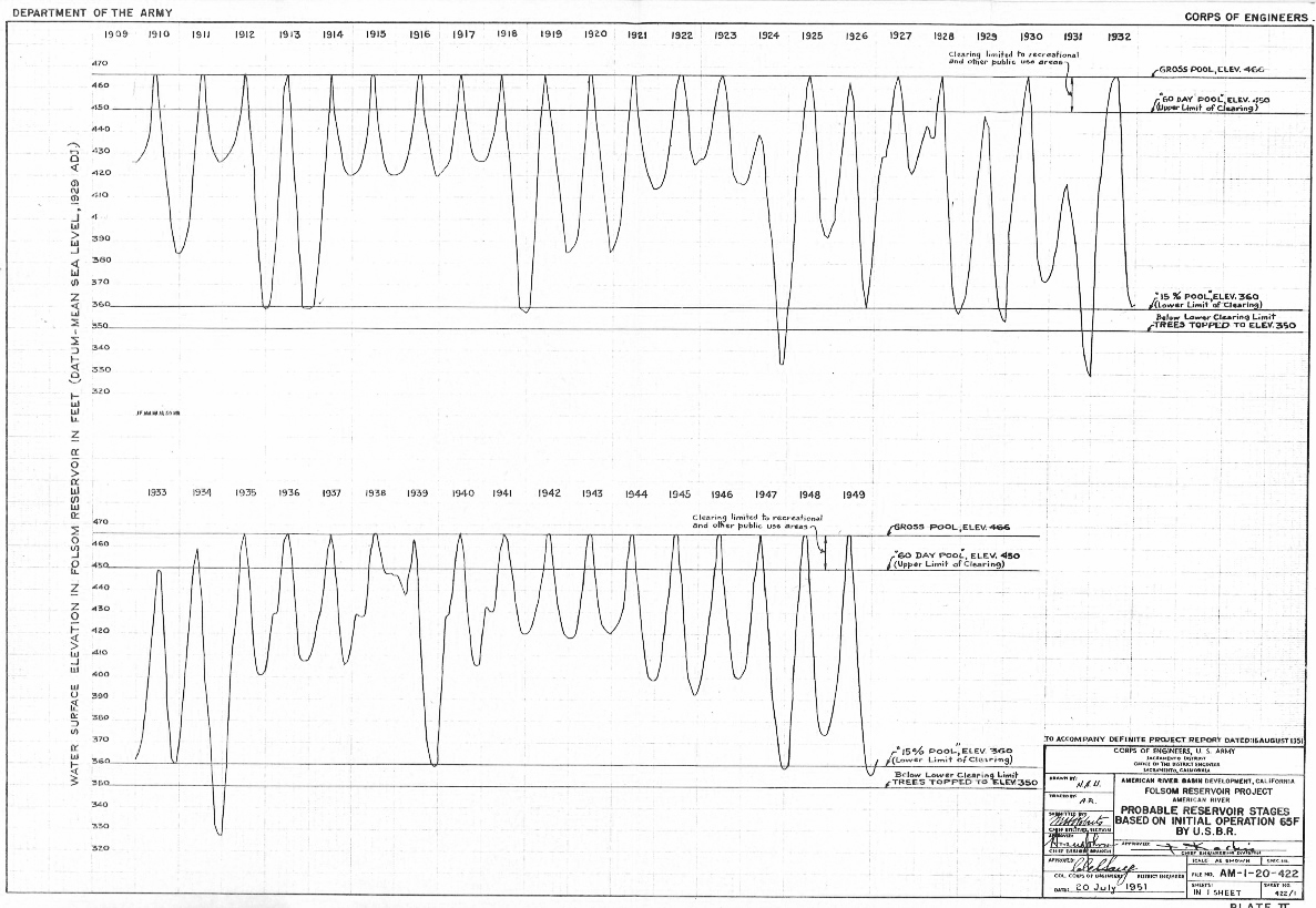
It is interesting to note that in the operation study of Folsom Lake, the U.S. Army Corp of Engineers estimated that the reservoir would have been drawn down to 15% of capacity, 360 feet elevation, 13 times over a forty-year period. They were basing this estimate on historical flows, between 1910 and 1950, into the proposed reservoir and expected releases of water for power generation, downstream users, and sending water south as part of the Central Valley Project. Yet, to the best of my knowledge, Folsom Lake has only been allowed to hit 15% of its capacity twice between 1956 and 2016. Once was during the 1976 – 1977 drought, and again in 2015 during another record drought in California.


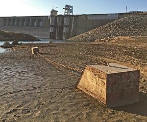
Folsom Lake hit record low water levels, 15% of capacity, in 2015 exposing much of the dam.
The Reservoir Clearing report of 1951 illustrates just how many different aspects of the Folsom Project the U.S. Army Corp of Engineers had to consider when they were planning and constructing Folsom Dam and subsequent lake.
Normally I post a copy of the reports that I am writing about, but this PDF document is a little large. If you would like a copy of it, contact me and we will make arrangements to send it to you electronically.
Another post from the U.S. Army Corp of Engineers documents I received is below.
1952 U.S. Army Corp of Engineers Map and Inventory Of The North Fork Ditch