
Gleason’s Pictorial periodical printed several illustrations of early Sacramento. While there is no date on the page, from the text, the illustrations could have been made around 1853. Of particular interest is the bridge at Leslie’s Ferry on the American River. This was most likely Lisle’s Bridge from the location mentioned in the article. There is also a view of the Historic Old Sacramento Cemetery. Finally, an image of a gold prospector from 1849 California Gold Rush. Below is the text from the one page I was able to obtain.
A Series of Interesting Sketches and Scenes in California

California Scenes
We give to the readers of the Pictorial, on this and the opposite page, a series of interesting views illustrative of the characteristics and belongings of El Dorado. The tide of emigration seems to be but little stayed; death, privation and numerous casualties that started the adventurous gold-seeker in the face, do not seem to prevent thousands upon thousands from wending their way to the golden shores of the Pacific. We have become so entirely used to the stories of suddenly-acquired fortunes, that the items which at first seemed to us to be fabulous are now too well authenticated to be challenged.
True there has lately arisen a rival to California, and one which seems to be a formidable one – we refer to Australia [May 1851], which has been finely illustrated in these pages – but the stream of emigration still sets to the westward though a few prefer to seek their fortunes in the South Pacific, in the penal colony of Great Britain.
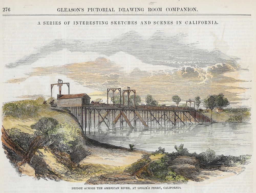
The view above represents the fine and substantial bridge across the American River at Leslie’s Ferry. It was commenced in the spring of 1851 and completed in the month of September of the same year. It is the largest and most substantial structure of the kind in California, being 620 feet in length, 25 feet in width, and 30 feet above low water mark.
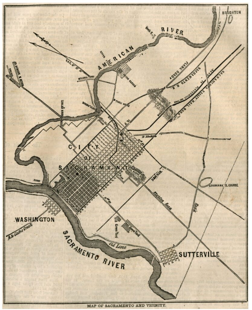
The 1855 map of Sacramento below shows Lisle’s Bridge across the American River connecting a northern road out of the city with Marysville road on the northside of the river. The cemetery is depicted on the road connecting Sacramento to Sutterville in the south.

It spans the American River about a mile east of the city and over it pass daily the Marysville, Nevada and Auburn stages. It is on the grand thoroughfare of travel to all the rich mining counties of Placer, Nevada, Sierra and the upper part of the Yuba. This bridge was erected with a view of withstanding the sever freshets of the American River; and during the greet spring flood of the present season, when nearly every other bridge on the North, South and Middle Fork of this stream were swept away, it stood firm and uninjured.
No pains or expense were spared in rendering it an elegant and tasteful structure, as well as a strong and durable one. In every respect, it will compare favorably in architectural beauty and finish with many in the Atlantic States, where labor and material are cheaper, and greater facilities afforded for building than in the youngest State.
The first picture below is a characteristic and truthful one of a miner starting off on a prospecting tour. He looks over his shoulder at us with a self-satisfied air, and strides off like a steam engine. He is fully equipped, having all the tools necessary for making a thorough examination of the ground which he designs to prospect.
From the discovery of the gold until the summer of 1849, a pan and knife were the only tools the digger would use. With these he proceeded to some ledge overhanging the mountain current, and commenced chipping off loose pieces of slate rock, thus working his way into the crevices, where the glittering lumps lie. In the course of time, the arrivals became so numerous, that other and more extensive diggings on the bars and in the ravines were located.

The rocker then came in use, and now, as the richest dirt has been overhauled and its hidden wealth extracted, the “long tom” and sluice have been substituted for the rocker; and it is found that with these, dirt, otherwise worthless, pays richly.
Historic Old Sacramento Cemetery Illustration
The next picture which we present speaks less of hope and cheerful promise than the one to the left of the page. The view is taken as it appears from an elevated point on the road to Sutter. The cemetery was laid out in the fall of 1850, and just before the dreadful choler made its appearance there. Before that time, internments were made on the upper part of J Street, in the immediate vicinity of Sutter’s Fort.

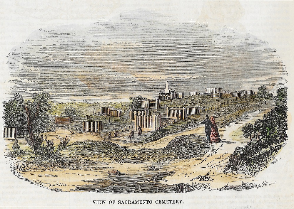
In fact, this ground had been the receptable of bodes for a long time prior to the discovery of the gold, as the dates upon the tombstones show. It has since been so far encroached upon by the public road, that many of the graves are now daily trodden under foot by animals and foot passengers going on the Coloma road.
The present cemetery is on the highest ground in the vicinity of the city, and commands an unobstructed view of the river, the coast range, the Sierra Nevada and the city itself. The hill is composed of sand, and every portion of it is far above high-water mark, which circumstance renders is a peculiarly favorable location for a cemetery.