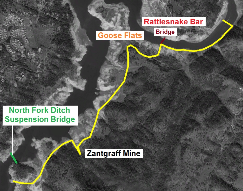
Hiking from Rattlesnake Bar, across Goose Flats, to Zantgraf Mine.
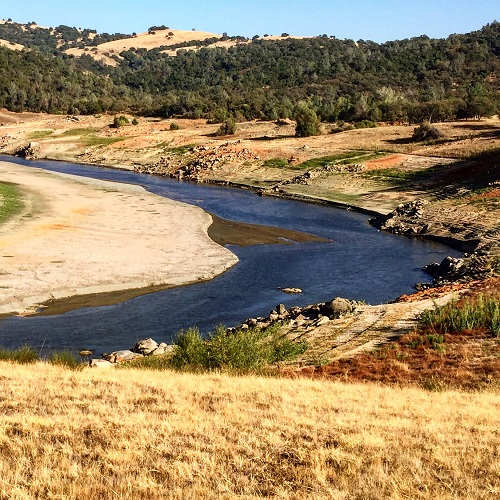
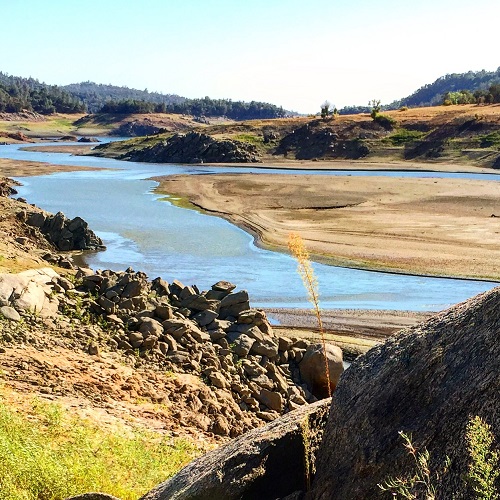
A multi-year drought where the Bureau of Reclamation drains Folsom Lake down to historically low levels creates a small window of opportunity to explore areas that are generally inaccessible. Goose Flats across the North Fork of the American River from Rattlesnake Bar State Recreation Area in usually only accessible by boat when the lake is at normal seasonal elevations. There are only private roads from Rattlesnake Bar Road on the eastern side of the lake that give Goose Flats easy access. The alternative, which I have done, is to hike from the Peninsula Campground several miles to the south. But it is a difficult hike along the lake shore to get up to Goose Flats. View photo gallery at end of post.
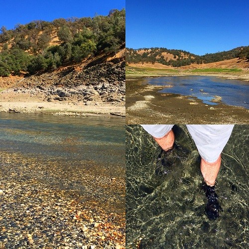
Fording the American River
With the North Fork of the American River actually flowing around Rattlesnake Bar since the stationary waters of Folsom Lake didn’t occur until around the bend at Horseshoe Bar, I figured I might be able walk across the river to explore Goose Flats and the old mining operations. I thought if the miners of the 1850’s could ford the river so could I. Much of the bottom and banks of the river are choked with mud, muck and sediment as the lake elevation can be eighty feet above the river bed at Rattlesnake Bar.
Crossing at Rattlesnake Bar
But the river had been flowing long enough with enough velocity to expose some rock and gravels beds. I could look down and see the rocks so I knew I could walk on them even if the water was knee high. But there were also some areas where the river had carved a deep trench. Without clear water to look through I could see where you could easily step right into one of these deep trenches and end up swimming instead of walking.
Easy to become lost in the river
I made it across to the eastern shore fairly quickly. But I failed to mark the spot. On my return trip later in the afternoon I hiked a few hundred yards above the Rattlesnake Nar boat launch like I did earlier and started to cross. But it obviously wasn’t the same area as I became stranded on a gravel bar surrounded by deep water. I followed the gravel bar a hundred yards up river until I found spot where I could see the river bed as I continued to ford across the river. It’s possible that the PG&E Newcastle power plant was dumping water into the river just north of where I was. The water seemed higher and faster than when I crossed earlier in the day.
Recording of fording the American River


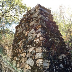
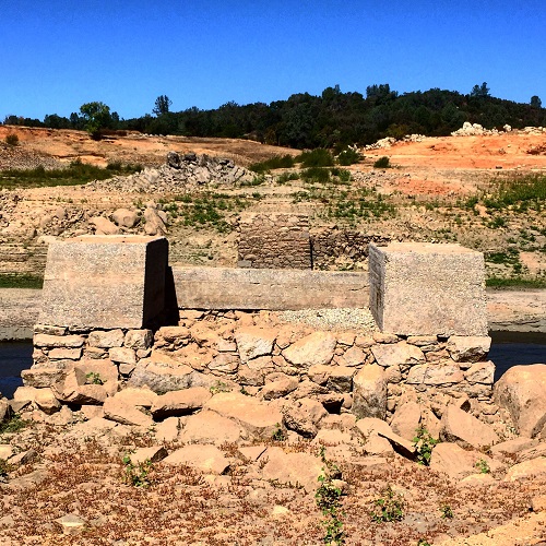
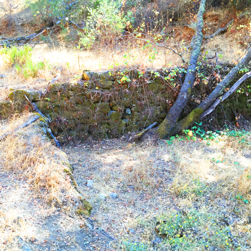
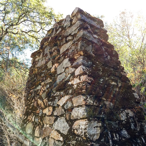
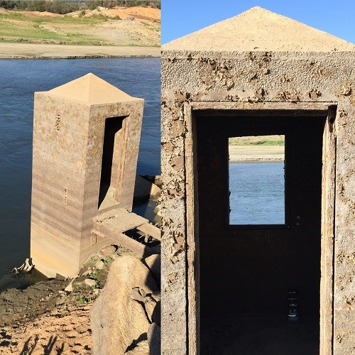
Stone rubble masonry of the a support column at the Zantgraf Mine built in late 19th century.
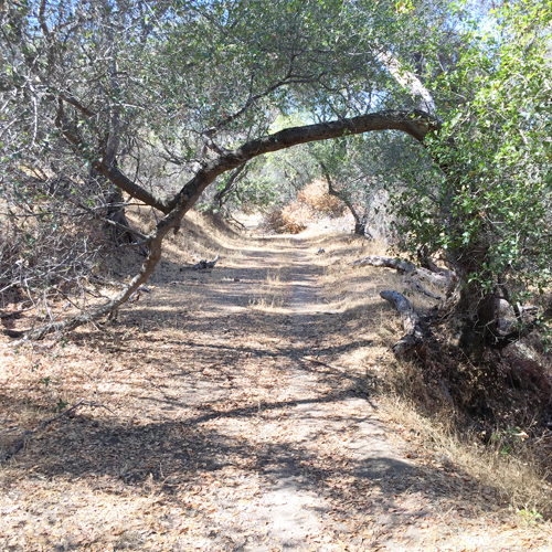
Hiking across Goose Flats
Actually, that was the most exciting part of the afternoon hike. Goose Flats and El Dorado County area along the river was heavily mined and the disturbance is still visible. Along the old Rattlesnake Bar Road you can see lots of placer dry diggings where they separated river cobble from soil in search of gold. Further down you can explore Zantgraf Mine which was a hard rock mining operation. The mine tailings, crushed rock, are distinctly different from the mounds of river cobble tailings down by the river.
Exploring Zantgraf Mine area
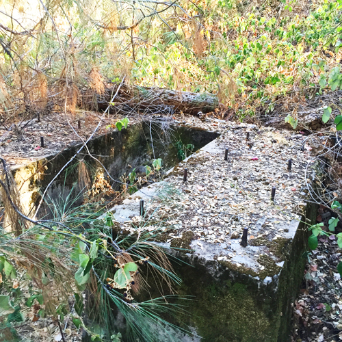
Zantgraf is interesting because of the stone rubble masonry used to construct retaining walls and mill supports. The one column looks like a giant chimney but it must have been a support for the stamp mill. One concrete foundation of a later vintage from the stone masonry was designed to have some sort of wheel spin within it. I’m not sure if it was for water or ore delivery into the mill. The Zantgraf did have water delivered from the North Fork Ditch. It was transported across the river in a large cast iron pipe held up by a suspension bridge. For more information on the Zantgraf see the post Hiking to Anderson Island and Zantgraf Mine.

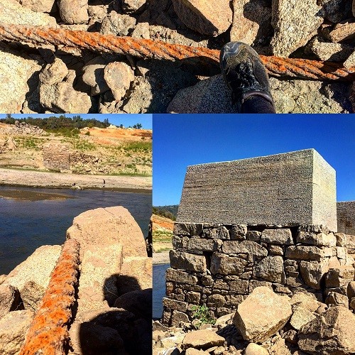
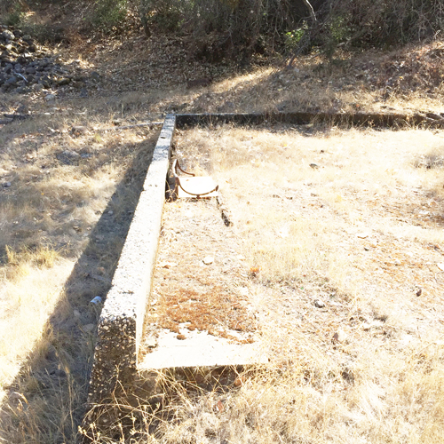
Concrete, stone rubble masonry, and suspension cable of the Rattlesnake Bar bridge.
Water and electricity at the mine
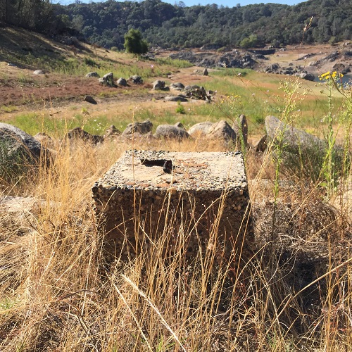
Also noted in some old documents was a power station south of the North Fork Ditch suspension bridge. The indication was that water released from the NFD powered a generator. This might have also been for the Zantgraf. I did come across some concrete pilings that supported angle iron on the road to the Zantgraf mine. They were in a position that could have been the line from the river up the hillside to the mining operation.
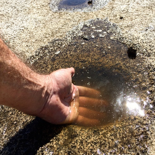
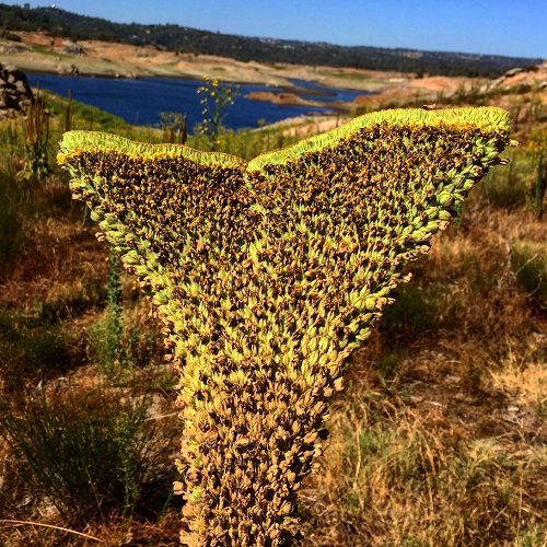
Indian grinding holes
I wasn’t able to find the all the same historical relics as I did back on my last hike. The Indian grinding holes may have a new find or the same ones. On this hike I was able to poke around the eastern support of the Rattlesnake Bar suspension bridge that washed out in the 1950’s and was never replaced. One of the cables is still present at the base of the abutment. I also walked by the old gaging river elevation gaging station, long abandon when Folsom dam was built.
Nice hike to see Rattlesnake Bar bridge eastern side
Round trip it was at least an eight mile hike. I wandered over to the point of Goose Flats which is an island when Folsom Lake is full. There was even evidence of mining on top of the point as a large pit, several hundred feet in diameter, had been excavated on top. Between the mining activity and the general desertification caused by the Folsom lake when it is full, it can be a little depressing hiking around the American River. It seems as if no one cared then or now about the ultimate destruction of the environment.