

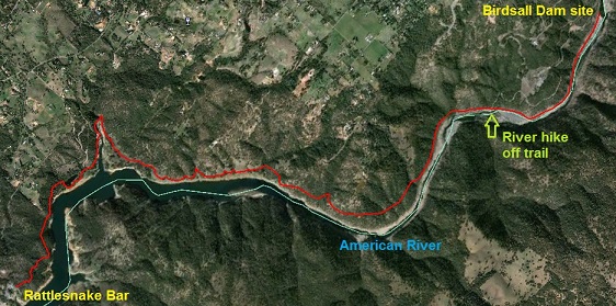
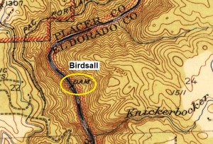
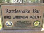
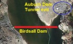
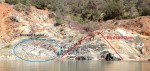
Map of hike from Rattlesnake Bar to Birdsall Dam.
History and hiking are a deadly combination for me. When I mix the pleasure of hiking along a wonderful trail with searching for historic sites and remnants of history, little can deter me from walking all day in the foot paths of pioneers.
It started with walking miners

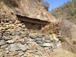
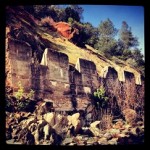
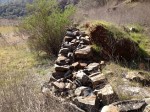
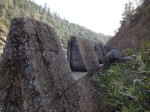
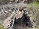
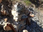
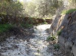
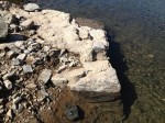
Rock work has fallen away exposing the concrete lining of the North Fork Ditch.
Nineteenth century gold miners wore the path along the North Fork of American River search for a good sand bar to pan for gold. Their path would become known as the Pioneer Express Trail: the most express route from Sacramento to the gold fields along the American River. As quickly as the miners arrived, the easy placer mining deposits in and next to the river were depleted.
Water more plentiful than gold
Water necessary to separate gold from sand became increasingly important as the
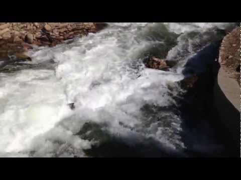
Water discharged from South Canal into Mormon’s Ravine into Folsom Lake.
mining operations moved away from the river channel to the surrounding sand bars and sloping foothills. The North Fork Ditch was conceived by the American River Mining and Water Company as a means to deliver water to the miners above where they were mining. Completed in 1856, the tenuous water canal all dug and constructed with manual labor, stretched 33 miles from Tamaroo Bar down to Mississippi Bar in Orangevale.
The big dig
Started in 1854, the North Fork Ditch was constructed to carry about 3,000 inches or approximately 448 gallons per second. To carry this much water the canal had the general dimensions of a 5′ base and 5′ high sides. A depth of 3 foot of water was usually flowing through the canal. Sometimes the ditch would use the rocky cliff as one side of the canal. I noticed some parts of the canal seemed to be open to an incoming creek from a ravine – collecting more water for transport?

Following the contours of the landscape
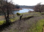
Just as the Pioneer Express Trail wound around the bluffs, ravines and cliffs of the American river, so did the North Fork Ditch. Unlike the trail, the ditch just couldn’t climb a hill to avoid a steep cliff or creek. The ditch had to follow a path that allowed the water to flow by a predetermined drop in elevation. As you hike along sometimes you will be a stones throw from the ditch at other times the trail will take you high above the canal and river. The canal slowly descends in elevation until it is submerged in Folsom Lake. With very low lake levels you can still see the out line and concrete of the ditch around Beal’s Point.
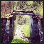
Bridge of flumes

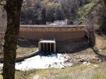
Over flow down stream of Birdsall dam to release excess flows.
Where the ditch couldn’t be dug through the nice soft soil of a meadow, the water canal would be created out of rock walls, wooden flumes and later large pipes. It was estimated that the ditch was losing half of its flow to leaks in the soil, rocks and wood flumes. In the 1910’s most of the canal was lined with concrete to reduce the water loss.
Sand bars and mining camps
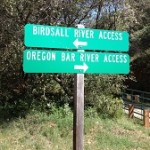
Occasionally you will happen upon one of the outlets to the main canal. The North Fork Ditch was originally designed to sell water to miners working the numerous gold bearing sand bars (Oregon, Rattlesnake, Whiskey, Horseshoe, Dotons and Beal to name a few) along the river. The outlets on the main canal allowed miners to wash their “dry diggins” to separate out the gold.
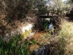
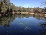
Avery’s Pond
The Pioneer Express Trail is a moderate hike, but you will encounter some steep climbs as the trail maneuvers around steep cliffs of the
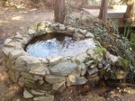
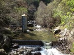
Watering spring as you enter Avery’s pond on the North Fork Ditch.
American River canyon. Avery’s Pond is a short hike from the Rattlesnake Bar trail head. I am not sure of the exact purpose of Avery’s Pond for the North Fork Ditch which flows into and out of it. It might have been used to regulate flows due to elevation changes.
Water and electricity
After Avery’s Pond you will come to the PG&E Newcastle Power Plant. This single turbine hydroelectric generator is fed water from the South Canal 280′ above. The water falls down a penstock, spinning a turbine to generate electricity and is then discharged into Mormon’s Ravine flowing into Folsom Lake. Mormon’s Ravine can also have a good flow of water coursing down it. Excess water not diverted into the penstock to turn the power plant is allowed to run down the ravine into Folsom Lake.
Crossing Mormon’s Ravine
Mormon’s Ravine must have always had a good creek flow because the NFD traveled over the ravine rather than negotiating the creek. The south side of the flume was approximately where the power house is located today. The water then flowed a short distance down to Avery’s Pond. The other issue is that Mormon’s Ravine is quite long that would have required considerable ditch work while gaining very little downstream progress.

Pioneer Express Trail ups and downs
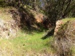
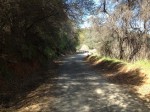
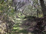
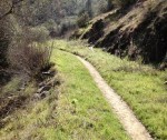
From here the Pioneer Express Trail alternates between level terrains to shaded steep slopes. It’s all beautiful if not a little hot on a
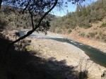
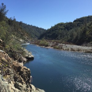
Hiking in the American River Canyon.
sunny afternoon. It took me about 3 hours to travel 7 miles. The 14 mile round trip was a solid day hike. The starting elevation at Rattlesnake Bar is 475′ and the final elevation at Birdsall Dam is 488′. You can see how gentle slope of the canal was at it worked its way south, 12′ elevation drop over 4.30 linear miles. The Pioneer Express Trail will reach elevations of about 600′ over the course of the hike.
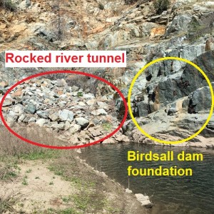
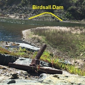
Birdsall Dam site
If you want to actually get to the base of the Birdsall Dam site, which was my goal, you have to be more adventurous. You’ll have to leave the Pioneer Express Trail, at Oregon Bar as it claims out of the canyon, and travel along the river bed. (Actually, the modern-day Pioneer Express Trail merges with North Fork Ditch and you are literally hiking on top of the dirt filled canal as you get closer to the dam site.)

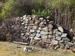
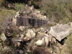
Rock climbing to history
The last mile along the river you will have to walk over river cobble and climb over rocky points that jut out into the flowing river. It is on the last mile that you can see the eight foot high rock walls built to support the early ditch. I was hiking in spring with moderate river flows. With high river flows after a storm or spring runoff, it might be too dangerous to forge along the bottom of the American River.

North entrance
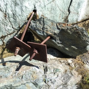
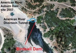
An alternate route to Birdsall, but still not without difficulty, would be to hike down from the China Bar parking lot on Maidu Drive and come in from the north along the river. This is a narrow point in the canyon and high river flow may make it impassable. Once at the Birdsall Dam site you can see across the river to a large outcropping of solid rock which was the south side of the dam. Look closely and you will be able to discern similar reinforcing metal work and bolts drilled into the massive rock. See also: Birdsall Dam and Knickerbocker Canyon Hike

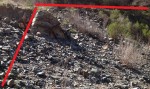
Focal point of water export
Just to the east is a large pile of rocks dumped by the Bureau of Reclamation to close off the tunnel drilled to divert the American River around the defunct Auburn dam. The entrance was very close to the original North Fork Ditch Dam at Tamaroo Bar a mile up stream. This part of the American River has been the focal point from numerous water projects to the early North Fork Ditch Dam, Auburn Dam and current Placer County water intake facilities.
Click on Birdsall images to enlarge


Solitary hike
Except for a couple of other hikers, a runner and two horses, my 13 mile hike was solitary. Can you imagine the traffic the trail must
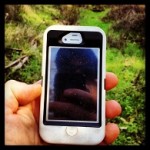
Look what I found? A lost iPhone 5. I was able to reunite it with the owner
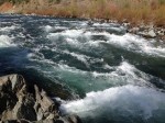
have had in the early years of miners looking for a place to strike it rich, construction workers and then maintenance crews working on ditch? Now it is all quiet. As the lake gives way to a running river, you’ll be called by rushing waters to cool your heals in the water. If you are hiking during the summer you’ll need to play in the water just to cool off. Enjoy the walking (hiking, running, horse back riding) in the foot path of history along the American River.


Click on thumbnails to enlarge.