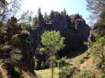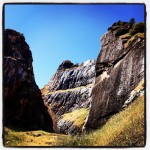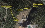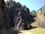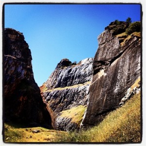
Hidden valley above Cave Valley climbing park, level 2
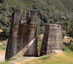
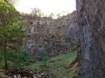
It feels like a miniaturized Yosemite when you first walk into the Auburn Quarry Crags climbing park. The towering rock cliffs were not made by glaciers but a mining operation in search of limestone. Because the Auburn Dam was not built, which would have submerged this area, we have a great hiking trail, cliff walls to climb and a little bit of history to walk through at the Auburn State Recreation Area.
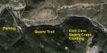
Multi-level Auburn quarry hike
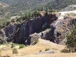
You can view the quarry crags on four different levels. The first is on the valley floor a short hike from the main trail that runs along the river. You can then continue up the old trail road to the second level where the climbers ascend up to. The third level allows you to look down into another steep mining pit west of the climbing valley. The fourth level, where I recorded the video is pretty much on top of the peak.
816′ Elevation gain
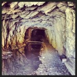
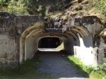
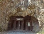
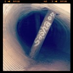
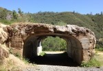
Mountain Quarry Cave A entrance of Cool Cave in Auburn.
The second and third viewing levels are accessed off the main trail road. They are not marked, but you will see the path traveling south. The fourth level is a small trail to the left of the electrical substation, it is easy to miss. From the base trail to the top is an elevation gain of 816′. Much of it is in the shade, but there are some deep portions on the trail.
Dinosaur fossils
The mine originally started by Davis and Cowell is also known as the Cool Valley Cave mine. You can still see the original mine cave entrance and while the mine may not have been named after the town of Cool up Hwy. 49, you can certainly feel the cool air coming out of the cave on a hot day. Found in the limestone were small dinosaur fossils. The mine was originally opened in 1880.
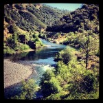
Trail follows the river
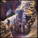
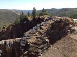
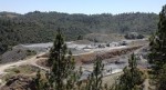
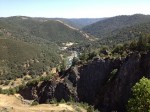
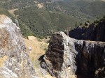
Quarry cuts and caves as seen from level 3 on the hike
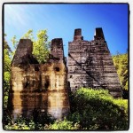
If you don’t feel the need to climb to the top of the crags peak, the trail along the river is excellent. It is fairly flat, smooth and wide. You’ll encounter runners, hikers, families, bikers and horse back riders. You can look at the remnants of the the limestone crushing mill and there are several interpretive signs detailing the history of the area. There was actually a company owned railroad short line that ran from the mill site across the American River to facility that manufactured Portland cement with the limestone. But I’ll save that for another blog post.
Click on thumbnail to enlarge