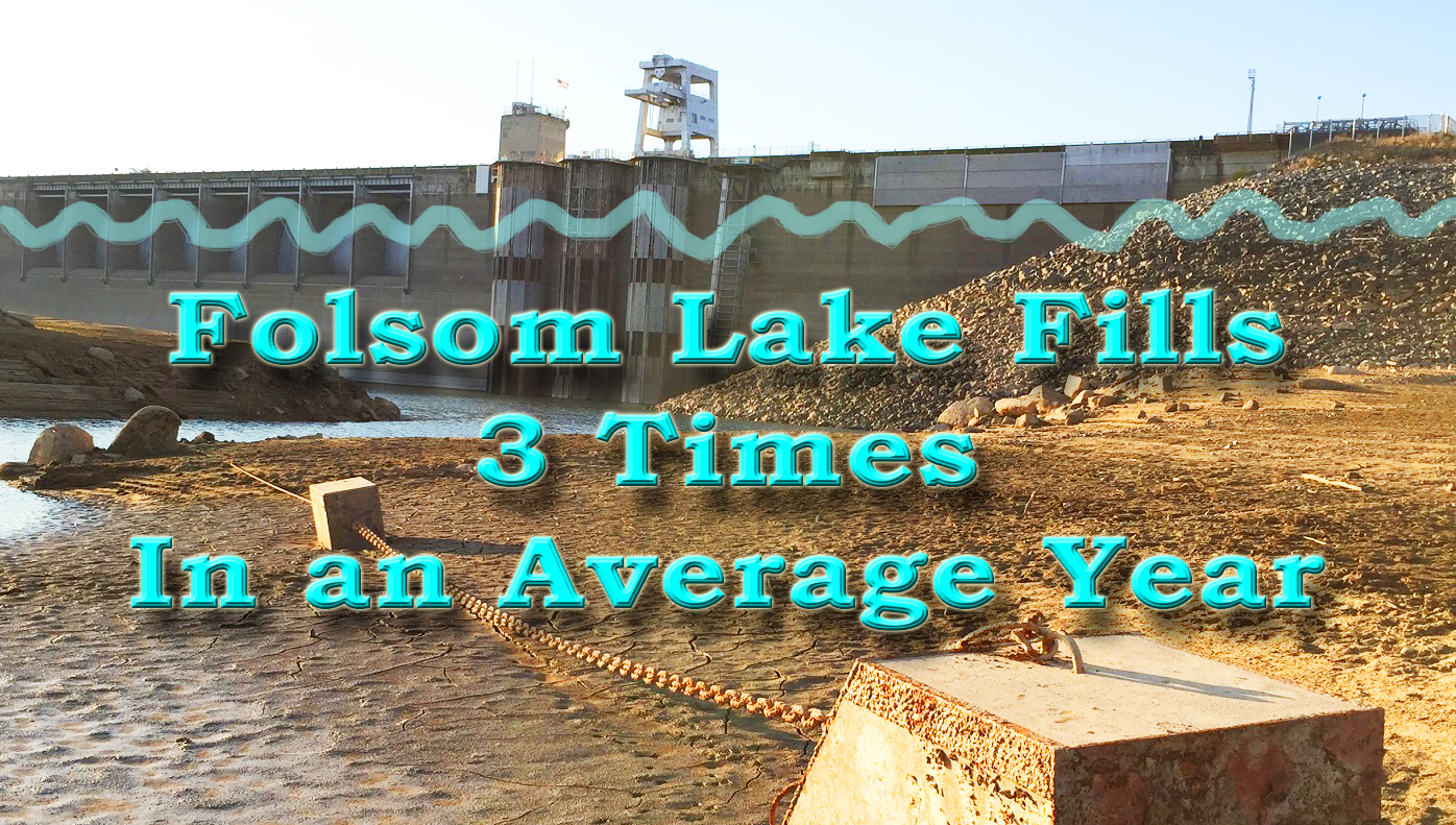
Many people are under the impression that Folsom Lake only receives enough water to fill once per year. The reality is that in a normal year, enough water flows into Folsom Lake to fill it to full capacity at least 3 times over. It is only because Folsom Lake is kept low during the months for flood protection that leads people to believe the reservoir is filled only once during the year.
The history and data collection of annual water flow in the American River up to 1949 strongly influenced the final design of Folsom dam. A 1955 Army Corp of Engineers document, Planning Report, Folsom Reservoir American River, January 1955, summarized the water flows behind Folsom Dam. The drainage area of the north, middle, and south forks of the American River was 1,875 square miles.
American River Flow Rates Into Folsom Lake
The mean annual flow rate was calculated at 3,930 cubic feet per second (cfs.) In November 1950, the American River experienced a peak river flow of 210,000 cfs. That massive flooding event was still smaller than the catastrophic flooding event of 1862 with an estimated 280,000 cfs.
From the drainage area and mean flow events, the Army Corp of Engineers, based on the time frame of 1903 – 1952, calculated the mean runoff to be 2,840,000 acre feet of water. The final holding capacity of Folsom Lake is 977,000 acre feet of water. The minimum amount of water is 88,000 acre feet*. That makes the holding capacity of Folsom Lake 889,000 acre feet of water. This means that in a normal or average year, enough water flows into Folsom Lake to fill it from dead pool to full capacity 3.19 times.
For a frame of reference, as of May 1, 2022, according to the Bureau of Reclamation’s daily report, Folsom Lake had received 1,208,000 acre feet of water for the year. (A water year runs from October 1 – September 30.) In other words, as of May 1, 2022, Folsom reservoir could have been filled 1.3 times and the snowpack is just beginning to melt.
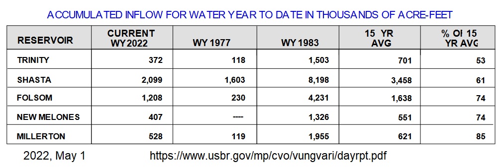
Of course, what baffles people is why the Bureau of Reclamation keeps the lake low during the winter and even releases water during rain storms. They are just following a flood protection agreement. They have agreed to allow the lake to remain low during the winter months in case a monster warm storm hits Northern California. From November through March the lake will be kept low to provide for flood protection. While the flood protection lake level curve can be adjusted based on a number of conditions, the lake will hover around an elevation of 428 feet (466 feet of elevation is considered full lake level.)
In 1955, having a volume of 400,000 acre feet available for flood protection was considered prudent. This assumption was challenged with large rain events in 1983. To illustrate how fast Folsom Lake can fill, let’s consider a big storm and potential flooding event with 200,000 cubic feet per second coming into Folsom Lake. One-acre feet of water is equal to 43,560 cubic feet. At a velocity of 200,000 cfs that would translate into 4.49 acre feet per second, 275 acre feet per minute, 16,528 acre feet per hour, or 396,672 acre feet within 24 hours. In other words, within one day, the 400,000 acre feet of flood protection would be wiped out.
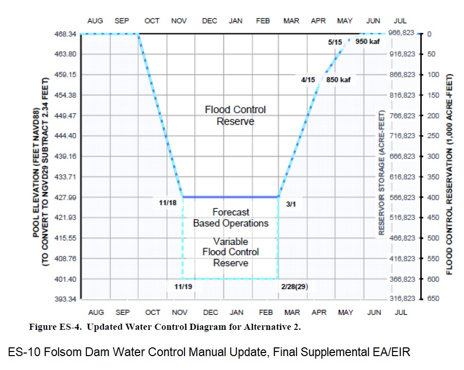
Conversely, in 1977, through the first 7 months of the water year, Folsom Lake had only received 230,000 acre feet of water. In that year, Folsom would barely receive enough river water to fill the lake once.
Of course, the Army Corp of Engineers only had 50 years of relatively good data to plan for flood protection. Based on river flows from 1909 – 1949, Folsom Lake would fill to capacity, 466 feet of elevation, in 34 out of 40 water years. In 13 of the years graphed, the lake level would drop down to 360 of elevation or lower. Consequently, all the trees and structures down to an elevation of 350 would need to be trimmed or removed to eliminate boating hazards.
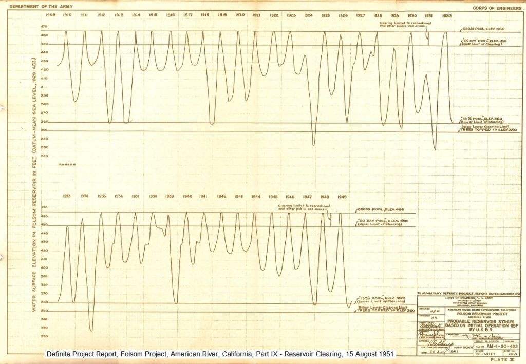
However, as the demand for irrigation and environmental water has increased, in additional to public perception, the lake is rarely allowed to drop below 350 of elevation. Extreme low water events occurred in 1977 and 2015. Even though another drought descended upon California in 2021, the Bureau of Reclamation maintained a water level of approximately 375 of elevation.
Since the construction of Folsom Dam there have been many changes. A variety of reservoirs were constructed within the drainage area of Folsom Lake. Climate, rainfall, and river flow data have been drastically improved. The engineering modeling of different flow events when the drainage area is saturated or drought dry are now part of the flood projections. The Bureau of Reclamation has added an additional set of gates to Folsom Dam to release water from Folsom Lake earlier in the event of major rain storms.
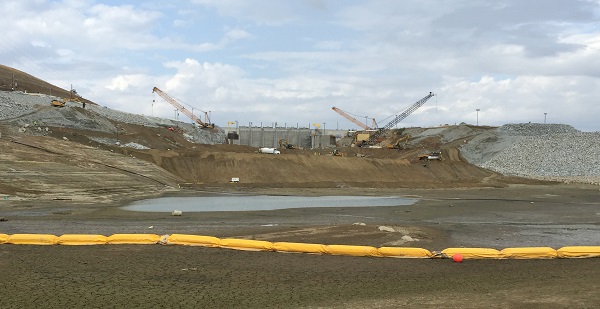
Whereas the Bureau of Reclamation has gotten better at managing the Folsom Lake water levels for the competing interests of flood control, recreation, electrical generation, and irrigation, the fact still remains that Folsom Dam is a flood control project. Consequently, Folsom Lake will always need to maintain lower than anticipated water levels during the winter to provide space for high river flow events.
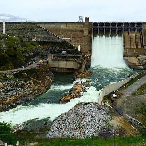
That Folsom Lake can be replenished to full capacity at least 3 times in the course of the year illustrates the dynamic nature of the rivers. Rivers are always flowing. Folsom dam is almost always releasing water for either electrical generation or flood control. In an ideal year, Folsom Lake would hit full capacity at the end of May or beginning or June; thence it would slowly drop to the appointed flood control level at the end of October.
Unfortunately, the demands for Folsom Lake water, combined with an increasingly unpredictable rain and snow fall patterns related to climate change, means that regardless of dam improvements, we’ll continue to see low lake levels during the winter and the lake may not reach full capacity no matter how much we dance for rain.
*The 88,000 acre feet is from the 1955 report and at the time represent the dead pool reservoir level. That is the level where no water can be released.
