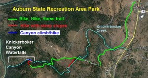
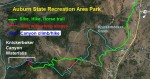
The Knickerbocker creek and waterfalls are pretty spectacular, if, you can get to them. These seasonal waterfalls through Knickerbocker Canyon are fairly inaccessible because of the steep terrain. Located in the Auburn State Recreational Area Park in Cool, Ca, Knickerbocker waterfalls in the rock lined canyon make for a challenging hike/climb to an area few people ever visit. Picture gallery and YouTube videos at end of post.
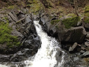
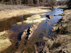
Knickerbocker creek tumbles over bedrock
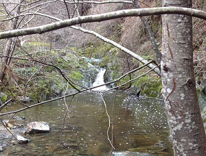
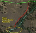
There are multiple waterfalls along Knickerbocker Creek, but I have broken them up into the Upper and Lower waterfalls. The most easily accessible, but less dramatic, are the Upper Knickerbocker waterfalls west, or upstream, of where the Olmstead Loop Trail in the Auburn SRA crosses Knickerbocker creek. The upper falls can still be a challenge to get as the terrain can be very steep. The trails on the south side of Knickerbocker creek are closer to the upper falls. It’s actually a nice spot to have lunch with lots of flat moss covered rocks for lounging.

At the top of the first tall water fall in Knickerbocker Canyon.
Spring time water flows
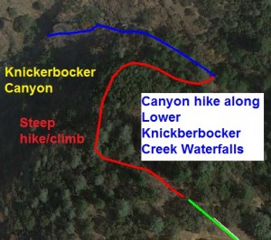
Because of the steep sides of upper Knickerbocker Creek, along with the abundant bramble bushes, it is virtually impossible to hike along the creek. Just getting down creek side will have you following deer trails. The best time to hike to the waterfalls is during the spring months when the creek is flowing and the trails aren’t so dusty. Click on map to enlarge.

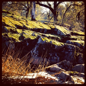
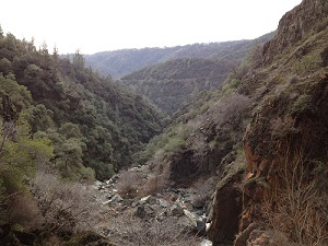
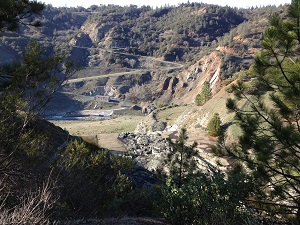
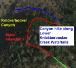
Steep, narrow Knickerbocker Canyon
Lower Knickerbocker waterfalls, as Knickerbocker creek flows into the canyon and drops from 1,175 foot elevation down to the North Fork of the American River at 470 feet, are really the hiking challenge of the Auburn SRA. While you can catch glimpses of the waterfalls from trails on the north side of the canyon, if you want to be up close to the creek as it rushes through solid rock sluice ways, you need work your way from the top of the Olmstead Loop trail into the canyon.

Moss covered rocks of lower Knickerbocker creek.
Rock climbing around Knickerbocker waterfalls
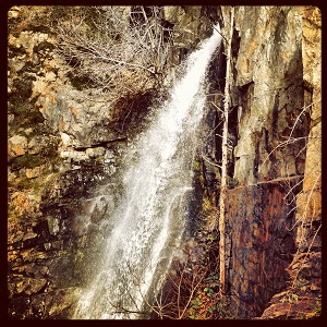
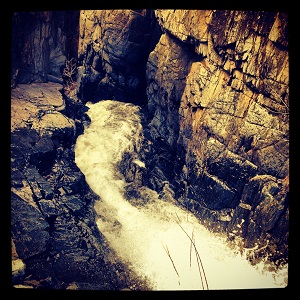
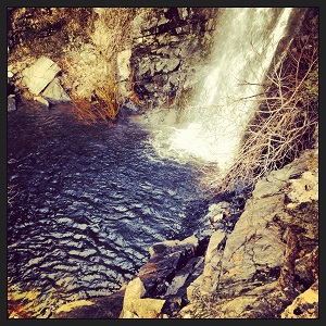
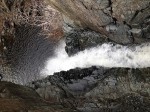
Once I made it down into the canyon I was only able to hike approximately a quarter mile down before the terrain exceeded my rocking climbing skills. But even in this short stretch, where the width was less than twenty feet in some places, there were numerous waterfalls to see and hop over. My Knickerbocker Canyon hike ended at the first of the tall waterfalls as Knickerbocker creek shoots out of a rock water slide and drops over 50 feet straight down into a shallow pool below.
From moss to barren bedrock canyon walls
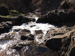
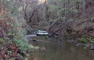
When I reached the canyon floor with a relatively calm Knickerbocker Creek flowing there were several trees and lots of moss covered rocks – a pretty idyllic spot. As I progressed west, the canyon narrowed, the sides became steeper and most of the vegetation disappeared as there was little soil to support shrubs or trees. This part of the canyon, which is pure bedrock, is where the water flows fastest around boulders and different channels the creek has worn into the rock.

How many people have set foot in Knickerbocker Canyon?
You can’t help but wonder how many other people have actually crawled over the canyon rocks and hopped over the rushing water. Other than some stunning views of water falls and the thrill of the hike, there is little reason for an early gold miner to hike through the canyon. But if you like to tread where few have gone before, hiking down to Knickerbocker Creek is a treat. Fortunately for me, in the drought of 2014, there was still enough water for the creek and the waterfalls to flow at a level I could hike through the canyon.

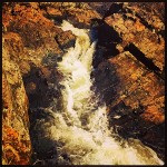
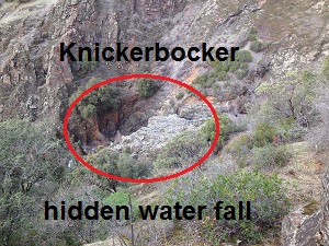
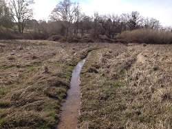
Upper Knickerbocker waterfalls.
Crawling up the canyon slope
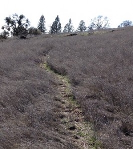
There is undoubtedly and easier way down to the Knickerbocker Canyon because I invariably select the hardest path in my haste to “get there.” But if you do follow my general “deer” trail path down to the creek, just realize that some of the slopes are close to 45 degrees. That means, for me at least, on the soft soils with no real foot path, that you are literally crawling up the hillside in some spots. Do a tick check after the “crawl” as I picked up a hitchhiker after my scramble to the canyon.

Olmstead Loop Trail truly multi-use
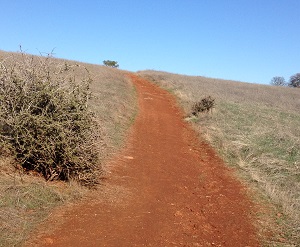
From the Auburn SRA parking area it is only about a three mile ride or hike to south rim of Knickerbocker Canyon. The climb down and through the canyon is short, but it can be very strenuous. With the miles of trails in the Auburn SRA, you can easily spend the day hiking around and never see the same pond or trail twice.

Click thumbnails to enlarge.