Maybe you can’t walk back in time, but you certainly can walk through part of California’s water history. Dug by hand in the side of the hill above the south fork of the Yuba River, the abandoned water canal and flumes have been transformed into a fairly easy, wheelchair accessible, hike. Named appropriately the Independence Trail, it’s more of a walk than a hike.
Independence Trail was a water ditch
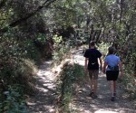
Walk in the ditch or on top of the levee.
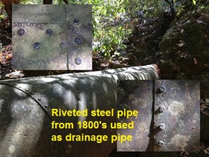
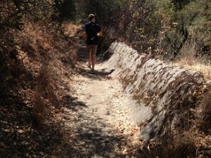
Originally constructed to supply water for gold mining operations of the late nineteenth century, the Excelsior ditch was filled with water from a dam a few miles up river from where Highway 49 crosses the South Yuba River. Constructed in late 1850’s, the Excelsior at about 1450′ elevation has and undetectable slope which makes for a great trail to walk through.
Dirt, rock, concrete and flumes
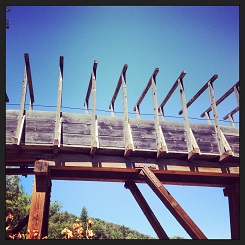
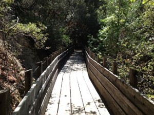
Parts of the trail are actually in the old ditch. Where the ditch is obstructed from small land slides or growth, the trail moves on top of the levee where the ditch tender would walk to survey for maintenance issues. When there wasn’t enough soil to build a levee, local rocks were piled up to make the outside wall. To carry the ditch water across creek ravines flumes were built. The skeletons of these early flumes have been transformed into the walkways, or in some instances sky ways, that connect the trail together.

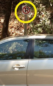
A no parking sign is easily missed on the shoulder of Highway 49.
30 years old and aging
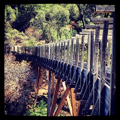
While the main trail is in good shape, the flume walk ways are showing wear and tear. Now part of the South Yuba State Park system, maintenance may not be a high priority. Consequently, you should exercise extreme caution when crossing the wooden flume bridges. There are cracked boards, broken planks, nails sticking up and the wooden rails are starting to get loose and wobbly. The trail with completely rebuilt flumes for bridges is now 30 years old.
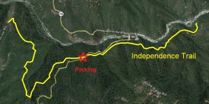
Tight parking
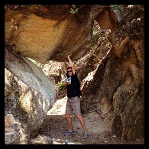
The parking lot off of Highway 49 is shallow and doesn’t allow for many cars. From the trail head, that has pit toilets, you can go west under Highway 49 to the large flume crossing with the wheelchair ramp that winds to Rush Creek. Again, the ramp is starting to show lots of wear from the elements. If you hike east you’ll go through the rock arch or fallen rock. It looks like they were able to excavate under the large boulder to run the water ditch without changing the elevation.
Independence trail is nice but not spectacular. It is good for summer because most of it is on the north side of the hill with lots of shade. We walked both sides of the trail in a little under four hours including a short lunch break.
Related: North Fork Ditch on the American River, Rose Spring Ditch, Humbug Creek Trail, Malakoff Diggins
Click to enlarge images.