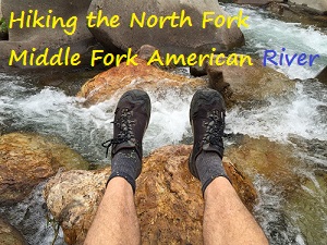
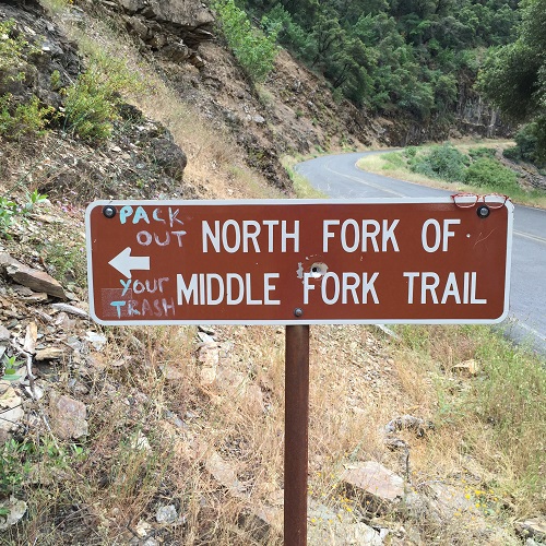
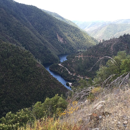
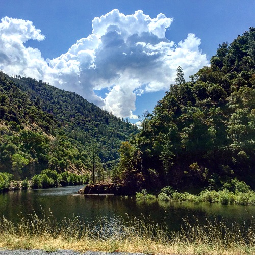
The North Fork of The Middle Fork trail is a short little hike right off Mosquito Ridge Road. It is so named because it parallels the North Fork of the Middle Fork of the American River. Because the Placer County Water Agency maintains a dam up-stream this part of the river should have flowing water virtually year round.
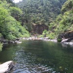
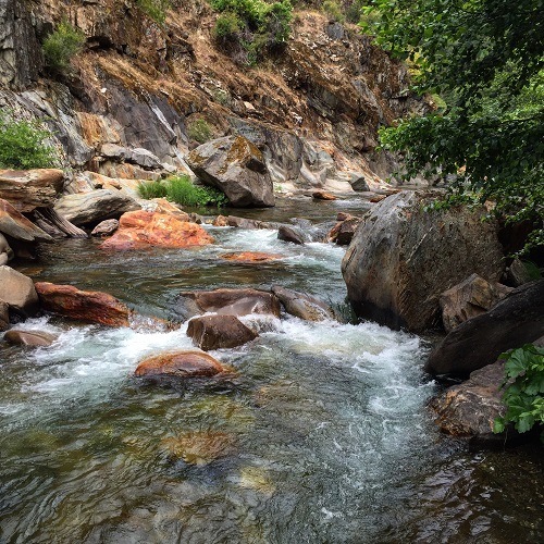
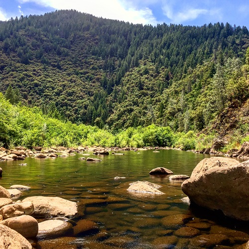
Swimming hole on the North Fork of the Middle Fork of the American River.
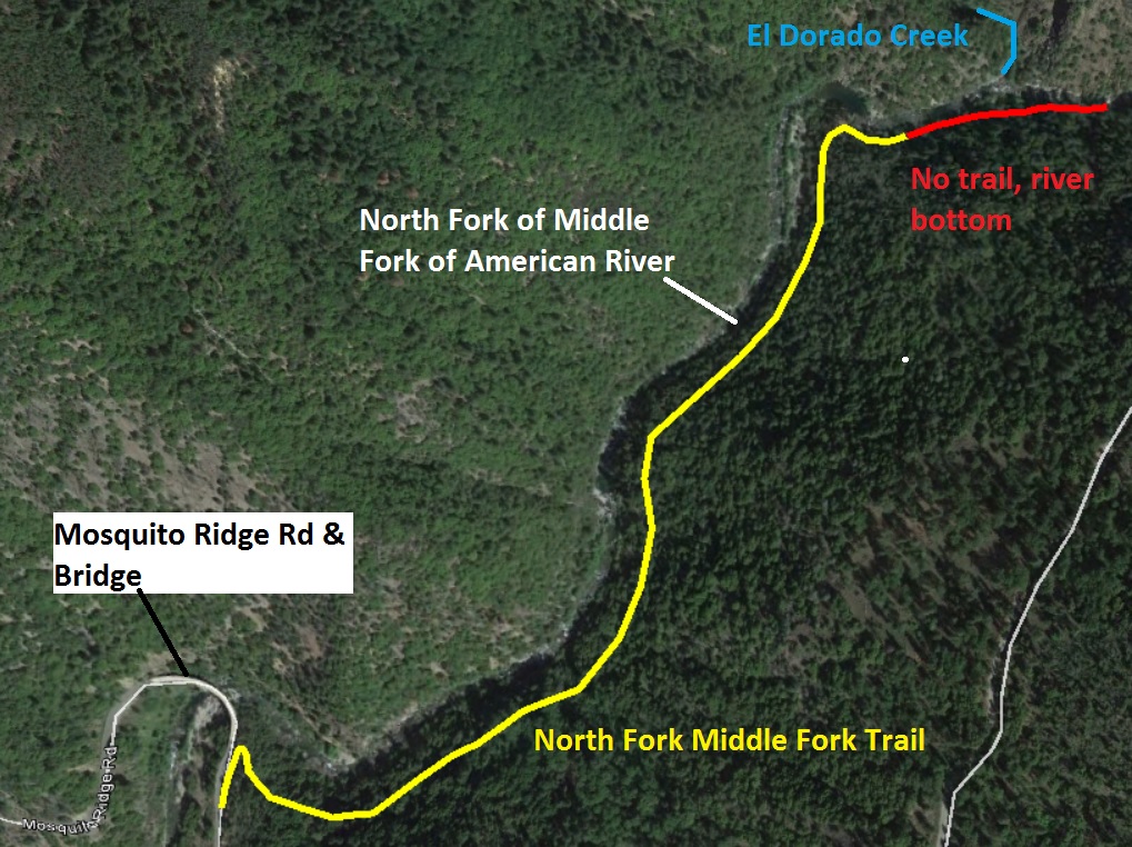
North Fork of Middle Fork American River Trail
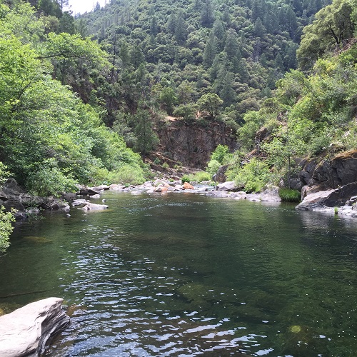
The official trail is a little over a mile long. For practical purposes it ends next to some tranquil river pools of water perfect for swimming. Someone has even erected a zip line across the narrow canyon over the water, but I don’t know if it is operational. The trail is little more than a narrow mule trail about 100 feet above the river for most of the way. Near the end of the trail are a series of steps, some cut into the bedrock, that lead down to the water’s edge. (Aerial view trail map located at end of post).
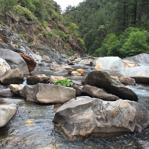
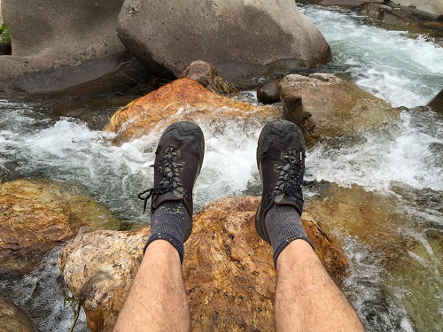
Hiking to the middle of the North Fork of Middle Fork American River
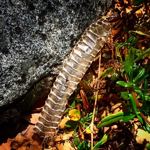
Once I got down to the river’s edge I pressed forward trying to go up as far as I could. Maps indicate that This portion of the Middle Fork of the North Fork is called El Dorado Canyon and the sides are very steep. But with the water level low in early June, I could scramble over the boulders and around tree to move upstream. I made it just passed where a little creek from north was flowing into the river. Some maps call this tributary Indian Creek and others El Dorado Creek.
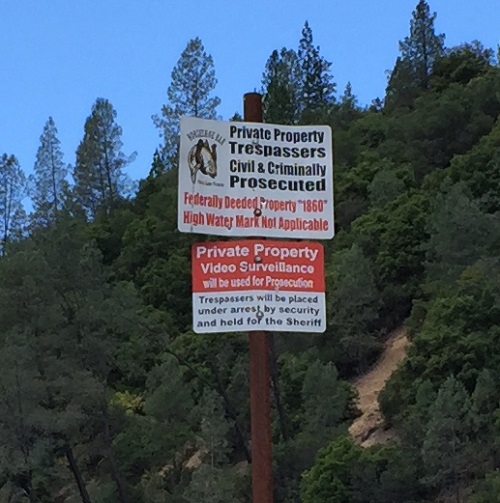
Be alert on the trails!
I was able to hop across rocks to get into the middle of the river to take some pictures. It’s a nice spot for exploring and a picnic. While I saw no one else on the hiking trail I got the sense that there were some folks in the canyon. On my return trip before I ascended the rock stairs I literally tripped over some drip tubing. Normally I love to investigate things I trip over on my hikes. But since I figured the drip tubing was irrigating a marijuana patch up the hill, I kept my head down and just picked up my hiking pace.
My gut was right, I wasn’t alone in the canyon. If you come across drip tubing or any indications that people have set up long term camping operations while you are out hiking in the forest, turn around and go back. Some of the people who maintain and guard these marijuana patches can be dangerous.
Old miner’s shack foundation
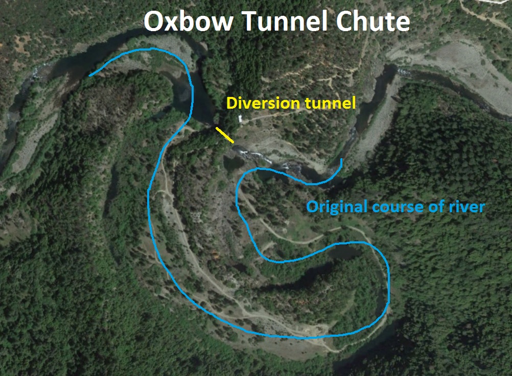
On my return hike, after I climbed up the steps, I did notice the foundational ruins of an old miner’s shack. This was not surprising because all of these rivers were extensively mined for placer gold in the 19th century. My original goal was not to stumble across a weed growing operation, but to hike to the Oxbow Tunnel or Tunnel Chute on the Middle Fork of the American River downstream of the Ralston Dam. The Oxbow tunnel was blasted out bedrock to divert the river from its original course so the de-watered river bed could be mined for gold.
Rivers and places can get confusing in the forest
The names and relative locations of the different streams, rivers, tunnels, and dams can be very confusing in this part of California. Different maps will indicate different names for the same structure. Here is my attempt to clarify the place and structure names as I have used them in this blog.
- North Fork of Middle Fork of American River – this river turns into the Middle Fork of the American River at the confluence of the discharge from Oxbow Powerhouse below Oxbow reservoir. The Middle Fork of the American River is only a trickle below Ralston Dam. The Oxbow Powerhouse is the water source into a new channel that converges with water from the North Fork of the Middle Fork.
- Middle Fork American River – converges with the Rubicon River below the Ralston Powerhouse but above Ralston Dam.
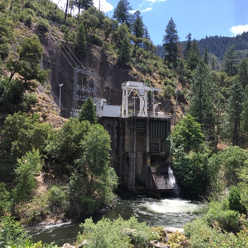
- Ralston Powerhouse – discharges water from a tunnel and penstock fed by a dam on the Middle Fork of the American River into the Rubicon River.
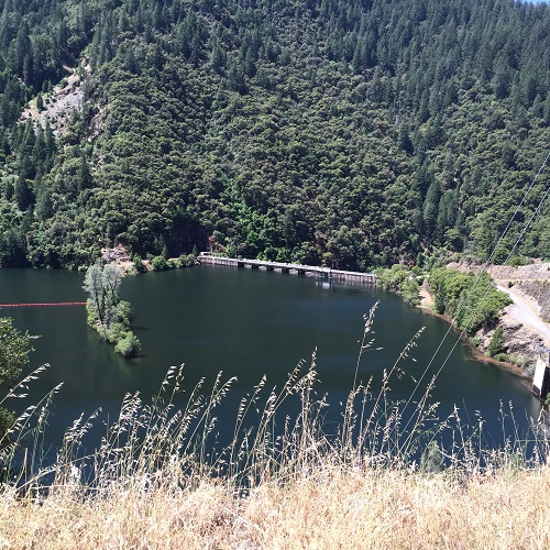
- Oxbow Powerhouse – is fed by a short tunnel from the Oxbow Reservoir. PCWA maps show Oxbow Tunnel feeding the Oxbow powerhouse. That is not the same tunnel as the 1880’s tunnel blasted out to divert the river just a few miles south on private property.
- Tunnel Chute – is the name some maps used to reference the artificial chute and tunnel blasted out in the 1880’s to divert the Middle Fork of the American River from its original river bed. This part of the Middle Fork is also referred to as Horseshoe Bar. (Unsourced historical information at http://goldprospectingwithminerreb.weebly.com/horseshoe-bar-american-river.html)
- Oxbow can refer to any U or horse shoe shape river or body of water. Several oxbows were created along the Middle Fork of the American River from landslides from the steep canyon walls.
History hidden on private property
This fascinating part of California gold history, when men placed gold and money above any environmental considerations, should be available for anyone to see. Unfortunately, the property where this historical treasure is located is private and strictly off limits. Whereas the high water mark of most rivers is public property that can be traversed, no one is allowed close to the Oxbow tunnel. What the properties owners couldn’t prohibit are rafters on the river. So if I want to experience the Oxbow tunnel and chute, I’ll need to ride on a raft with a licensed river rafting guide. YouTube Video -Tunnel Chute Rapid on the Middle Fork of the American River https://youtu.be/T8EYWCFgdT8
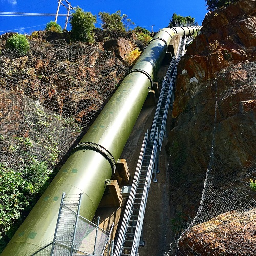
Middle Fork Project
I was able to hike around the power houses and dams on the Rubicon River that are part of the Middle Fork Project of the Placer County Water Agency. Similar to the Wild West of the gold rush days, the Middle Fork Project with its series of dams, tunnels, and pen stocks, is an even larger manipulation of the environment for electricity and money than the Oxbow tunnel. The Middle Fork of the American River now flows through a power house to generate electricity and most of the original river bed downstream of the dam is exposed with a trickle of water running through it.
On a relatively quiet Friday in June I saw families picnicking at the below Ralston Dam and I encountered a fisherman angling downstream of the powerhouse. It is a neat place to visit. While Mosquito Ridge Road out of Foresthill can be narrow it is generally well maintained.
Pictures from my hike and explorations around the Middle Fork of the American River


YouTube recordings:
North Fork of the Middle Fork of the American River
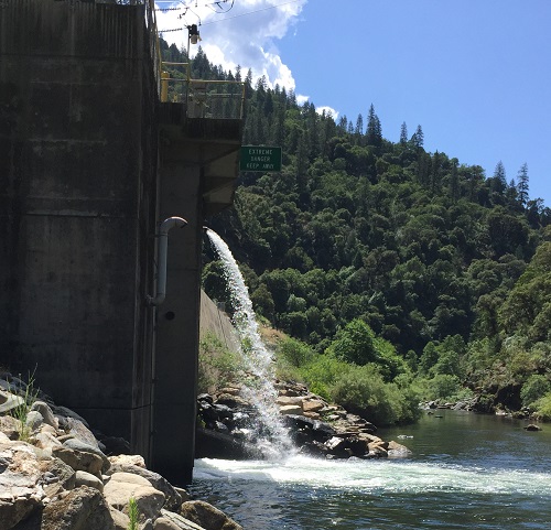
Oxbow Powerhouse Water Discharge