By the time of the Army Corp report conducted its inventory most of the North Fork Ditch had been lined with concrete. Many of the appurtenances were also concrete such as wasteways, intake structures and sluice gates. Of the 37 flumes, 32 were constructed of timber and only 5 were metal. The timber flume construction allowed them to be built with small changes or bends in the direction to navigate around boulders and hillsides. The metal flumes, by contrast, were best adapted to spanning a small ravine in a straight line.
American River
Posts related to the American River in California, history, hiking, pictures, maps.
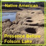
Native American Presence Before Folsom Lake
There is no record of when the last Native American camp ceased to exist in the Folsom Lake region. Many historians note that by 1853, most of the Native American population had dispersed, move south, died in conflicts with immigrant settlers, or died of disease. But there is no doubt that there was a thriving Native American population and culture along the north and south forks of the American River. Where Native Americans once ground acorns, skinned deer, or fashioned tools from local rocks, Folsom Lake visitors now fish, hike, ride horses, bikes, and have picnics.
Going Home With John Downs To Wild Goose Flat
What the house lacked in modern amenities, according to John, was more than made up for in the wild El Dorado County countryside that surrounded it. Fostered by the books John’s father read to him, his imagination blossomed and streams, fields, and hillsides were his land of adventure. There were whales to harpoon, witches to avoid, and Indian wars to recreate. By virtue of being an only child, John was forced out into the sunshine and fresh air to create his own daily entertainment.
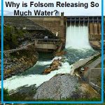
Why is Folsom Dam Releasing So Much Water? Flood Protection
Invariably, whenever the Bureau of Reclamation releases water stored behind Folsom Dam during the winter before the reservoir is full, people across the region accuse the Bureau of mismanagement, incompetence, and wasting water. The management of Folsom reservoir is complicated. But during the winter months, the main priority of Folsom Dam is flood control. That is why the dam was built in the first place.
Converting Backyard Acorns Into A Thanksgiving Side Dish
With just four Live Oaks (Quercus agrifolia nee) in my backyard, I will usually rake up 2 to 3 wheelbarrow loads of acorns every fall. Until I started reading about Maidu Native Americans that lived in the Granite Bay area of California, I hadn’t considered acorns as a food source. After I had documented numerous Native American acorn grinding-hole sites around Folsom Lake, I figured that I should try and prepare some acorn mush that was a staple of the Native American diet prior to the gold rush of the 1850s.
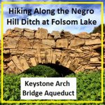
Hiking along the Negro Hill Ditch at Folsom Lake in El Dorado County
It can be a difficult task to locate the faint outlines of the Negro Hill Ditch which is usually under water at Folsom Lake. But when the lake is low enough it’s possible to find the old grade and structures associated with the historic water canal that ran from east of Salmon Falls down to Negro Hill and Massachusetts Flat. In the autumn of 2016 I was able to complete my goal of walking along most of the Negro Hill Ditch.
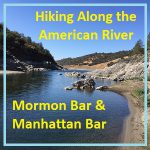
Hiking along the American River from Mormon to Manhattan Bar
With Folsom Lake water levels low in the autumn of 2016, I decided to hike from Rattlesnake Bar up the North Fork of the American River to see if I could catch glimpses of gold rush era history. The terrain was far more difficult than I imagine. While I know the river canyon has change since the gold rush of 1849, I was surprised at just how arduous the hiking along this stretch of the river must have been for the gold miners.
Pictures and history of Folsom Lake and American River during the drought
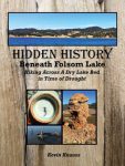
As the lake level drops, the history is revealed. As Folsom Lake hit record low water levels in 2015, a whole lot of history was revealed. A drought shrunken Folsom Lake of 2015 was the highlight for a guy like me who had been hiking around the reservoir for years looking for historical sites. After numerous hikes around the North and South Forks of the American River at Folsom Lake, I finally organized my photographs and historical research into a book, Hidden History Beneath Folsom Lake – Hiking Across a Dry Lake in Time of Drought.
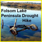
Folsom Lake Peninsula drought hike
I started hiking from the Folsom Lake Peninsula campground down to the tip of this stretch of land. Usually underwater, the drought of 2015 had drained the lake down to 15% of capacity. This exposed lake bed that is rarely visited during normal lake levels. Like many people I tripped across sunken boats, abandon gold mines and a surprising number of dams.
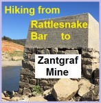
Hiking around Goose Flats to Zantgraf Mine
With the North Fork of the American River actually flowing around Rattlesnake Bar since the stationary waters of Folsom Lake didn’t occur until around the bend at Horseshoe Bar, I figured I might be able walk across the river to explore Goose Flats and the old mining operations. I thought if the miners of the 1850’s could ford the river so could I. Much of the bottom and banks of the river are choked with mud, muck and sediment as the lake elevation can be eighty feet above the river bed at Rattlesnake Bar.