From my car at the Oregon Bar parking lot, to the point where I estimated the first tunnel was located, is a little over 2.65 miles. However, those 2 miles, along the river, over the river cobble, cliffs, and sand bars is some of the most challenging and strenuous terrain I have hiked over. There are points where bare rock juts into the river and you must literally climb up and over the slate or granite.
Folsom Lake
Posts related to Folsom Lake history, operation, Folsom Dam, recreation, park.
Folsom Lake Can Fill Three Times In One Year
From the drainage area and mean flow events, the Army Corp of Engineers, based on the time frame of 1903 – 1952, calculated the mean runoff to be 2,840,000 acre feet of water. The final holding capacity of Folsom Lake is 977,000 acre feet of water. The minimum amount of water is 88,000 acre feet*. That makes the holding capacity of Folsom Lake 889,000 acre feet of water. This means that in a normal or average year, enough water flows into Folsom Lake to fill it from dead pool to full capacity 3.19 times.
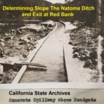
Natoma Ditch Slope Salmon Falls to Mormon Island
A dam site at Salmon Falls was too low in elevation to allow for the ditch to exit the river canyon between Red Bank and Mormon Island. Consequently, the dam site was moved to Rocky Bar which had an elevation of approximately 450 feet. With a small dam across the river, the headwaters for the canal would be elevated to 465 feet. The minimal slope of the ditch line would put the water canal at between 390 to 395 feet of elevation at the saddle.
Is Folsom Lake Artificially Low To Help El Dorado Hills Irrigation?
The conspiracy theories that the Bureau of Reclamation is keeping the lake low is based on an incomplete analysis of water discharges for power generation. At first glance, the discharge numbers – water being released from Folsom Lake – is greater than the inflow. The erroneous conclusion is that discharge is to keep the lake low. The reality is that there are numerous reasons why the Bureau of Reclamation is releasing water for power generation greater than the inflows.
Should Negro Bar State Park Change Its Name? A Historical Perspective
The experience of Black Americans and their contributions had been mere footnotes or commas in the printed saga of California of the 19th century. The visible traces of Black Americans of the Gold Rush are the names of places such as Negro Bar, Negro Hill, and the Negro Hill Ditch. Both Negro Hill and the ditch only exist on maps as Folsom Lake now covers both. Similarly, Negro Bar only partially remains above the high water of Lake Natoma.
Granite Bay to Anderson Island Hike on the Pioneer Express Trail
The first third of the hike is along relatively level ground until you reach Beeks Bight. Then you climb up the hillside that overlooks Folsom Lake. This portion can have some steep climbs for short distances. While the trail can wind far away from the lake at times, there are usually spots every half-mile or so to venture down to the water.
Murder On The American River Triggered By Folsom Dam
As her 78 year old father ate the breakfast she had prepared for him, she picked up the family shotgun, pointed it at the back of his head, and pulled the trigger. She then poured kerosene in the living room, kitchen, and on some of her clothes tossed on the floor, and set the house ablaze. She later recalled she had every intention of dying in the fire along with her father. Death was the only way out of the dilemma she had created as she saw it.
Folsom Lake Park Ready To Explode With Fire
Most of the homes that are most directly threatened by a fire at Folsom Lake are in Granite Bay and El Dorado Hills. There are only a few scattered homes above and around the Peninsula Campground. Ironically, it is the peninsula that has some of the best fire suppression features. There are more meadows with fewer trees. Fewer people visit the Peninsula Campground Park because it can be difficult to access, especially when towing a boat, from Highway 49. There are also wide dirt roads that act both as fire break and allow for fire trucks to reach areas burning. In contrast, large swaths of Folsom Park land in Granite Bay and El Dorado Hills have only small dirt footpaths with limited access for large fire trucks. There is more human activity in these areas as they are close to recreational access points.
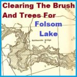
Clearing The Brush And Trees Before Folsom Lake Filled
Within the 90 foot elevation change of the lake, it was proposed that all standing and down timber, brush over 6 feet high or with trunks greater than 2 inches in diameter would be cleared out. Trees whose height reached to 360 feet in elevation would be topped to 10 feet below the expected low water elevation.
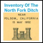
1952 U.S. Army Corp of Engineers Map and Inventory Of The North Fork Ditch
By the time of the Army Corp report conducted its inventory most of the North Fork Ditch had been lined with concrete. Many of the appurtenances were also concrete such as wasteways, intake structures and sluice gates. Of the 37 flumes, 32 were constructed of timber and only 5 were metal. The timber flume construction allowed them to be built with small changes or bends in the direction to navigate around boulders and hillsides. The metal flumes, by contrast, were best adapted to spanning a small ravine in a straight line.