If you think you can escape from my hands after such dealings, you are mistaken. For by the God who made me, I will have satisfaction, which if it does not shake your pocket will shake your damn cowardly nerves.

Kevin Knauss: Health, History, Travel, Insurance
Posts related to Mormon Island on the South Fork of the American River, now under Folsom Lake, gold mining history.


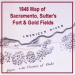
It has been pointed out that several features or bends of the American River are not illustrated. I don’t believe it was the intent of the map maker to accurately depict river but to note its relative position to the mines. The distances of 25 miles to the lower mines and of 50 miles to the upper mines is pretty accurate. The lower mines were also known as Mormon Island for the first group of miners who did extensive mining after the initial discovery of gold by Marshall. The distance to the upper mines, site of Marshall’s gold discovery is also relatively accurate considering hilly terrain that had to be traversed to get to the location.


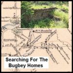
The short story of B. N. Bugbey was that he ran a fairly successful vineyard along the South Fork of the American River in El Dorado County. He made wine, brandy, champagne, sold vine cuttings, was the Sheriff of Sacramento County and its tax collector. He also went bankrupt, lost homes and businesses to fire and lost his wife to a freak riding accident, but never seemed to give up on life. Even into his 60s, he was still running for office and active in public life.


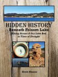
As the lake level drops, the history is revealed. As Folsom Lake hit record low water levels in 2015, a whole lot of history was revealed. A drought shrunken Folsom Lake of 2015 was the highlight for a guy like me who had been hiking around the reservoir for years looking for historical sites. After numerous hikes around the North and South Forks of the American River at Folsom Lake, I finally organized my photographs and historical research into a book, Hidden History Beneath Folsom Lake – Hiking Across a Dry Lake in Time of Drought.


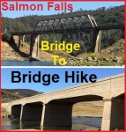
A 2015 drought depleted Folsom Lake has allowed a rare opportunity to hike from the current Salmon Falls bridge over the South Fork of the American River all the way down to the old bridge which is usually covered by Folsom Lake. What makes this hike so special is that the South Fork of the American is flowing free like a river should.

Spam prevention powered by Akismet