Am I the right person to fill the board vacancy? That is a decision for the San Juan Water District Board of Directors. All I can do is offer my background, experience, knowledge, and understanding of the wholesale and retail divisions of the water district. I will admit that I have developed a unique interest in the district because of its history beginning as a water project to deliver water to gold mining operations along the American River and its current and future role to sustain and enhance water reliability for south Placer and northeast Sacramento counties.
Water
Posts related to water in California, historical, canals, use, conservation, irrigation, flooding, Folsom Dam, American River
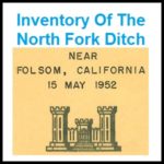
1952 U.S. Army Corp of Engineers Map and Inventory Of The North Fork Ditch
By the time of the Army Corp report conducted its inventory most of the North Fork Ditch had been lined with concrete. Many of the appurtenances were also concrete such as wasteways, intake structures and sluice gates. Of the 37 flumes, 32 were constructed of timber and only 5 were metal. The timber flume construction allowed them to be built with small changes or bends in the direction to navigate around boulders and hillsides. The metal flumes, by contrast, were best adapted to spanning a small ravine in a straight line.
San Juan Water District Granite Bay Rate Increases Reflect Real Costs Of Business
For years I have been at odds over how the San Juan Water District (SJWD) set their daily and metered rates for water in the Granite Bay area. Finally, SJWD is proposing a five-year rate structure that addresses the long term capital improvement needs of the district. The unfortunate 8% and 9% increase in the rates is a reflection of past Board decisions not to implement a stable rate structure for future maintenance, operations, and system upgrades.
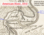
1910 map of water canals in Sacramento and Placer counties
For history buffs there is nothing closer to heaven than examining an old map. I share that fascination and also enjoy sharing old maps that I’ve found. Recently I uploaded a map published in 1910 by the American River & Natomas Water & Mining Company illustrating their network of canals. The map is generally topographically accurate and includes some place names not found on previous or later topographical maps.
Citrus Heights Car Wash, powered by karma
I thought it was so sweet that a fellow car wash patron was taking time out from washing her own car to help other people figure out how to get tokens or work the wash selector switch. But when she asked me how my car washing experience was, I figured she was one excellent employee. Wrong again! […]
Historic photos of Feather River’s Golden Gate dam and flume
These photos along with a short review of the project and photographer originally appeared in the 1964 issue of Diggin’s from the Butte County Historical Society, Voume 8, No. 1, Spring Edition. You can download the light edited submission by Chico State Professor of History Dr. Clarence F. McIntosh. I republish this material courtesy of […]
Delta twin tunnels are last link in the California system
California Department of Water Resources (DWR) has open a public comment period for their modified Bay Delta Conservation Plan Draft Environment Impact Report. While many aspects of Bay Delta Conservation Plan have been changed, the controversial twin tunnel conveyance proposal remains a central feature of the project. Known within the plan as the Waterfix, DWR […]
Granite Bay goes brown to conserve water during 2015 Drought
As opposed to drought shaming I decided to highlight the many properties near Folsom Lake who were going the extra mile to conserve water during our nasty drought of 2015. The Granite Bay area and the San Juan Water District retail service area have been singled out for some of the highest per capita water use in […]
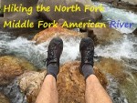
Middle Fork Trail Hike and Oxbow Powerhouse
The North Fork of The Middle Fork trail is a short little hike right off Mosquito Ridge Road. It is so named because it parallels the North Fork of the Middle Fork of the American River. Because the Placer County Water Agency maintains a dam up-stream this part of the river should have flowing water virtually […]
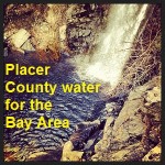
Residents must conserve so Placer County can sell water to Bay Area
In a May 18th op-ed in the Sacramento Bee Even in a drought, selling some water makes sense, Einar Maisch, General Manager of the Placer County Water Agency (PCWA) argued his agency was merely fulfilling their environmental duty to release 12,000 acre feet of water into the American River so it can be sold to […]