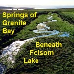
I had always noticed Rose Springs and Rock Springs marked on maps that encompassed the south Placer county region we know today as Granite Bay. It wasn’t until Folsom Lake hit historically low water levels that what I think are Rose and Rock springs became apparent to me.
Railroad History
Posts specifically to the history of railroads in the Sacramento region such as the CCRR, SPNRR, SVRR, with maps and images.
Hiking along Oroville’s Thermalito lake trail
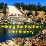
Virtually all visible signs of two dams on the Feather River along with thousands of feet of wooden flume and rock wall canal built in the 1890’s are hidden under the waters of the succeeding water project of Thermalito Lake in Oroville. Nonetheless, I was still drawn, like any amateur historian; to retrace the route […]
Proposed Tahoe -Truckee River to San Francisco water tunnel
Sometimes the craziest ideas actually become reality. In 1870 one man proposed tunneling underneath the Sierra Nevada mountain range to ship Tahoe lake water to San Francisco. While that may seem like an audacious scheme today, similar projects were already underway in the 19th century and parts of the tunnel project under the Sierras have […]
Brief history of engineered transportation tunnels
Tunnel Engineering – A Museum Treatment by Robert M. Vogel is a brief history of engineered transportation tunnels published in 1964. The booklet was part of series that accompanied scaled model displays illustrating the advances in tunneling primarily in the 19th century. The short thirty-six page bulletin focuses on how modern engineering design evolved as […]
American River images before Folsom Lake
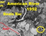
Even before Folsom Lake Dam was built and the reservoir filled, the north fork of the American River was supplying water to communities, farms and ranches in south Placer and northeast Sacramento counties. I recently found aerial photography from 1952 showing a free flowing north and south fork of the American River. Finally, I can […]
1865 map of California and the U.S. unfolded
It was a political junket that inspired the 1865 map of the western United States and territories. In the summer of 1865 Samuel Bowles, editor of the Springfield Republican in Massachusetts, traveled across the territories of the United States to California with Speaker of the House of Representatives Schuyler Colfax. Specifically included on the map are the […]
Tiny town of Forks loves Twilight vampires
Half the fun of a vacation is being pleasantly surprised by unexpected experiences. As we drove into the small hamlet of Forks, Washington, you could tell the local merchants had adopted the teenage vampire saga Twilight as their claim to fame. Even the Bed and Breakfast we stayed at was on a mission to incorporate […]
Mt. Judah and Donner Pass Hike
The original transcontinental tunnels and snow sheds over Donner Summit were abandoned in 1993 for the tunnel under Mt. Judah. After hiking to the top of Mt. Judah you can walk the many miles of tunnels and cliffs blasted out by Chinese labor in the 1860’s. The concrete snow sheds that replaced the wooden coverings that were prone to fire from the steam engine embers, is now a canvass for graffiti art.
Trails to Rails: Rush Ranch and Western Railway Museum
The new age of electricity ushered in the mass transit possibility of street cars. Even today the sight of an electric trolley car rolling down the tracks in this sparsely populated portion of California looks out of place. But the scenery of wheat fields, cattle and sheep grazing has changed little since the first trolley line rolled through the Montezuma Hills.
Roseville’s unique Carnegie Museum
You definitely know you are not stepping into a library the moment you push open the door and the authentic railroad crossing bell clangs and lights flash.