The description within the receipt also provided information on the wage rate. For white laborers, the daily rate was $2.50. Chinese labor was paid at $1.50 per man per day. I created a spreadsheet to compare the Chinese labor costs to that of white labor employed by the American River Water and Mining Company. Where the number of men and daily rate was not specifically mentioned, I imputed the daily rate by the total dollar amount. For example, Ah Sune was paid $13.50 for nine days work on cleaning out the Fox’s Ravine ditch in the Rose Springs district. Nine days times $1.50 per day comes out to $13.50.
American River
Posts related to the American River in California, history, hiking, pictures, maps.
Folsom Lake Can Fill Three Times In One Year
From the drainage area and mean flow events, the Army Corp of Engineers, based on the time frame of 1903 – 1952, calculated the mean runoff to be 2,840,000 acre feet of water. The final holding capacity of Folsom Lake is 977,000 acre feet of water. The minimum amount of water is 88,000 acre feet*. That makes the holding capacity of Folsom Lake 889,000 acre feet of water. This means that in a normal or average year, enough water flows into Folsom Lake to fill it from dead pool to full capacity 3.19 times.
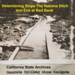
Natoma Ditch Slope Salmon Falls to Mormon Island
A dam site at Salmon Falls was too low in elevation to allow for the ditch to exit the river canyon between Red Bank and Mormon Island. Consequently, the dam site was moved to Rocky Bar which had an elevation of approximately 450 feet. With a small dam across the river, the headwaters for the canal would be elevated to 465 feet. The minimal slope of the ditch line would put the water canal at between 390 to 395 feet of elevation at the saddle.
The Negro Bar Water Canal Mining Dispute of 1851
About one week after this while I was at work on Tennessee Bar, I saw deft with another man going to that part of the race which is made of lumber and is called the “Break”. He said he was going to cut it down. I followed him, he cut it down and let the water in the river. The direct consequence of which was that water overflowed what is called the Middle Bar of the Virginia Co. on which was located plaintiff’s claim. This was about three weeks ago.
Is Folsom Lake Artificially Low To Help El Dorado Hills Irrigation?
The conspiracy theories that the Bureau of Reclamation is keeping the lake low is based on an incomplete analysis of water discharges for power generation. At first glance, the discharge numbers – water being released from Folsom Lake – is greater than the inflow. The erroneous conclusion is that discharge is to keep the lake low. The reality is that there are numerous reasons why the Bureau of Reclamation is releasing water for power generation greater than the inflows.
Mormon Island Letters of Amos Catlin 1851 – 1852
The one line of business Amos did try to explain was his investment in a steam engine for a saw mill. He thought the saw mill would produce him the most income, and he was proud of his investment. “The engine belongs to me, a beautiful 12 horse locomotive which cost me $3,000.” He then goes on to loosely explain the business arrangement and business proposition. We also learn that he was the main salesman for the operation.
Should Negro Bar State Park Change Its Name? A Historical Perspective
The experience of Black Americans and their contributions had been mere footnotes or commas in the printed saga of California of the 19th century. The visible traces of Black Americans of the Gold Rush are the names of places such as Negro Bar, Negro Hill, and the Negro Hill Ditch. Both Negro Hill and the ditch only exist on maps as Folsom Lake now covers both. Similarly, Negro Bar only partially remains above the high water of Lake Natoma.
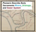
California Pioneers Describe Early Sacramento Rivers, Drainage, and Sewer System
Perhaps that was a necessity, although it does not seem to me to be so, because no solid or fecal matter is discharged into these sewers, or these drains which we call sewers. The city authorities have strictly adhered to the policy, if it is a policy, of having all the matter sink into the soil upon which the city is built, to saturate it, permeate it, and fester there and breed disease. And a city having a system of sewers like that comes into Court here in the name of the People of the State and complains that we have destroyed its sewerage system. Well, such a sewerage system as that ought to be destroyed. It never ought to be allowed to exist.
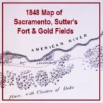
1848 Map Of Gold Mines On The South Fork Of the American River
It has been pointed out that several features or bends of the American River are not illustrated. I don’t believe it was the intent of the map maker to accurately depict river but to note its relative position to the mines. The distances of 25 miles to the lower mines and of 50 miles to the upper mines is pretty accurate. The lower mines were also known as Mormon Island for the first group of miners who did extensive mining after the initial discovery of gold by Marshall. The distance to the upper mines, site of Marshall’s gold discovery is also relatively accurate considering hilly terrain that had to be traversed to get to the location.
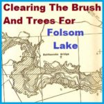
Clearing The Brush And Trees Before Folsom Lake Filled
Within the 90 foot elevation change of the lake, it was proposed that all standing and down timber, brush over 6 feet high or with trunks greater than 2 inches in diameter would be cleared out. Trees whose height reached to 360 feet in elevation would be topped to 10 feet below the expected low water elevation.