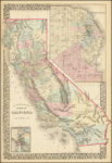
In 1871 California had fifty different counties. These counties were outlined in water color on an 1871 County Map of the State of California. Counties yet to be created were Glenn, Imperial, Kings, Madera, Modoc, Orange, Riverside, San Benito, and Ventura. The 1871 map also has an inset of San Francisco that also has water-colored […]
Maps
Generally, post that either include an image of a map and/or allow you to download the full version of the that are usually historical about California.
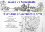
1850 Sacramento River and Delta Chart Map of Water Depths
By 1849, because of the Gold Rush, Sacramento had become a magnet for immigrants seeking their fortune in the gold fields. The Sacramento River was the primary conduit for passage from San Francisco. The importance of the river corridor prompted an 1850 hydrographic expedition to map the Sacramento River and associated sloughs, along with the […]
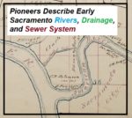
California Pioneers Describe Early Sacramento Rivers, Drainage, and Sewer System
Perhaps that was a necessity, although it does not seem to me to be so, because no solid or fecal matter is discharged into these sewers, or these drains which we call sewers. The city authorities have strictly adhered to the policy, if it is a policy, of having all the matter sink into the soil upon which the city is built, to saturate it, permeate it, and fester there and breed disease. And a city having a system of sewers like that comes into Court here in the name of the People of the State and complains that we have destroyed its sewerage system. Well, such a sewerage system as that ought to be destroyed. It never ought to be allowed to exist.
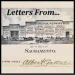
Albert Gallatin Correspondence 1875 – 1894
1887 Gallatin Steffens: Letter noting the sale from Gallatin to Joseph Steffens, E ½ of Lot 5 between I and J streets and 18 and 19 streets. Gallatin sold his Victorian mansion to Steffens that later became the California Governor’s Mansion.
Clearing The Brush And Trees Before Folsom Lake Filled
Within the 90 foot elevation change of the lake, it was proposed that all standing and down timber, brush over 6 feet high or with trunks greater than 2 inches in diameter would be cleared out. Trees whose height reached to 360 feet in elevation would be topped to 10 feet below the expected low water elevation.
California Central Railroad: Folsom To Roseville
While SVRR was planning the extension, Charles Lincoln Wilson incorporated a new company called the California Central Railroad in 1857 with Theodore Judah as Chief Engineer and Wilson as the appointed contractor. I have found no actual map filed, thus far, with the state by the California Central Railroad, but it’s probably floating around someplace. However, in 1864, the Central Pacific Railroad filed a map of their lower division from Sacramento to Auburn. On it the CCRR is depicted in the relative alignment indicated by the SVRR extension map.
Mapping The Folsom And Granite Bay Historic Railroad
It was a stroke of luck that I stumbled upon the original 1861 map of the Sacramento, Placer & Nevada Railroad (SPNRR) map in the California State Archives. With a digitized version of the original map, I could then compare the constructed rail line to modern roads and Folsom Lake shown on 20th century maps. While the 1861 and modern day maps don’t align perfectly, there are enough similarities to confirm suspicions of the route through the Folsom and Granite Bay areas.
Hiking along the Negro Hill Ditch at Folsom Lake in El Dorado County
It can be a difficult task to locate the faint outlines of the Negro Hill Ditch which is usually under water at Folsom Lake. But when the lake is low enough it’s possible to find the old grade and structures associated with the historic water canal that ran from east of Salmon Falls down to Negro Hill and Massachusetts Flat. In the autumn of 2016 I was able to complete my goal of walking along most of the Negro Hill Ditch.
Pictures and history of Folsom Lake and American River during the drought
As the lake level drops, the history is revealed. As Folsom Lake hit record low water levels in 2015, a whole lot of history was revealed. A drought shrunken Folsom Lake of 2015 was the highlight for a guy like me who had been hiking around the reservoir for years looking for historical sites. After numerous hikes around the North and South Forks of the American River at Folsom Lake, I finally organized my photographs and historical research into a book, Hidden History Beneath Folsom Lake – Hiking Across a Dry Lake in Time of Drought.
FEMA wiped out my home value with new flood maps in Granite Bay
The Federal Emergency Management Agency (FEMA) in cooperation with Placer County have released new flood hazard maps and my house is right in the middle of the floodway. According to the preliminary maps, my house never should have been built and I will be required to secure flood insurance if the preliminary flood maps are approved and become effective in June 2017. The new flood maps put the kiss of death on my ability to ever sell my house, my investment, my future. Thank you FEMA and Placer County.