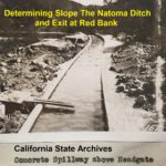
Even though the miners paid for the water on a daily basis, it was assumed that the mining day was 10 hours long, after which the water was shut down. If a miner continued using water during the night, it was understood they were trying to steal extra water.[26] During his tenure as superintendent, Amos estimated the North Fork Ditch was carrying 2200 to 2300 inches of water as measured under 6 inches of head pressure.[27]
Posts I have written about local and regional history, people, places, documents, maps, Sacramento, Placer, and California.
Chinese Mining and Labor on the American River, 1858 – 1868
The description within the receipt also provided information on the wage rate. For white laborers, the daily rate was $2.50. Chinese labor was paid at $1.50 per man per day. I created a spreadsheet to compare the Chinese labor costs to that of white labor employed by the American River Water and Mining Company. Where the number of men and daily rate was not specifically mentioned, I imputed the daily rate by the total dollar amount. For example, Ah Sune was paid $13.50 for nine days work on cleaning out the Fox’s Ravine ditch in the Rose Springs district. Nine days times $1.50 per day comes out to $13.50.
Folsom Lake Can Fill Three Times In One Year
From the drainage area and mean flow events, the Army Corp of Engineers, based on the time frame of 1903 – 1952, calculated the mean runoff to be 2,840,000 acre feet of water. The final holding capacity of Folsom Lake is 977,000 acre feet of water. The minimum amount of water is 88,000 acre feet*. That makes the holding capacity of Folsom Lake 889,000 acre feet of water. This means that in a normal or average year, enough water flows into Folsom Lake to fill it from dead pool to full capacity 3.19 times.
New Grave Marker at Historic Sacramento Cemetery for Amos Catlin’s Children
It was a pandemic lengthen 2-year project to research and write a book on the life of Amos Catlin. In the course of the research, I could not locate the burial site for several of Amos Catlin’s children. Historic Sacramento Cemetery documents indicated that some of the children had been moved closer to their mother Ruth Anne (Donaldson) Catlin who died in 1878. However, there were no headstones in the plot with Ruth Anne and Amos.
Amos Catlin, From Mormon Island Mining to Sacramento Judge
“Amos P. Catlin, The Whig Who Put Sacramento On The Map,” chronicles Amos’ life from his arrival in California in 1849 to his death in 1900 in Sacramento. Particular attention is paid to Amos’ work on organizing and building the Natoma water ditch in the early 1850s. It was during the ditch construction that Amos was elected to the California Senate. He wrote the bill to relocate the state’s capital to Sacramento. However, Amos did not consider the water projects or the state capital his most significant accomplishments in life.
Natoma Ditch Slope Salmon Falls to Mormon Island
A dam site at Salmon Falls was too low in elevation to allow for the ditch to exit the river canyon between Red Bank and Mormon Island. Consequently, the dam site was moved to Rocky Bar which had an elevation of approximately 450 feet. With a small dam across the river, the headwaters for the canal would be elevated to 465 feet. The minimal slope of the ditch line would put the water canal at between 390 to 395 feet of elevation at the saddle.
The Defense of Theodore Judah and the Transcontinental Railroad
My Dear Mrs. Judah, a subject which has often been upon my mind, and upon which I have often intended to write to you has quite recently been renewed itself with more than usual force. History is now being made for California and much of it false. You know with what studious zeal efforts have been in a certain quarter to bury the memory of Theo. D. Judah out of sight to the future reader of the history of California. You know also how some of his friends have endeavored at times to preserve that memory.
The Negro Bar Water Canal Mining Dispute of 1851
About one week after this while I was at work on Tennessee Bar, I saw deft with another man going to that part of the race which is made of lumber and is called the “Break”. He said he was going to cut it down. I followed him, he cut it down and let the water in the river. The direct consequence of which was that water overflowed what is called the Middle Bar of the Virginia Co. on which was located plaintiff’s claim. This was about three weeks ago.
Natural Bridges Tunnels and Tubing
From the main exit, where the main trail ends, I walked the short distance to the entrance or opening where Coyote Creek enters. The entrance is more spectacular than the exit. The exit opening is around eight feet in height. The entrance is at least 30 feet and the interior soars even higher. It is this section that most resembles a gothic cathedral. At the entrance, there are several large bedrock mortars, six inches in width and depth that indicate Native Americans were present long before the Europeans arrived.
1871 California Counties Map
In 1871 California had fifty different counties. These counties were outlined in water color on an 1871 County Map of the State of California. Counties yet to be created were Glenn, Imperial, Kings, Madera, Modoc, Orange, Riverside, San Benito, and Ventura. The 1871 map also has an inset of San Francisco that also has water-colored […]