There is no record of when the last Native American camp ceased to exist in the Folsom Lake region. Many historians note that by 1853, most of the Native American population had dispersed, move south, died in conflicts with immigrant settlers, or died of disease. But there is no doubt that there was a thriving Native American population and culture along the north and south forks of the American River. Where Native Americans once ground acorns, skinned deer, or fashioned tools from local rocks, Folsom Lake visitors now fish, hike, ride horses, bikes, and have picnics.
Posts I have written about local and regional history, people, places, documents, maps, Sacramento, Placer, and California.
Searching For The Bugbey Homes And Vineyards At Folsom Lake
The short story of B. N. Bugbey was that he ran a fairly successful vineyard along the South Fork of the American River in El Dorado County. He made wine, brandy, champagne, sold vine cuttings, was the Sheriff of Sacramento County and its tax collector. He also went bankrupt, lost homes and businesses to fire and lost his wife to a freak riding accident, but never seemed to give up on life. Even into his 60s, he was still running for office and active in public life.
Natomas Ditch, Canals, Flumes, Siphons And The 1921 Water Rate Battle
Within the rate submission was a detailed outline of the Natomas water canal along with photos of the Natomas Dam on the South Fork of the American River, the New York Ravine wooden siphon, and other pictures detailing the canals and flumes. The detailed history of the Natomas canal ownership along with a complete inventory of the structures submitted with the application for higher water rates gives a glimpse of this important gold rush era water works project.
Going Home With John Downs To Wild Goose Flat
What the house lacked in modern amenities, according to John, was more than made up for in the wild El Dorado County countryside that surrounded it. Fostered by the books John’s father read to him, his imagination blossomed and streams, fields, and hillsides were his land of adventure. There were whales to harpoon, witches to avoid, and Indian wars to recreate. By virtue of being an only child, John was forced out into the sunshine and fresh air to create his own daily entertainment.
Mapping The Folsom And Granite Bay Historic Railroad
It was a stroke of luck that I stumbled upon the original 1861 map of the Sacramento, Placer & Nevada Railroad (SPNRR) map in the California State Archives. With a digitized version of the original map, I could then compare the constructed rail line to modern roads and Folsom Lake shown on 20th century maps. While the 1861 and modern day maps don’t align perfectly, there are enough similarities to confirm suspicions of the route through the Folsom and Granite Bay areas.
Retracing The California Central Railroad From Folsom To Roseville
I’m a typical history nerd who daydreams while driving about old trains or historical events that took place on the same road I’m driving over. The daydreams turn obsessive when I’ve read and researched about certain historical events and I can almost recreate them in my mind. A good example is the path the California Central Railroad took from Folsom to Roseville, California, in 1861. I’ve driven and walked over so much of the rail grade that is accessible, and thought about its construction and daily operations, that I finally made a video about retracing the long forgotten railroad grade.
Converting Backyard Acorns Into A Thanksgiving Side Dish
With just four Live Oaks (Quercus agrifolia nee) in my backyard, I will usually rake up 2 to 3 wheelbarrow loads of acorns every fall. Until I started reading about Maidu Native Americans that lived in the Granite Bay area of California, I hadn’t considered acorns as a food source. After I had documented numerous Native American acorn grinding-hole sites around Folsom Lake, I figured that I should try and prepare some acorn mush that was a staple of the Native American diet prior to the gold rush of the 1850s.
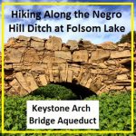
Hiking along the Negro Hill Ditch at Folsom Lake in El Dorado County
It can be a difficult task to locate the faint outlines of the Negro Hill Ditch which is usually under water at Folsom Lake. But when the lake is low enough it’s possible to find the old grade and structures associated with the historic water canal that ran from east of Salmon Falls down to Negro Hill and Massachusetts Flat. In the autumn of 2016 I was able to complete my goal of walking along most of the Negro Hill Ditch.
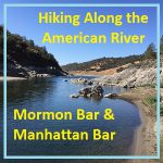
Hiking along the American River from Mormon to Manhattan Bar
With Folsom Lake water levels low in the autumn of 2016, I decided to hike from Rattlesnake Bar up the North Fork of the American River to see if I could catch glimpses of gold rush era history. The terrain was far more difficult than I imagine. While I know the river canyon has change since the gold rush of 1849, I was surprised at just how arduous the hiking along this stretch of the river must have been for the gold miners.
Pictures and history of Folsom Lake and American River during the drought
As the lake level drops, the history is revealed. As Folsom Lake hit record low water levels in 2015, a whole lot of history was revealed. A drought shrunken Folsom Lake of 2015 was the highlight for a guy like me who had been hiking around the reservoir for years looking for historical sites. After numerous hikes around the North and South Forks of the American River at Folsom Lake, I finally organized my photographs and historical research into a book, Hidden History Beneath Folsom Lake – Hiking Across a Dry Lake in Time of Drought.