The conspiracy theories that the Bureau of Reclamation is keeping the lake low is based on an incomplete analysis of water discharges for power generation. At first glance, the discharge numbers – water being released from Folsom Lake – is greater than the inflow. The erroneous conclusion is that discharge is to keep the lake low. The reality is that there are numerous reasons why the Bureau of Reclamation is releasing water for power generation greater than the inflows.
Folsom American River Granite Bay
Posts on Folsom Lake, American River, Granite Bay, history of the area. Gold Rush, Railroad, People, Hiking.
Folsom Lake Vandals aka Mountain Bikers
It is not uncommon to see ten or twenty mountain bike riders in a pack on the trails. Some are courteous to hikers, others just blow by you without a ring of a bell or a word of warning. For these people, hikers and horses are the invaders to their race track. They need to train for the next race. They need to go fast. They need a thrill of careening down a steep hill, regardless of who is at the bottom. The mountain bikers cutting new unauthorized trails down Mooney Ridge or digging a race course north of the lake are common vandals.
The California Mighty Oak Of The Leidesdorff Land Grant Dispute
By today’s standards, it seems absolutely crazy that anyone would invest money in property or infrastructure when there was no clear title to the land and the State of California continually threatened to strip Folsom of his ownership of the Leidesdorff estate. But this was the state of California in the 1850s. Even before the untimely death of Folsom, he and other men were pushing forward with their development plans in Sacramento County. Folsom had been working with the Sacramento Valley Railroad to run a line from Sacramento to Negro Bar on the south side of the American River over the Leidesdorff land grant.
Should Negro Bar State Park Change Its Name? A Historical Perspective
The experience of Black Americans and their contributions had been mere footnotes or commas in the printed saga of California of the 19th century. The visible traces of Black Americans of the Gold Rush are the names of places such as Negro Bar, Negro Hill, and the Negro Hill Ditch. Both Negro Hill and the ditch only exist on maps as Folsom Lake now covers both. Similarly, Negro Bar only partially remains above the high water of Lake Natoma.
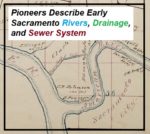
California Pioneers Describe Early Sacramento Rivers, Drainage, and Sewer System
Perhaps that was a necessity, although it does not seem to me to be so, because no solid or fecal matter is discharged into these sewers, or these drains which we call sewers. The city authorities have strictly adhered to the policy, if it is a policy, of having all the matter sink into the soil upon which the city is built, to saturate it, permeate it, and fester there and breed disease. And a city having a system of sewers like that comes into Court here in the name of the People of the State and complains that we have destroyed its sewerage system. Well, such a sewerage system as that ought to be destroyed. It never ought to be allowed to exist.
Granite Bay to Anderson Island Hike on the Pioneer Express Trail
The first third of the hike is along relatively level ground until you reach Beeks Bight. Then you climb up the hillside that overlooks Folsom Lake. This portion can have some steep climbs for short distances. While the trail can wind far away from the lake at times, there are usually spots every half-mile or so to venture down to the water.
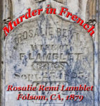
Murder In French
Rosalie lay bleeding to death. A thick pool of blood had gathered around her body from all of the cuts she had suffered earlier. Francois requested the men present to pick her up and place her on the lounge. Shortly thereafter, Dr. Rhodes who had been sent for, arrived to dress the wounds. The loss of blood was too great. Rosalie Remi Lamblet died on August 16, 1879.
Biography of B. N. Bugbey, Sacramento ’49er Pioneer and Champagne King
My research took me to the Bancroft Library at UC Berkeley where I found some important letters and images of Bugbey’s Natoma Vineyard in El Dorado County. The letters, from a local Folsom resident, describe how the prevailing opinion of the town was that Bugbey himself had set the 1871 fire that burned several buildings including his wine storehouse. The gossip was that he was in financial troubles and needed the insurance money.
From Big Gulch To The Hinkle Creek Nature Trail In Folsom
Isaac Hinkle was 25 years old and working on his father’s farm in Indiana in 1880. His older brother Amos had left the farm for California and Isaac decided to follow him in 1881. By 1882 Isaac was a registered voter in Sacramento County’s Mississippi Township. In 1885 Isaac married Jessie Brown and would have a long marriage with Jessie for the next 48 years. Also in 1885 Isaac Hinkle would make his first land purchase. He bought land in the town of Ashland from John Cardwell who was a large owner of in the area for $850. Even though the land was within the Public Land Survey System of Townships and Ranges, the deed refers to original metes and bounds description before the 1865 official survey map.
1848 Map Of Gold Mines On The South Fork Of the American River
It has been pointed out that several features or bends of the American River are not illustrated. I don’t believe it was the intent of the map maker to accurately depict river but to note its relative position to the mines. The distances of 25 miles to the lower mines and of 50 miles to the upper mines is pretty accurate. The lower mines were also known as Mormon Island for the first group of miners who did extensive mining after the initial discovery of gold by Marshall. The distance to the upper mines, site of Marshall’s gold discovery is also relatively accurate considering hilly terrain that had to be traversed to get to the location.