European immigrants were dominated by people immigrating from Ireland, making up 40 percent. Next were individuals born in England (25.88%) and Germany (18.42%.) Immigrants from France, Scotland, and the Western Islands totaled slightly less than 14 percent of the population. The population of Chinese individuals was close to the number of immigrants who listed England as their birth origin.
Gold
Usually, these posts relate to metal tier Gold level plan benefits. Sometimes, the posts relate to gold mining and history.
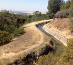
The Negro Bar Water Canal Mining Dispute of 1851
About one week after this while I was at work on Tennessee Bar, I saw deft with another man going to that part of the race which is made of lumber and is called the “Break”. He said he was going to cut it down. I followed him, he cut it down and let the water in the river. The direct consequence of which was that water overflowed what is called the Middle Bar of the Virginia Co. on which was located plaintiff’s claim. This was about three weeks ago.
Kaiser’s Portfolio Of Stable Family Health Insurance Plans For 2019
Kaiser Permanente has seen their market share increase with the Affordable Care Act. Their percentage of Covered California enrollments has steadily increased from 24% in 2015 to 33% in 2018.They have also been very stable in their plan offerings on and off exchange. Kaiser rates increased 3% – 7% in Northern California and 6% – 10% in Southern California in 2018. In 2019, the average rate increase will be 9% throughout California.
From Big Gulch To The Hinkle Creek Nature Trail In Folsom
Isaac Hinkle was 25 years old and working on his father’s farm in Indiana in 1880. His older brother Amos had left the farm for California and Isaac decided to follow him in 1881. By 1882 Isaac was a registered voter in Sacramento County’s Mississippi Township. In 1885 Isaac married Jessie Brown and would have a long marriage with Jessie for the next 48 years. Also in 1885 Isaac Hinkle would make his first land purchase. He bought land in the town of Ashland from John Cardwell who was a large owner of in the area for $850. Even though the land was within the Public Land Survey System of Townships and Ranges, the deed refers to original metes and bounds description before the 1865 official survey map.
1848 Map Of Gold Mines On The South Fork Of the American River
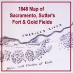
It has been pointed out that several features or bends of the American River are not illustrated. I don’t believe it was the intent of the map maker to accurately depict river but to note its relative position to the mines. The distances of 25 miles to the lower mines and of 50 miles to the upper mines is pretty accurate. The lower mines were also known as Mormon Island for the first group of miners who did extensive mining after the initial discovery of gold by Marshall. The distance to the upper mines, site of Marshall’s gold discovery is also relatively accurate considering hilly terrain that had to be traversed to get to the location.
Some Gold And Platinum Plans Cheaper Than Covered California Silver Plans
What has not been explained was if the increased Silver plan rates were based on existing Silver plan enrollments or projected enrollments. For those individuals and families who receive very little or no APTC the off-exchange Silver 70 plans will be 8.3% to 27% less expensive. People will naturally enroll in off-exchange Silver plans to save money. There will also be people who downgrade their plans from Silver to Bronze to save money, or, enroll in a Gold or Platinum plan for more benefits at an equal or lower cost of a Silver plan through Covered California. Either way, people will exit Covered California Silver plans in 2018. And since only the Covered California Silver plans have the increased rates, will that generate enough money to subsidize those people left in the enhanced Silver plans?
Retracing The California Central Railroad From Folsom To Roseville
I’m a typical history nerd who daydreams while driving about old trains or historical events that took place on the same road I’m driving over. The daydreams turn obsessive when I’ve read and researched about certain historical events and I can almost recreate them in my mind. A good example is the path the California Central Railroad took from Folsom to Roseville, California, in 1861. I’ve driven and walked over so much of the rail grade that is accessible, and thought about its construction and daily operations, that I finally made a video about retracing the long forgotten railroad grade.
Table Mountain Cherokee Hydraulic Mining District
A group of Native Americans from Georgia settled in the area working the exposed auriferous gravel deposit north of Table Mountain and called the area Cherokee. By 1855 there were several small placer mining operations working the ground. By 1873 they had built the largest inverted siphon to carry water across the Feather River.
California’s New Health Plans and Actuarial Value
What makes my video unique beyond my pictures from around California? Probably not much other than I try to keep it simple. There are no flashy animations or cool music. The text is simple and in large fonts. In short, if you suffer from insomnia, California Health Insurance Market Place video might be the cure.
Bureau of Reclamation Attempts To Flood Granite Bay Gold Mine
History may be posing a greater threat to the integrity of Folsom Dam than the terrorists. Recent road widening projects and dam improvements have uncovered several gold mining tunnels and shafts precariously close to the dykes which could comprise Folsom Dam. In attempt to safely probe the depths of a mine shaft between dykes 4 and 5, the Bureau of Reclamation pumped several thousand gallons into a large pit on top of the ridge this past August, 2013.