Even though the miners paid for the water on a daily basis, it was assumed that the mining day was 10 hours long, after which the water was shut down. If a miner continued using water during the night, it was understood they were trying to steal extra water.[26] During his tenure as superintendent, Amos estimated the North Fork Ditch was carrying 2200 to 2300 inches of water as measured under 6 inches of head pressure.[27]
Granite Bay
Posts related to Granite Bay, California, history, trails, parks, water.
Chinese Mining and Labor on the American River, 1858 – 1868
The description within the receipt also provided information on the wage rate. For white laborers, the daily rate was $2.50. Chinese labor was paid at $1.50 per man per day. I created a spreadsheet to compare the Chinese labor costs to that of white labor employed by the American River Water and Mining Company. Where the number of men and daily rate was not specifically mentioned, I imputed the daily rate by the total dollar amount. For example, Ah Sune was paid $13.50 for nine days work on cleaning out the Fox’s Ravine ditch in the Rose Springs district. Nine days times $1.50 per day comes out to $13.50.
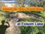
Folsom Lake Vandals aka Mountain Bikers
It is not uncommon to see ten or twenty mountain bike riders in a pack on the trails. Some are courteous to hikers, others just blow by you without a ring of a bell or a word of warning. For these people, hikers and horses are the invaders to their race track. They need to train for the next race. They need to go fast. They need a thrill of careening down a steep hill, regardless of who is at the bottom. The mountain bikers cutting new unauthorized trails down Mooney Ridge or digging a race course north of the lake are common vandals.
Granite Bay to Anderson Island Hike on the Pioneer Express Trail
The first third of the hike is along relatively level ground until you reach Beeks Bight. Then you climb up the hillside that overlooks Folsom Lake. This portion can have some steep climbs for short distances. While the trail can wind far away from the lake at times, there are usually spots every half-mile or so to venture down to the water.
Photo Of Noose In Roseville Park Sparks Comments From Shock To Dismissal
I cannot vouch for the veracity of the image or its location in a public park. But the comments from individuals on Nextdoor were interesting because of how they broke along gender lines. Most women who commented were shocked and saddened at the noose display. Men who commented were generally dismissive and sarcastic in their replies.
Murder On The American River Triggered By Folsom Dam
As her 78 year old father ate the breakfast she had prepared for him, she picked up the family shotgun, pointed it at the back of his head, and pulled the trigger. She then poured kerosene in the living room, kitchen, and on some of her clothes tossed on the floor, and set the house ablaze. She later recalled she had every intention of dying in the fire along with her father. Death was the only way out of the dilemma she had created as she saw it.
Folsom Lake Park Ready To Explode With Fire
Most of the homes that are most directly threatened by a fire at Folsom Lake are in Granite Bay and El Dorado Hills. There are only a few scattered homes above and around the Peninsula Campground. Ironically, it is the peninsula that has some of the best fire suppression features. There are more meadows with fewer trees. Fewer people visit the Peninsula Campground Park because it can be difficult to access, especially when towing a boat, from Highway 49. There are also wide dirt roads that act both as fire break and allow for fire trucks to reach areas burning. In contrast, large swaths of Folsom Park land in Granite Bay and El Dorado Hills have only small dirt footpaths with limited access for large fire trucks. There is more human activity in these areas as they are close to recreational access points.
San Juan Water District Granite Bay Rate Increases Reflect Real Costs Of Business
For years I have been at odds over how the San Juan Water District (SJWD) set their daily and metered rates for water in the Granite Bay area. Finally, SJWD is proposing a five-year rate structure that addresses the long term capital improvement needs of the district. The unfortunate 8% and 9% increase in the rates is a reflection of past Board decisions not to implement a stable rate structure for future maintenance, operations, and system upgrades.
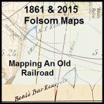
Mapping The Folsom And Granite Bay Historic Railroad
It was a stroke of luck that I stumbled upon the original 1861 map of the Sacramento, Placer & Nevada Railroad (SPNRR) map in the California State Archives. With a digitized version of the original map, I could then compare the constructed rail line to modern roads and Folsom Lake shown on 20th century maps. While the 1861 and modern day maps don’t align perfectly, there are enough similarities to confirm suspicions of the route through the Folsom and Granite Bay areas.
Converting Backyard Acorns Into A Thanksgiving Side Dish
With just four Live Oaks (Quercus agrifolia nee) in my backyard, I will usually rake up 2 to 3 wheelbarrow loads of acorns every fall. Until I started reading about Maidu Native Americans that lived in the Granite Bay area of California, I hadn’t considered acorns as a food source. After I had documented numerous Native American acorn grinding-hole sites around Folsom Lake, I figured that I should try and prepare some acorn mush that was a staple of the Native American diet prior to the gold rush of the 1850s.