Bugbey commissioned Yanke to compose a galop and a waltz. The galop premiered on July 4, 1870. Bugbey was heavily involved in politics and the Republican Party at the time. So his galop was part patriotic pomp and part marketing for his sparkling wines that he was shipping to the East Coast market and Europe. Similar to the Railroad Kings Galop, Bugbey’s Champagne Galop displayed his image on the cover of the sheet music. His portrait is surrounded by grapevines and bordered on one side by an overflowing champagne flute and an exploding cork and champagne bottle on the other side.
History From Kevin Knauss
Posts related to historical topics such the Gold Rush, early California, Maps, and historical documents.
Clearing The Brush And Trees Before Folsom Lake Filled
Within the 90 foot elevation change of the lake, it was proposed that all standing and down timber, brush over 6 feet high or with trunks greater than 2 inches in diameter would be cleared out. Trees whose height reached to 360 feet in elevation would be topped to 10 feet below the expected low water elevation.
1952 U.S. Army Corp of Engineers Map and Inventory Of The North Fork Ditch
By the time of the Army Corp report conducted its inventory most of the North Fork Ditch had been lined with concrete. Many of the appurtenances were also concrete such as wasteways, intake structures and sluice gates. Of the 37 flumes, 32 were constructed of timber and only 5 were metal. The timber flume construction allowed them to be built with small changes or bends in the direction to navigate around boulders and hillsides. The metal flumes, by contrast, were best adapted to spanning a small ravine in a straight line.
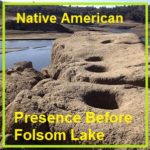
Native American Presence Before Folsom Lake
There is no record of when the last Native American camp ceased to exist in the Folsom Lake region. Many historians note that by 1853, most of the Native American population had dispersed, move south, died in conflicts with immigrant settlers, or died of disease. But there is no doubt that there was a thriving Native American population and culture along the north and south forks of the American River. Where Native Americans once ground acorns, skinned deer, or fashioned tools from local rocks, Folsom Lake visitors now fish, hike, ride horses, bikes, and have picnics.
Searching For The Bugbey Homes And Vineyards At Folsom Lake
The short story of B. N. Bugbey was that he ran a fairly successful vineyard along the South Fork of the American River in El Dorado County. He made wine, brandy, champagne, sold vine cuttings, was the Sheriff of Sacramento County and its tax collector. He also went bankrupt, lost homes and businesses to fire and lost his wife to a freak riding accident, but never seemed to give up on life. Even into his 60s, he was still running for office and active in public life.
Going Home With John Downs To Wild Goose Flat
What the house lacked in modern amenities, according to John, was more than made up for in the wild El Dorado County countryside that surrounded it. Fostered by the books John’s father read to him, his imagination blossomed and streams, fields, and hillsides were his land of adventure. There were whales to harpoon, witches to avoid, and Indian wars to recreate. By virtue of being an only child, John was forced out into the sunshine and fresh air to create his own daily entertainment.
Mapping The Folsom And Granite Bay Historic Railroad
It was a stroke of luck that I stumbled upon the original 1861 map of the Sacramento, Placer & Nevada Railroad (SPNRR) map in the California State Archives. With a digitized version of the original map, I could then compare the constructed rail line to modern roads and Folsom Lake shown on 20th century maps. While the 1861 and modern day maps don’t align perfectly, there are enough similarities to confirm suspicions of the route through the Folsom and Granite Bay areas.
Retracing The California Central Railroad From Folsom To Roseville
I’m a typical history nerd who daydreams while driving about old trains or historical events that took place on the same road I’m driving over. The daydreams turn obsessive when I’ve read and researched about certain historical events and I can almost recreate them in my mind. A good example is the path the California Central Railroad took from Folsom to Roseville, California, in 1861. I’ve driven and walked over so much of the rail grade that is accessible, and thought about its construction and daily operations, that I finally made a video about retracing the long forgotten railroad grade.
Hiking along the Negro Hill Ditch at Folsom Lake in El Dorado County
It can be a difficult task to locate the faint outlines of the Negro Hill Ditch which is usually under water at Folsom Lake. But when the lake is low enough it’s possible to find the old grade and structures associated with the historic water canal that ran from east of Salmon Falls down to Negro Hill and Massachusetts Flat. In the autumn of 2016 I was able to complete my goal of walking along most of the Negro Hill Ditch.
Hiking along the American River from Mormon to Manhattan Bar
With Folsom Lake water levels low in the autumn of 2016, I decided to hike from Rattlesnake Bar up the North Fork of the American River to see if I could catch glimpses of gold rush era history. The terrain was far more difficult than I imagine. While I know the river canyon has change since the gold rush of 1849, I was surprised at just how arduous the hiking along this stretch of the river must have been for the gold miners.